
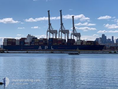
APL BOSTON
Container Ship
Current Trip
| Trip Time | 20 days |
|---|---|
| Trip Distance | 8180.53 nm |
| AVG Speed | 17 Knots |
| MAX Speed | 20.2 Knots |
| Dybgang | 13.3 m |
| AVG Wind | 13 knots |
| MAX Wind | 28 knots |
| MIN Temp | 9.9°C / 49.82°F |
| MAX Temp | 27.7°C / 81.86°F |
| Position Modtaget | 6 d siden |
Current Position
| Longitude | --- |
|---|---|
| Latitude | --- |
| Status | Under way using engine |
| Fart | 16.5 Knots |
| Kurs | 111° |
| Område | South Atlantic Ocean |
| Station | T-AIS |
| Position Modtaget | 6 d siden |
Info
Information
The current position of APL BOSTON is in South Atlantic Ocean with coordinates -34.61966° / 18.28041° as reported on 2025-12-28 17:41 by AIS to our vessel tracker app. The vessel's current speed is 16.5 Knots and is currently inside the port of REUNION.
The vessel APL BOSTON (IMO: 9597496, MMSI: 566950000) is a Container Ship that was built in 2013 ( 13 år gamle ). It's sailing under the flag of [SG] Singapore.
In this page you can find informations about the vessels current position, last detected port calls, and current voyage information. If the vessels is not in coverage by AIS you will find the latest position.
The current position of APL BOSTON is detected by our AIS receivers and we are not responsible for the reliability of the data. The last position was recorded while the vessel was in Coverage by the Ais receivers of our vessel tracking app.
The current draught of APL BOSTON as reported by AIS is 13.3 meters
Weather
| Temperature | 22.2°C / 71.96°F |
|---|---|
| Wind Speed | 1 knots |
| Direction | 202° SSW |
| Pressure | 1011.9 hPa |
| Humidity | 72.8 % |
| Cloud Coverage | 21 % |
Featured Company
Last Port Calls
| Port | Arrival | Departure | Time In Port |
|---|---|---|---|
| 2026-01-03 03:24 | |||
| 2025-12-11 08:35 | 2025-12-13 15:08 | 2 d | |
| 2025-12-01 13:00 | 2025-12-02 09:57 | 20 h | |
| 2025-11-26 05:40 | 2025-11-27 12:08 | 1 d | |
| 2025-11-23 06:00 | 2025-11-24 19:38 | 1 d | |
| 2025-11-19 20:27 | 2025-11-21 07:19 | 1 d | |
| 2025-11-17 17:30 | 2025-11-18 23:22 | 1 d | |
| 2025-11-13 04:20 | 2025-11-14 16:28 | 1 d |
Last Trips
| Origin | Departure | Destination | Arrival | Distance | |
|---|---|---|---|---|---|
| 2025-12-13 15:08 | 2026-01-03 03:24 | 8180.53 nm | |||
| 2025-12-02 09:57 | 2025-12-11 08:35 | 558.61 nm | |||
| 2025-11-27 12:08 | 2025-12-01 13:00 | 1667.35 nm | |||
| 2025-11-24 19:38 | 2025-11-26 05:40 | 532.79 nm | |||
| 2025-11-21 07:19 | 2025-11-23 06:00 | 427.28 nm | |||
| 2025-11-18 23:22 | 2025-11-19 20:27 | 138.21 nm | |||
| 2025-11-14 16:28 | 2025-11-17 17:30 | 169.23 nm | |||
| 2025-10-18 00:09 | 2025-11-13 04:20 | 10741.12 nm |
Events
| Tid | Hændelsen | Detaljer | Position / Dest | Info |
|---|---|---|---|---|
| 2026-01-02 23:55 | STOP Sejllads |
-20.93172 / 55.31580
[RE] REUNION
|
Fart: 0.2 kn Kurs: 266° |
|
| 2026-01-02 23:24 | Skibe i havn |
|
-20.92836 / 55.32100
[RE] REUNION
|
Fart: 6.5 kn Kurs: 162° |
| 2025-12-28 17:46 | Status er ændret | Default Under way using engine |
-34.62766 / 18.30529
ITSPE>REPDG
|
Fart: 16.5 kn Kurs: 111° |
| 2025-12-28 17:41 | Status er ændret | Under way using engine Default |
-34.61966 / 18.28041
ITSPE>REPDG
|
Fart: 16 kn Kurs: 111° |
| 2025-12-28 17:41 | Udenfor Dækning |
-34.61966 / 18.28041
South Atlantic Ocean
ITSPE>REPDG
|
Fart: 16.5 kn Kurs: 111° |
|
| 2025-12-28 17:14 | Status er ændret | Default Under way using engine |
-34.55833 / 18.15167
ITSPE>REPDG
|
Fart: 16.4 kn Kurs: 129.7° |
| 2025-12-28 17:08 | Status er ændret | Under way using engine Default |
-34.53966 / 18.12328
ITSPE>REPDG
|
Fart: 16.3 kn Kurs: 129° |
| 2025-12-28 17:03 | Status er ændret | Default Under way using engine |
-34.52488 / 18.10173
ITSPE>REPDG
|
Fart: 16.2 kn Kurs: 129.3° |
| 2025-12-28 16:56 | Status er ændret | Under way using engine Default |
-34.50726 / 18.07590
ITSPE>REPDG
|
Fart: 16.2 kn Kurs: 130° |
| 2025-12-28 16:21 | Status er ændret | Default Under way using engine |
-34.40051 / 17.92813
ITSPE>REPDG
|
Fart: 15.9 kn Kurs: 133.1° |