
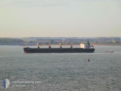
APIRADEE NAREE
Bulk Carrier
Current Trip
BHAVNAGHR
| Time Travelled | 5 days |
|---|---|
| Remaining Time | --- |
| Distance Travelled | 1073.75 nm |
| Remaining Distance | --- |
| AVG Speed | 10.7 Knots |
| MAX Speed | 13.3 Knots |
| AVG Wind | 9.2 knots |
| MAX Wind | 24.6 knots |
| MIN Temp | 28.7°C / 83.66°F |
| MAX Temp | 35.8°C / 96.44°F |
| Dybgang | 12.6 m |
| Position Modtaget | 4 d siden |
Current Position
| Longitude | 57.14251° |
|---|---|
| Latitude | 25.66484° |
| Status | Under way using engine |
| Fart | 11.5 Knots |
| Kurs | 140° |
| Område | Gulf of Oman |
| Station | T-AIS |
| Position Modtaget | 4 d siden |
Info
Information
The current position of APIRADEE NAREE is in Gulf of Oman with coordinates 25.66484° / 57.14251° as reported on 2024-05-17 14:18 by AIS to our vessel tracker app. The vessel's current speed is 11.5 Knots
The vessel APIRADEE NAREE (IMO: 9613410, MMSI: 566631000) is a Bulk Carrier that was built in 2012 ( 12 år gamle ). It's sailing under the flag of [SG] Singapore.
In this page you can find informations about the vessels current position, last detected port calls, and current voyage information. If the vessels is not in coverage by AIS you will find the latest position.
The current position of APIRADEE NAREE is detected by our AIS receivers and we are not responsible for the reliability of the data. The last position was recorded while the vessel was in Coverage by the Ais receivers of our vessel tracking app.
The current draught of APIRADEE NAREE as reported by AIS is 12.6 meters
Weather
| Temperature | 35.5°C / 95.9°F |
|---|---|
| Wind Speed | 7 knots |
| Direction | 144° SE |
| Pressure | 1000.6 hPa |
| Humidity | 49.4 % |
| Cloud Coverage | --- |
Featured Company
Most Visited Ports (Last year)
| Port | Arrivals | |
|---|---|---|
| 2 | ||
| 2 | ||
| 2 | ||
| 1 | ||
| 1 | ||
| 1 |
Events
| Tid | Hændelsen | Detaljer | Position / Dest | Info |
|---|---|---|---|---|
| 2024-05-21 09:42 | STOP Sejllads | 4.68 nm, East of GHOGHA |
21.68515 / 72.36742
BHAVNAGHR
|
Fart: 0.3 kn Kurs: 113° |
| 2024-05-17 14:25 | Status er ændret | Default Under way using engine |
25.64800 / 57.15812
BHAVNAGHR
|
Fart: 11.5 kn Kurs: 140° |
| 2024-05-17 14:18 | Udenfor Dækning |
25.66484 / 57.14251
Gulf of Oman
BHAVNAGHR
|
Fart: 11.5 kn Kurs: 140° |
|
| 2024-05-17 13:08 | ETA er ændret | 2024/05/21 04:00 2024/05/21 12:30 |
25.85311 / 57.01184
BHAVNAGHR
|
Fart: 11.3 kn Kurs: 150.8° |
| 2024-05-17 13:05 | Fundet i havområde | Iranian part of the Gulf of Oman |
25.86180 / 57.00629
Gulf of Oman
BHAVNAGHR
|
Fart: 11.3 kn Kurs: 150.1° |
| 2024-05-17 13:04 | Status er ændret | Under way using engine Default |
25.86447 / 57.00452
BHAVNAGHR
|
Fart: 11.3 kn Kurs: 150° |
| 2024-05-17 13:00 | Indenfor Dækning |
25.86180 / 57.00629
Gulf of Oman
BHAVNAGHR
|
Fart: 11.3 kn Kurs: 150.1° |
|
| 2024-05-17 05:13 | Status er ændret | Default Under way using engine |
26.14834 / 56.04407
BHAVNAGHR
|
Fart: 11 kn Kurs: 19.7° |
| 2024-05-17 05:05 | Udenfor Dækning |
26.12749 / 56.03330
Persian Gulf
BHAVNAGHR
|
Fart: 11 kn Kurs: 19.7° |
|
| 2024-05-17 04:56 | Ændre havområde | Omani part of the Persian Gulf United Arab Emirates part of the Persian Gulf |
26.10041 / 56.02634
Persian Gulf
BHAVNAGHR
|
Fart: 11 kn Kurs: 0.4° |