
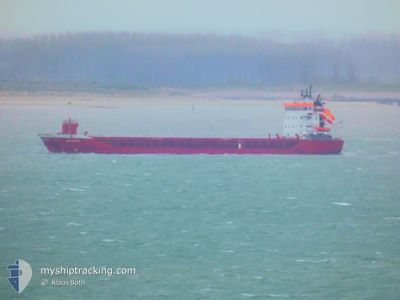
ANZORAS
General Cargo
Current Trip
IR LMK
| Time Travelled | 2 days |
|---|---|
| Remaining Time | --- |
| Distance Travelled | 668.45 nm |
| Remaining Distance | --- |
| AVG Speed | 9.9 Knots |
| MAX Speed | 15 Knots |
| AVG Wind | 15.6 knots |
| MAX Wind | 24.3 knots |
| MIN Temp | 3.3°C / 37.94°F |
| MAX Temp | 14.1°C / 57.38°F |
| Dybgang | 4.5 m |
| Position Modtaget | 7 d siden |
Current Position
| Longitude | -10.79750° |
|---|---|
| Latitude | 51.98434° |
| Status | Under way using engine |
| Fart | 10.3 Knots |
| Kurs | 338° |
| Område | North Atlantic Ocean |
| Station | T-AIS |
| Position Modtaget | 7 d siden |
Info
Information
The current position of ANZORAS is in North Atlantic Ocean with coordinates 51.98434° / -10.79750° as reported on 2024-04-23 12:55 by AIS to our vessel tracker app. The vessel's current speed is 10.3 Knots
The vessel ANZORAS (IMO: 9397664, MMSI: 224376000) is a General Cargo that was built in 2008 ( 16 år gamle ). It's sailing under the flag of [ES] Spain.
In this page you can find informations about the vessels current position, last detected port calls, and current voyage information. If the vessels is not in coverage by AIS you will find the latest position.
The current position of ANZORAS is detected by our AIS receivers and we are not responsible for the reliability of the data. The last position was recorded while the vessel was in Coverage by the Ais receivers of our vessel tracking app.
The current draught of ANZORAS as reported by AIS is 4.5 meters
Weather
| Temperature | 14°C / 57.2°F |
|---|---|
| Wind Speed | 10 knots |
| Direction | 148° SSE |
| Pressure | 1010 hPa |
| Humidity | 79.6 % |
| Cloud Coverage | 31 % |
Featured Company
Last Port Calls
| Port | Arrival | Departure | Time In Port |
|---|---|---|---|
| 2024-04-24 06:13 | 2024-04-27 19:21 | 3 d | |
| 2024-04-21 20:41 | 2024-04-22 19:14 | 22 h | |
| 2024-04-16 22:34 | 2024-04-19 16:02 | 2 d | |
| 2024-04-12 18:28 | 2024-04-12 18:32 | 4 m | |
| 2024-04-12 11:51 | 2024-04-12 18:16 | 6 h | |
| 2024-04-10 18:55 | 2024-04-11 17:43 | 22 h | |
| 2024-04-07 05:51 | 2024-04-08 16:09 | 1 d | |
| 2024-03-21 18:00 | |||
| 2024-03-11 13:31 | 2024-03-14 18:21 | 3 d | |
| 2024-03-06 06:32 | 2024-03-06 20:36 | 14 h |
Last Trips
| Origin | Departure | Destination | Arrival | Distance | |
|---|---|---|---|---|---|
| 2024-04-22 20:14 | 2024-04-24 07:13 | 293.78 nm | |||
| 2024-04-19 18:02 | 2024-04-21 21:41 | 527.40 nm | |||
| 2024-04-12 20:32 | 2024-04-17 00:34 | 168.40 nm | |||
| 2024-04-12 20:16 | 2024-04-12 20:28 | 1.97 nm | |||
| 2024-04-11 19:43 | 2024-04-12 13:51 | 147.71 nm | |||
| 2024-04-08 17:09 | 2024-04-10 20:55 | 509.78 nm | |||
| 2024-03-21 19:00 | 2024-04-07 06:51 | 1701.27 nm | |||
| 2024-03-06 20:36 | 2024-03-11 13:31 | 1026.38 nm | |||
| 2024-03-05 02:20 | 2024-03-06 06:32 | 261.81 nm | |||
| 2024-02-14 16:13 | 2024-02-29 17:49 | 1009.25 nm |
Events
| Tid | Hændelsen | Detaljer | Position / Dest | Info |
|---|---|---|---|---|
| 2024-04-27 19:38 | START Sejllads | 2.62 nm, West of LIMERICK |
52.66650 / -8.70433
IR LMK
|
Fart: 8.6 kn Kurs: 345° |
| 2024-04-27 19:21 | Afsejlet fra sidste havn |
|
52.66650 / -8.70433
IR LMK
|
Fart: Kurs: -1° |
| 2024-04-24 06:13 | STOP Sejllads |
52.65833 / -8.64167
[IE] LIMERICK
|
Fart: Kurs: -1° |
|
| 2024-04-24 06:13 | Skibe i havn |
|
52.65833 / -8.64167
[IE] LIMERICK
|
Fart: 2 kn Kurs: -1° |
| 2024-04-24 03:02 | START Sejllads | 1.68 nm, West of MONEYPOINT |
52.60533 / -9.46500
IR LMK
|
Fart: 3.6 kn Kurs: 100° |
| 2024-04-23 19:58 | STOP Sejllads | 1.62 nm, South East of CAPPA UPPER |
52.60484 / -9.47400
IR LMK
|
Fart: 0.1 kn Kurs: 96° |
| 2024-04-23 13:00 | Status er ændret | Default Under way using engine |
51.99667 / -10.80667
IR LMK
|
Fart: 10.3 kn Kurs: 338° |
| 2024-04-23 12:55 | Udenfor Dækning |
51.98434 / -10.79750
North Atlantic Ocean
IR LMK
|
Fart: 10.3 kn Kurs: 338° |
|
| 2024-04-23 12:32 | Status er ændret | Under way using engine Default |
51.92450 / -10.75533
IR LMK
|
Fart: 10 kn Kurs: 336° |
| 2024-04-23 12:32 | Indenfor Dækning |
51.92950 / -10.75900
North Atlantic Ocean
IR LMK
|
Fart: 10.3 kn Kurs: 336° |