
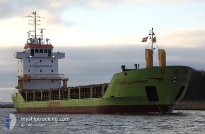
ANNA LEHMANN
General Cargo
Current Trip
| Trip Time | 1 day |
|---|---|
| Trip Distance | 285.49 nm |
| AVG Speed | 11.4 Knots |
| MAX Speed | 12.5 Knots |
| Dybgang | 3.8 m |
| AVG Wind | 7.9 knots |
| MAX Wind | 11.6 knots |
| MIN Temp | 4.1°C / 39.38°F |
| MAX Temp | 7°C / 44.6°F |
| Position Modtaget | 1 d siden |
Current Position
| Longitude | 19.35331° |
|---|---|
| Latitude | 60.58552° |
| Status | Under way using engine |
| Fart | 11.8 Knots |
| Kurs | 42.5° |
| Område | Gulf of Bothnia |
| Station | T-AIS |
| Position Modtaget | 1 d siden |
Info
Information
The current position of ANNA LEHMANN is in Gulf of Bothnia with coordinates 60.58552° / 19.35331° as reported on 2024-05-12 12:49 by AIS to our vessel tracker app. The vessel's current speed is 11.8 Knots and is currently inside the port of PORI.
The vessel ANNA LEHMANN (IMO: 9225562, MMSI: 304145000) is a General Cargo that was built in 2000 ( 24 år gamle ). It's sailing under the flag of [AG] Antigua Barbuda.
In this page you can find informations about the vessels current position, last detected port calls, and current voyage information. If the vessels is not in coverage by AIS you will find the latest position.
The current position of ANNA LEHMANN is detected by our AIS receivers and we are not responsible for the reliability of the data. The last position was recorded while the vessel was in Coverage by the Ais receivers of our vessel tracking app.
The current draught of ANNA LEHMANN as reported by AIS is 3.8 meters
Weather
| Temperature | 7.3°C / 45.14°F |
|---|---|
| Wind Speed | 5 knots |
| Direction | 286° WNW |
| Pressure | 1020.1 hPa |
| Humidity | 88.2 % |
| Cloud Coverage | 59 % |
Featured Company
Last Port Calls
| Port | Arrival | Departure | Time In Port |
|---|---|---|---|
| 2024-05-13 07:32 | |||
| 2024-05-11 04:43 | 2024-05-11 20:03 | 15 h | |
| 2024-05-07 12:23 | 2024-05-08 13:53 | 1 d | |
| 2024-04-30 10:59 | 2024-05-03 22:39 | 3 d | |
| 2024-04-23 21:40 | 2024-04-23 22:20 | 40 m | |
| 2024-04-22 06:08 | 2024-04-23 16:48 | 1 d | |
| 2024-04-22 01:20 | 2024-04-22 01:42 | 22 m | |
| 2024-04-19 23:44 | 2024-04-20 20:06 | 20 h | |
| 2024-04-18 11:38 | |||
| 2024-04-09 14:39 | 2024-04-11 22:00 | 2 d |
Most Visited Ports (Last year)
| Port | Arrivals | |
|---|---|---|
| 10 | ||
| 9 | ||
| 9 | ||
| 4 | ||
| 4 | ||
| 3 |
Last Trips
| Origin | Departure | Destination | Arrival | Distance | |
|---|---|---|---|---|---|
| 2024-05-11 23:03 | 2024-05-13 10:32 | 285.49 nm | |||
| 2024-05-08 15:53 | 2024-05-11 07:43 | 648.98 nm | |||
| 2024-05-04 00:39 | 2024-05-07 14:23 | 873.63 nm | |||
| 2024-04-24 00:20 | 2024-04-30 12:59 | 1306.45 nm | |||
| 2024-04-23 18:48 | 2024-04-23 23:40 | 48.77 nm | |||
| 2024-04-22 03:42 | 2024-04-22 08:08 | 49.14 nm | |||
| 2024-04-20 23:06 | 2024-04-22 03:20 | 249.58 nm | |||
| 2024-04-12 00:00 | 2024-04-18 14:38 | 1407.24 nm | |||
| 2024-04-04 21:12 | 2024-04-09 16:39 | 1268.20 nm | |||
| 2024-03-31 12:33 | 2024-04-01 09:55 | 227.65 nm |
Events
| Tid | Hændelsen | Detaljer | Position / Dest | Info |
|---|---|---|---|---|
| 2024-05-13 07:40 | STOP Sejllads |
61.64018 / 21.40016
[FI] PORI
|
Fart: 0.1 kn Kurs: 211° |
|
| 2024-05-13 07:32 | Skibe i havn |
|
61.64128 / 21.40172
[FI] PORI
|
Fart: 1.6 kn Kurs: 214° |
| 2024-05-13 06:40 | START Sejllads | 4.61 nm, South West of PORI |
61.58852 / 21.27797
TAHKOLUOTO
|
Fart: 3.1 kn Kurs: 9° |
| 2024-05-12 20:07 | STOP Sejllads | 4.84 nm, South West of PORI |
61.58474 / 21.27416
TAHKOLUOTO
|
Fart: 0.3 kn Kurs: 152° |
| 2024-05-12 12:56 | Status er ændret | Default Under way using engine |
60.60371 / 19.38810
TAHKOLUOTO
|
Fart: 11.8 kn Kurs: 42.5° |
| 2024-05-12 12:49 | Udenfor Dækning |
60.58552 / 19.35331
Gulf of Bothnia
TAHKOLUOTO
|
Fart: 11.8 kn Kurs: 42.5° |
|
| 2024-05-12 12:48 | Status er ændret | Under way using engine Default |
60.58353 / 19.34955
TAHKOLUOTO
|
Fart: 11.9 kn Kurs: 41° |
| 2024-05-12 12:44 | Status er ændret | Default Under way using engine |
60.57412 / 19.33227
TAHKOLUOTO
|
Fart: 11.9 kn Kurs: 41.9° |
| 2024-05-12 12:38 | Status er ændret | Under way using engine Default |
60.55874 / 19.30475
TAHKOLUOTO
|
Fart: 11.8 kn Kurs: 42° |
| 2024-05-12 12:20 | Status er ændret | Default Under way using engine |
60.51522 / 19.22544
TAHKOLUOTO
|
Fart: 12.1 kn Kurs: 41° |