
ANDREAS KALVOS
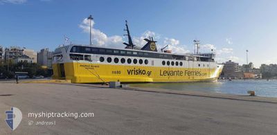
Ro-Ro/Passenger Ship
Current Trip
| Trip Time | 3 h, 14 mins |
|---|---|
| Trip Distance | 50.98 nm |
| AVG Speed | 15.7 Knots |
| MAX Speed | 16.1 Knots |
| Dybgang | 4.4 m |
| AVG Wind | 4 knots |
| MAX Wind | 10.8 knots |
| MIN Temp | 15.6°C / 60.08°F |
| MAX Temp | 16.5°C / 61.7°F |
| Position Modtaget | 12 h, 6 m siden |
Current Position
| Longitude | --- |
|---|---|
| Latitude | --- |
| Status | Under way using engine |
| Fart | 15.9 Knots |
| Kurs | 276.5° |
| Område | Ionian Sea |
| Station | T-AIS |
| Position Modtaget | 12 h, 6 m siden |
Info
Information
The current position of ANDREAS KALVOS is in Ionian Sea with coordinates 38.27602° / 20.79059° as reported on 2025-12-07 13:56 by AIS to our vessel tracker app. The vessel's current speed is 15.9 Knots and is currently inside the port of SAMI.
The vessel ANDREAS KALVOS (IMO: 8500484, MMSI: 237416000) is a Ro-Ro/Passenger Ship that was built in 1985 ( 40 år gamle ). It's sailing under the flag of [GR] Greece.
In this page you can find informations about the vessels current position, last detected port calls, and current voyage information. If the vessels is not in coverage by AIS you will find the latest position.
The current position of ANDREAS KALVOS is detected by our AIS receivers and we are not responsible for the reliability of the data. The last position was recorded while the vessel was in Coverage by the Ais receivers of our vessel tracking app.
The current draught of ANDREAS KALVOS as reported by AIS is 4.4 meters
Weather
| Temperature | 16.1°C / 60.98°F |
|---|---|
| Wind Speed | 4 knots |
| Direction | 331° NNW |
| Pressure | 1012.8 hPa |
| Humidity | 67.4 % |
| Cloud Coverage | 99 % |
Featured Company
Last Port Calls
| Port | Arrival | Departure | Time In Port |
|---|---|---|---|
| 2025-12-07 16:22 | |||
| 2025-12-07 11:54 | 2025-12-07 13:08 | 1 h | |
| 2025-12-06 11:54 | 2025-12-06 13:09 | 1 h | |
| 2025-12-05 11:49 | 2025-12-05 13:04 | 1 h | |
| 2025-12-04 17:15 | 2025-12-05 08:03 | 14 h | |
| 2025-12-04 12:31 | 2025-12-04 13:56 | 1 h | |
| 2025-12-03 16:31 | 2025-12-03 16:46 | 15 m | |
| 2025-12-03 11:54 | 2025-12-03 13:04 | 1 h | |
| 2025-12-03 08:24 | 2025-12-03 08:33 | 9 m | |
| 2025-12-02 11:58 | 2025-12-02 13:05 | 1 h |
Last Trips
| Origin | Departure | Destination | Arrival | Distance | |
|---|---|---|---|---|---|
| 2025-12-07 13:08 | 2025-12-07 16:22 | 50.98 nm | |||
| 2025-12-06 13:09 | 2025-12-07 11:54 | 105.95 nm | |||
| 2025-12-05 13:04 | 2025-12-06 11:54 | 104.69 nm | |||
| 2025-12-05 08:03 | 2025-12-05 11:49 | 51.45 nm | |||
| 2025-12-04 13:56 | 2025-12-04 17:15 | 50.87 nm | |||
| 2025-12-03 16:46 | 2025-12-04 12:31 | 52.49 nm | |||
| 2025-12-03 13:04 | 2025-12-03 16:31 | 52.11 nm | |||
| 2025-12-03 08:33 | 2025-12-03 11:54 | 51.48 nm | |||
| 2025-12-03 08:33 | 2025-12-03 08:24 | 51.48 nm | |||
| 2025-12-02 08:35 | 2025-12-02 11:58 | 40.64 nm |
Events
| Tid | Hændelsen | Detaljer | Position / Dest | Info |
|---|---|---|---|---|
| 2025-12-07 14:22 | Skibe i havn |
|
38.25516 / 20.64778
[GR] SAMI
|
Fart: 15.9 kn Kurs: 276.5° |
| 2025-12-07 13:56 | Indenfor Dækning |
38.27602 / 20.79059
Ionian Sea
|
Fart: 15.9 kn Kurs: 276.5° |
|
| 2025-12-07 13:56 | Udenfor Dækning |
38.27602 / 20.79059
Ionian Sea
|
Fart: 15.9 kn Kurs: 276.5° |
|
| 2025-12-07 12:37 | Udenfor Dækning |
38.25221 / 21.23159
Ionian Sea
|
Fart: 15.7 kn Kurs: 271.8° |
|
| 2025-12-07 11:08 | Afsejlet fra sidste havn |
|
38.24561 / 21.72231
GRSAI
|
Fart: 10.8 kn Kurs: 263° |
| 2025-12-07 11:05 | START Sejllads |
38.24941 / 21.73045
[GR] PATRA
|
Fart: 6.3 kn Kurs: 268° |
|
| 2025-12-07 10:58 | Destination er ændret | GRSAI GRGPA |
38.24915 / 21.73275
[GR] PATRA
|
Fart: Kurs: 230° |
| 2025-12-07 10:58 | Status er ændret | Under way using engine Moored |
38.24912 / 21.73275
[GR] PATRA
|
Fart: Kurs: 230° |
| 2025-12-07 10:03 | Status er ændret | Moored Under way using engine |
38.24909 / 21.73270
[GR] PATRA
|
Fart: Kurs: 231° |
| 2025-12-07 10:02 | STOP Sejllads |
38.24909 / 21.73276
[GR] PATRA
|
Fart: 0.3 kn Kurs: 227° |