
KAREN
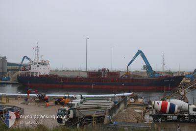
General Cargo
Current Trip
| Time Travelled | 1 day |
|---|---|
| Remaining Time | --- |
| Distance Travelled | 327.33 nm |
| Remaining Distance | 33.77 nm |
| AVG Speed | 8.6 Knots |
| MAX Speed | 11.7 Knots |
| AVG Wind | 7.5 knots |
| MAX Wind | 11 knots |
| MIN Temp | 10.9°C / 51.62°F |
| MAX Temp | 16.6°C / 61.88°F |
| Dybgang | 5.8 m |
| Position Modtaget | 1 m siden |
Current Position
| Longitude | 2.55475° |
|---|---|
| Latitude | 51.32661° |
| Status | At anchor |
| Fart | |
| Kurs | 90° |
| Område | North Sea |
| Station | T-AIS |
| Position Modtaget | 1 m siden |
Info
Information
The current position of KAREN is in North Sea with coordinates 51.32661° / 2.55475° as reported on 2024-05-01 01:34 by AIS to our vessel tracker app. The vessel's current speed is 0 Knots and is heading at the port of BRUGGE. The estimated time of arrival as calculated by MyShipTracking vessel tracking app is 2024-05-01 01:00 LT
The vessel KAREN (IMO: 9487603, MMSI: 304108000) is a General Cargo that was built in 2008 ( 16 år gamle ). It's sailing under the flag of [AG] Antigua Barbuda.
In this page you can find informations about the vessels current position, last detected port calls, and current voyage information. If the vessels is not in coverage by AIS you will find the latest position.
The current position of KAREN is detected by our AIS receivers and we are not responsible for the reliability of the data. The last position was recorded while the vessel was in Coverage by the Ais receivers of our vessel tracking app.
The current draught of KAREN as reported by AIS is 5.8 meters
Weather
| Temperature | 12.3°C / 54.14°F |
|---|---|
| Wind Speed | 10 knots |
| Direction | 125° SE |
| Pressure | 1009.8 hPa |
| Humidity | 94.2 % |
| Cloud Coverage | 100 % |
Featured Company
Last Port Calls
| Port | Arrival | Departure | Time In Port |
|---|---|---|---|
| 2024-04-29 11:17 | 2024-04-29 11:31 | 13 m | |
| 2024-04-26 16:23 | 2024-04-27 07:44 | 15 h | |
| 2024-04-22 12:25 | 2024-04-24 10:15 | 1 d | |
| 2024-04-18 22:30 | 2024-04-19 17:59 | 19 h | |
| 2024-04-15 17:30 | 2024-04-18 21:05 | 3 d | |
| 2024-04-10 18:16 | 2024-04-11 13:30 | 19 h | |
| 2024-04-04 16:27 | 2024-04-09 09:14 | 4 d | |
| 2024-03-30 03:21 | 2024-04-01 11:01 | 2 d | |
| 2024-03-25 22:09 | 2024-03-26 18:57 | 20 h | |
| 2024-03-18 02:38 | 2024-03-19 20:45 | 1 d |
Last Trips
| Origin | Departure | Destination | Arrival | Distance | |
|---|---|---|---|---|---|
| 2024-04-27 10:44 | 2024-04-29 13:17 | 463.06 nm | |||
| 2024-04-24 12:15 | 2024-04-26 19:23 | 551.66 nm | |||
| 2024-04-19 19:59 | 2024-04-22 14:25 | 487.66 nm | |||
| 2024-04-18 23:05 | 2024-04-19 00:30 | 14.89 nm | |||
| 2024-04-11 16:30 | 2024-04-15 19:30 | 774.97 nm | |||
| 2024-04-09 11:14 | 2024-04-10 21:16 | 310.31 nm | |||
| 2024-04-01 14:01 | 2024-04-04 18:27 | 702.15 nm | |||
| 2024-03-26 20:57 | 2024-03-30 06:21 | 168.68 nm | |||
| 2024-03-19 20:45 | 2024-03-26 00:09 | 1228.45 nm | |||
| 2024-03-04 14:04 | 2024-03-18 02:38 | 1518.42 nm |
Events
| Tid | Hændelsen | Detaljer | Position / Dest | Info |
|---|---|---|---|---|
| 2024-04-30 22:27 | Status er ændret | At anchor Under way using engine |
51.32766 / 2.55680
BE BGS
|
Fart: 0.4 kn Kurs: 85° |
| 2024-04-30 22:27 | STOP Sejllads | 13.74 nm, North West of NIEUWPOORT |
51.32766 / 2.55680
BE BGS
|
Fart: 0.2 kn Kurs: 86° |
| 2024-04-30 21:13 | Dybgangen er ændret | 5.8 5.9 |
51.46429 / 2.55825
BE BGS
|
Fart: 8.7 kn Kurs: 204.6° |
| 2024-04-30 21:13 | ETA er ændret | 2024/05/01 01:00 2024/05/01 00:01 |
51.46429 / 2.55825
BE BGS
|
Fart: 8.7 kn Kurs: 204.6° |
| 2024-04-30 18:31 | Ændre havområde | Belgian part of the North Sea Dutch part of the North Sea |
51.83285 / 2.60031
North Sea
BE BGS
|
Fart: 8.7 kn Kurs: 204.7° |
| 2024-04-30 16:23 | ETA er ændret | 2024/05/01 00:01 2024/05/01 01:00 |
52.07019 / 2.88018
BE BGS
|
Fart: 8.7 kn Kurs: 215.4° |
| 2024-04-30 16:00 | Status er ændret | Under way using engine Default |
52.10896 / 2.92462
BE BGS
|
Fart: 9 kn Kurs: 214° |
| 2024-04-30 15:41 | Indenfor Dækning |
52.10896 / 2.92462
North Sea
BE BGS
|
Fart: 9 kn Kurs: 212.6° |
|
| 2024-04-30 05:44 | Status er ændret | Default Under way using engine |
53.41593 / 4.58610
BE BGS
|
Fart: 10.1 kn Kurs: 201.9° |
| 2024-04-30 05:40 | Udenfor Dækning |
53.42762 / 4.59389
North Sea
BE BGS
|
Fart: 10.1 kn Kurs: 201.9° |