
AMARO
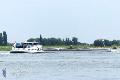
Cargo
Current Trip
| Time Travelled | 4 days |
|---|---|
| Remaining Time | --- |
| Distance Travelled | 180.46 nm |
| Remaining Distance | --- |
| AVG Speed | 8.1 Knots |
| MAX Speed | 10.1 Knots |
| AVG Wind | 9.4 knots |
| MAX Wind | 14 knots |
| MIN Temp | 5.7°C / 42.26°F |
| MAX Temp | 11.7°C / 53.06°F |
| Dybgang | 2.4 m |
| Position Modtaget | 4 m siden |
Current Position
| Longitude | --- |
|---|---|
| Latitude | --- |
| Status | Moored |
| Fart | |
| Kurs | --- |
| Område | North Sea |
| Station | T-AIS |
| Position Modtaget | 4 m siden |
Info
Information
The current position of AMARO is in North Sea with coordinates 52.18617° / 10.42111° as reported on 2025-12-14 06:11 by AIS to our vessel tracker app. The vessel's current speed is 0 Knots and is heading at the port of ZWARTSLUIS. The estimated time of arrival as calculated by MyShipTracking vessel tracking app is 2025-12-13 07:57 LT
The vessel AMARO (MMSI: 244700115) is a Cargo It's sailing under the flag of [NL] Netherlands.
In this page you can find informations about the vessels current position, last detected port calls, and current voyage information. If the vessels is not in coverage by AIS you will find the latest position.
The current position of AMARO is detected by our AIS receivers and we are not responsible for the reliability of the data. The last position was recorded while the vessel was in Coverage by the Ais receivers of our vessel tracking app.
The current draught of AMARO as reported by AIS is 2.4 meters
Weather
| Temperature | 2.9°C / 37.22°F |
|---|---|
| Wind Speed | 7 knots |
| Direction | 202° SSW |
| Pressure | 1026.2 hPa |
| Humidity | 91.6 % |
| Cloud Coverage | 55 % |
Featured Company
Last Port Calls
| Port | Arrival | Departure | Time In Port |
|---|---|---|---|
| 2025-12-08 14:48 | 2025-12-09 09:02 | 18 h | |
| 2025-12-08 09:08 | 2025-12-08 13:14 | 4 h | |
| 2025-12-06 15:27 | 2025-12-08 07:48 | 1 d | |
| 2025-12-03 15:18 | 2025-12-04 05:35 | 14 h | |
| 2025-12-03 12:18 | 2025-12-03 13:04 | 46 m | |
| 2025-11-28 19:04 | 2025-12-01 20:21 | 3 d | |
| 2025-11-24 17:11 | 2025-11-24 18:00 | 48 m | |
| 2025-11-12 13:20 | 2025-11-12 13:57 | 37 m | |
| 2025-11-11 12:44 | 2025-11-12 10:24 | 21 h | |
| 2025-11-10 17:16 | 2025-11-11 11:14 | 17 h |
Last Trips
| Origin | Departure | Destination | Arrival | Distance | |
|---|---|---|---|---|---|
| 2025-12-08 13:14 | 2025-12-08 14:48 | 13.14 nm | |||
| 2025-12-08 07:48 | 2025-12-08 09:08 | 12.46 nm | |||
| 2025-12-04 05:35 | 2025-12-06 15:27 | 83.36 nm | |||
| 2025-12-03 13:04 | 2025-12-03 15:18 | 11.38 nm | |||
| 2025-12-01 20:21 | 2025-12-03 12:18 | 91.50 nm | |||
| 2025-11-24 18:00 | 2025-11-28 19:04 | 96.50 nm | |||
| 2025-11-12 13:57 | 2025-11-24 17:11 | 302.63 nm | |||
| 2025-11-12 10:24 | 2025-11-12 13:20 | 20.21 nm | |||
| 2025-11-11 11:14 | 2025-11-11 12:44 | 11.40 nm | |||
| 2025-11-10 11:40 | 2025-11-10 17:16 | 1.15 nm |
Events
| Tid | Hændelsen | Detaljer | Position / Dest | Info |
|---|---|---|---|---|
| 2025-12-12 20:09 | Status er ændret | Moored Under way using engine |
52.18617 / 10.42112
ZWARTSLUIS
|
Fart: Kurs: 511° |
| 2025-12-12 19:47 | STOP Sejllads | 0.94 nm, North East of SALZGITTER |
52.18902 / 10.42081
ZWARTSLUIS
|
Fart: 0.3 kn Kurs: 511° |
| 2025-12-12 19:30 | START Sejllads | 2.34 nm, North of SALZGITTER |
52.21286 / 10.42400
ZWARTSLUIS
|
Fart: 5 kn Kurs: 166.7° |
| 2025-12-12 19:30 | Status er ændret | Under way using engine Moored |
52.21355 / 10.42371
ZWARTSLUIS
|
Fart: Kurs: 511° |
| 2025-12-12 19:26 | Status er ændret | Moored Under way using engine |
52.21449 / 10.42319
ZWARTSLUIS
|
Fart: Kurs: 511° |
| 2025-12-12 19:16 | STOP Sejllads | 2.44 nm, North of SALZGITTER |
52.21465 / 10.42307
ZWARTSLUIS
|
Fart: Kurs: 511° |
| 2025-12-12 19:01 | Indenfor Dækning |
52.22862 / 10.41651
North Sea
ZWARTSLUIS
|
Fart: 5.8 kn Kurs: 165.4° |
|
| 2025-12-12 13:31 | Udenfor Dækning |
52.40782 / 9.73925
North Sea
ZWARTSLUIS
|
Fart: 6.8 kn Kurs: 118.3° |
|
| 2025-12-12 11:46 | ETA er ændret | 2025/12/13 06:57 2025/12/11 14:03 |
52.39590 / 9.44385
ZWARTSLUIS
|
Fart: 6.7 kn Kurs: 73° |
| 2025-12-12 10:59 | Indenfor Dækning |
52.38932 / 9.35222
North Sea
|
Fart: 5.5 kn Kurs: 87.6° |