
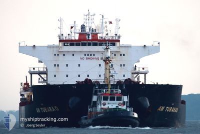
AG SATURN
Cargo
Current Trip
| Time Travelled | 7 days |
|---|---|
| Remaining Time | --- |
| Distance Travelled | 1722.80 nm |
| Remaining Distance | --- |
| AVG Speed | 11.3 Knots |
| MAX Speed | 15.9 Knots |
| AVG Wind | 11 knots |
| MAX Wind | 28 knots |
| MIN Temp | 11°C / 51.8°F |
| MAX Temp | 19.4°C / 66.92°F |
| Dybgang | 7 m |
| Position Modtaget | 56 m siden |
Current Position
| Longitude | 0.14507° |
|---|---|
| Latitude | 36.70457° |
| Status | Under way using engine |
| Fart | 11.8 Knots |
| Kurs | 259.8° |
| Område | Mediterranean Sea - Western Basin |
| Station | T-AIS |
| Position Modtaget | 56 m siden |
Info
Information
The current position of AG SATURN is in Mediterranean Sea - Western Basin with coordinates 36.70457° / 0.14507° as reported on 2024-05-05 06:55 by AIS to our vessel tracker app. The vessel's current speed is 11.8 Knots and is heading at the port of UST-LUGA.
The vessel AG SATURN (MMSI: 636015171) is a Cargo It's sailing under the flag of [LR] Liberia.
In this page you can find informations about the vessels current position, last detected port calls, and current voyage information. If the vessels is not in coverage by AIS you will find the latest position.
The current position of AG SATURN is detected by our AIS receivers and we are not responsible for the reliability of the data. The last position was recorded while the vessel was in Coverage by the Ais receivers of our vessel tracking app.
The current draught of AG SATURN as reported by AIS is 7 meters
Weather
| Temperature | 18.4°C / 65.12°F |
|---|---|
| Wind Speed | 7 knots |
| Direction | 226° SW |
| Pressure | 1016.5 hPa |
| Humidity | 67.4 % |
| Cloud Coverage | 18 % |
Featured Company
Most Visited Ports (Last year)
| Port | Arrivals | |
|---|---|---|
| 5 | ||
| 4 | ||
| 3 | ||
| 1 | ||
| 1 | ||
| 1 |
Last Trips
| Origin | Departure | Destination | Arrival | Distance | |
|---|---|---|---|---|---|
| 2024-03-31 12:59 | 2024-04-23 06:04 | 4829.34 nm | |||
| 2024-03-18 02:09 | 2024-03-25 01:42 | 1333.24 nm | |||
| 2024-03-07 03:27 | 2024-03-07 23:48 | 143.03 nm | |||
| 2024-02-16 04:00 | 2024-03-02 18:22 | 3116.58 nm |
Events
| Tid | Hændelsen | Detaljer | Position / Dest | Info |
|---|---|---|---|---|
| 2024-05-05 07:00 | Status er ændret | Default Under way using engine |
36.70186 / .12428
RUULU
|
Fart: 11.8 kn Kurs: 259.8° |
| 2024-05-05 06:54 | Status er ændret | Under way using engine Default |
36.70536 / .15046
RUULU
|
Fart: 11.8 kn Kurs: 260° |
| 2024-05-05 06:51 | Status er ændret | Default Under way using engine |
36.70722 / .16256
RUULU
|
Fart: 10.9 kn Kurs: 260° |
| 2024-05-05 06:11 | Status er ændret | Under way using engine Default |
36.73303 / .32022
RUULU
|
Fart: 11.6 kn Kurs: 263° |
| 2024-05-05 05:53 | Status er ændret | Default Under way using engine |
36.74077 / .39524
RUULU
|
Fart: 10.9 kn Kurs: 260° |
| 2024-05-05 04:43 | Dybgangen er ændret | 7 7.7 |
36.77460 / .67472
RUULU
|
Fart: 10.9 kn Kurs: 261° |
| 2024-05-05 04:31 | Status er ændret | Under way using engine Default |
36.77984 / .71929
RUULU
|
Fart: 11.5 kn Kurs: 264° |
| 2024-05-05 03:36 | Status er ændret | Default Under way using engine |
36.79929 / .94034
RUULU
|
Fart: 10.9 kn Kurs: 263° |
| 2024-05-05 03:30 | Status er ændret | Under way using engine Default |
36.80171 / .96817
RUULU
|
Fart: 11.8 kn Kurs: 264° |
| 2024-05-05 03:04 | Status er ændret | Default Under way using engine |
36.81049 / 1.07034
RUULU
|
Fart: 11.9 kn Kurs: 262° |