
ALINTERI-17
Passenger
Current Trip
ERT BC
| Time Travelled | 43 days |
|---|---|
| Remaining Time | --- |
| Distance Travelled | 115.73 nm |
| Remaining Distance | --- |
| AVG Speed | 6.6 Knots |
| MAX Speed | 10.8 Knots |
| AVG Wind | 8.2 knots |
| MAX Wind | 14 knots |
| MIN Temp | 8.4°C / 47.12°F |
| MAX Temp | 25.4°C / 77.72°F |
| Dybgang | 0 m |
| Position Modtaget | 2 d siden |
Current Position
| Longitude | 26.37838° |
|---|---|
| Latitude | 40.15344° |
| Status | Default |
| Fart | |
| Kurs | --- |
| Område | Sea of Marmara |
| Station | T-AIS |
| Position Modtaget | 2 d siden |
Info
Information
The current position of ALINTERI-17 is in Sea of Marmara with coordinates 40.15344° / 26.37838° as reported on 2024-05-12 09:03 by AIS to our vessel tracker app. The vessel's current speed is 0 Knots
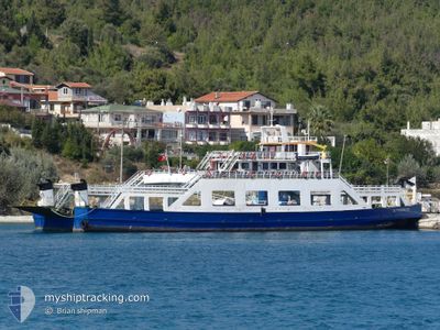
The vessel ALINTERI-17 (MMSI: 271002675) is a Passenger It's sailing under the flag of [TR] Turkey.
In this page you can find informations about the vessels current position, last detected port calls, and current voyage information. If the vessels is not in coverage by AIS you will find the latest position.
The current position of ALINTERI-17 is detected by our AIS receivers and we are not responsible for the reliability of the data. The last position was recorded while the vessel was in Coverage by the Ais receivers of our vessel tracking app.
Weather
| Temperature | 19.3°C / 66.74°F |
|---|---|
| Wind Speed | 10 knots |
| Direction | 29° NNE |
| Pressure | 1016 hPa |
| Humidity | 45.9 % |
| Cloud Coverage | 19 % |
Featured Company
Last Trips
| Origin | Departure | Destination | Arrival | Distance |
|---|
Events
| Tid | Hændelsen | Detaljer | Position / Dest | Info |
|---|---|---|---|---|
| 2024-05-12 09:03 | Udenfor Dækning |
40.15344 / 26.37838
Sea of Marmara
|
Fart: Kurs: 308.2° |
|
| 2024-05-12 08:51 | STOP Sejllads | 1.13 nm, West of CANAKKALE |
40.15343 / 26.37836
ERT BC
|
Fart: Kurs: 511° |
| 2024-05-12 07:29 | Indenfor Dækning |
40.05012 / 26.30735
Sea of Marmara
|
Fart: 7.5 kn Kurs: 47.3° |
|
| 2024-05-12 03:46 | START Sejllads | 3.66 nm, South West of BOZCAADA |
39.78549 / 26.02851
ERT BC
|
Fart: 7.3 kn Kurs: 80° |
| 2024-05-11 23:39 | STOP Sejllads | 3.95 nm, South West of BOZCAADA |
39.78383 / 26.02120
ERT BC
|
Fart: Kurs: -1° |
| 2024-05-11 20:18 | Udenfor Dækning |
40.06917 / 26.27380
Sea of Marmara
|
Fart: 10.3 kn Kurs: 239.1° |
|
| 2024-05-11 19:30 | START Sejllads | 1 nm, West of CANAKKALE |
40.15273 / 26.38122
ERT BC
|
Fart: 5.3 kn Kurs: 111.6° |
| 2024-05-11 16:00 | Indenfor Dækning |
40.15337 / 26.37837
Sea of Marmara
|
Fart: Kurs: 0° |
|
| 2024-05-11 11:22 | Udenfor Dækning |
40.15341 / 26.37841
Sea of Marmara
|
Fart: Kurs: 0° |
|
| 2024-05-11 09:49 | Indenfor Dækning |
40.15339 / 26.37835
Sea of Marmara
|
Fart: Kurs: 5.6° |