
ALASKA
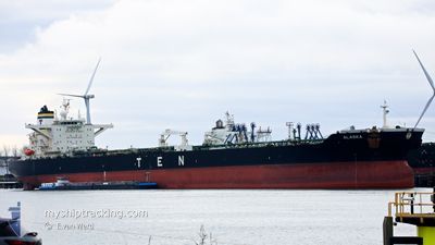
Crude Oil Tanker
Current Trip
| Time Travelled | 11 days |
|---|---|
| Remaining Time | --- |
| Distance Travelled | 3467.92 nm |
| Remaining Distance | --- |
| AVG Speed | 12.2 Knots |
| MAX Speed | 15 Knots |
| AVG Wind | 22.3 knots |
| MAX Wind | 34.5 knots |
| MIN Temp | 2.4°C / 36.32°F |
| MAX Temp | 16.8°C / 62.24°F |
| Dybgang | 16.1 m |
| Position Modtaget | 2 m siden |
Current Position
| Longitude | --- |
|---|---|
| Latitude | --- |
| Status | Under way using engine |
| Fart | 11.8 Knots |
| Kurs | 29.8° |
| Område | Aegean Sea |
| Station | T-AIS |
| Position Modtaget | 2 m siden |
Info
Information
The current position of ALASKA is in Aegean Sea with coordinates 37.12022° / 23.86824° as reported on 2026-01-10 18:28 by AIS to our vessel tracker app. The vessel's current speed is 11.8 Knots and is heading at the port of IZMIT. The estimated time of arrival as calculated by MyShipTracking vessel tracking app is 2026-01-12 05:00 LT
The vessel ALASKA (IMO: 9302607, MMSI: 538008784) is a Crude Oil Tanker that was built in 2006 ( 20 år gamle ). It's sailing under the flag of [MH] Marshall Is.
In this page you can find informations about the vessels current position, last detected port calls, and current voyage information. If the vessels is not in coverage by AIS you will find the latest position.
The current position of ALASKA is detected by our AIS receivers and we are not responsible for the reliability of the data. The last position was recorded while the vessel was in Coverage by the Ais receivers of our vessel tracking app.
The current draught of ALASKA as reported by AIS is 16.1 meters
Weather
| Temperature | 15.7°C / 60.26°F |
|---|---|
| Wind Speed | 31 knots |
| Direction | 243° WSW |
| Pressure | 1005.5 hPa |
| Humidity | 76.8 % |
| Cloud Coverage | 7 % |
Featured Company
Last Port Calls
| Port | Arrival | Departure | Time In Port |
|---|---|---|---|
| 2025-12-28 19:16 | 2025-12-29 22:11 | 1 d | |
| 2025-12-25 15:35 | 2025-12-26 20:58 | 1 d |
Last Trips
| Origin | Departure | Destination | Arrival | Distance | |
|---|---|---|---|---|---|
| 2025-12-26 20:58 | 2025-12-28 19:16 | 489.88 nm |
Events
| Tid | Hændelsen | Detaljer | Position / Dest | Info |
|---|---|---|---|---|
| 2026-01-10 17:44 | Status er ændret | Under way using engine Default |
36.99666 / 23.77804
NO MON>TR IZT
|
Fart: 11.7 kn Kurs: 32° |
| 2026-01-10 17:30 | Status er ændret | Default Under way using engine |
36.95618 / 23.74616
NO MON>TR IZT
|
Fart: 11.5 kn Kurs: 11.4° |
| 2026-01-10 16:39 | Status er ændret | Under way using engine Default |
36.79962 / 23.70979
NO MON>TR IZT
|
Fart: 11.6 kn Kurs: 8° |
| 2026-01-10 15:59 | Status er ændret | Default Under way using engine |
36.67712 / 23.65887
NO MON>TR IZT
|
Fart: 12 kn Kurs: 32.4° |
| 2026-01-10 15:50 | Fundet i havområde | Greek part of the Aegean Sea |
36.65168 / 23.63901
Aegean Sea
NO MON>TR IZT
|
Fart: 12.1 kn Kurs: 31.8° |
| 2026-01-10 15:46 | Status er ændret | Under way using engine Default |
36.64122 / 23.63091
NO MON>TR IZT
|
Fart: 12.4 kn Kurs: 31° |
| 2026-01-10 15:46 | Indenfor Dækning |
36.65168 / 23.63901
Aegean Sea
NO MON>TR IZT
|
Fart: 12.1 kn Kurs: 31.8° |
|
| 2026-01-09 02:17 | Status er ændret | Default Under way using engine |
36.35831 / 14.55437
NO MON>TR IZT
|
Fart: 12.3 kn Kurs: 105.3° |
| 2026-01-09 02:10 | Udenfor Dækning |
36.36382 / 14.52840
Mediterranean Sea - Eastern Basin
NO MON>TR IZT
|
Fart: 12.3 kn Kurs: 105.3° |
|
| 2026-01-09 00:29 | ETA er ændret | 2026/01/12 02:00 2026/01/11 22:00 |
36.45663 / 14.11193
NO MON>TR IZT
|
Fart: 12.4 kn Kurs: 114.5° |