
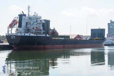
AASTIND
General Cargo
Current Trip
NOARE
| Time Travelled | 2 days |
|---|---|
| Remaining Time | --- |
| Distance Travelled | 310.46 nm |
| Remaining Distance | --- |
| AVG Speed | 9.5 Knots |
| MAX Speed | 12.1 Knots |
| AVG Wind | 8.8 knots |
| MAX Wind | 20.9 knots |
| MIN Temp | 9.2°C / 48.56°F |
| MAX Temp | 13.9°C / 57.02°F |
| Dybgang | 4.2 m |
| Position Modtaget | Nu |
Current Position
| Longitude | 11.06256° |
|---|---|
| Latitude | 54.63712° |
| Status | Under way using engine |
| Fart | 11.6 Knots |
| Kurs | 300.8° |
| Område | Baltic Sea |
| Station | T-AIS |
| Position Modtaget | Nu |
Info
Information
The current position of AASTIND is in Baltic Sea with coordinates 54.63712° / 11.06256° as reported on 2024-05-06 23:06 by AIS to our vessel tracker app. The vessel's current speed is 11.6 Knots
The vessel AASTIND (IMO: 9147136, MMSI: 236729000) is a General Cargo that was built in 1997 ( 27 år gamle ). It's sailing under the flag of [GI] Gibraltar.
In this page you can find informations about the vessels current position, last detected port calls, and current voyage information. If the vessels is not in coverage by AIS you will find the latest position.
The current position of AASTIND is detected by our AIS receivers and we are not responsible for the reliability of the data. The last position was recorded while the vessel was in Coverage by the Ais receivers of our vessel tracking app.
The current draught of AASTIND as reported by AIS is 4.2 meters
Weather
| Temperature | 10.3°C / 50.54°F |
|---|---|
| Wind Speed | 9 knots |
| Direction | 75° ENE |
| Pressure | 1013.8 hPa |
| Humidity | 90.3 % |
| Cloud Coverage | 100 % |
Featured Company
Last Port Calls
| Port | Arrival | Departure | Time In Port |
|---|---|---|---|
| 2024-05-04 06:19 | 2024-05-04 20:38 | 14 h | |
| 2024-04-09 03:36 | 2024-05-02 18:39 | 23 d | |
| 2024-04-06 03:14 | 2024-04-06 18:19 | 15 h | |
| 2024-04-02 18:03 | 2024-04-03 13:41 | 19 h | |
| 2024-04-01 04:35 | 2024-04-02 04:30 | 23 h | |
| 2024-03-30 00:18 | 2024-03-30 12:39 | 12 h | |
| 2024-03-27 09:23 | 2024-03-28 10:09 | 1 d | |
| 2024-03-26 02:06 | 2024-03-26 03:51 | 1 h | |
| 2024-03-23 10:39 | 2024-03-24 05:20 | 18 h | |
| 2024-03-19 16:19 | 2024-03-20 11:21 | 19 h |
Last Trips
| Origin | Departure | Destination | Arrival | Distance | |
|---|---|---|---|---|---|
| 2024-05-02 20:39 | 2024-05-04 08:19 | 381.86 nm | |||
| 2024-04-06 20:19 | 2024-04-09 05:36 | 376.86 nm | |||
| 2024-04-03 15:41 | 2024-04-06 05:14 | 401.46 nm | |||
| 2024-04-02 06:30 | 2024-04-02 20:03 | 155.67 nm | |||
| 2024-03-30 13:39 | 2024-04-01 06:35 | 404.97 nm | |||
| 2024-03-28 11:09 | 2024-03-30 01:18 | 275.19 nm | |||
| 2024-03-26 04:51 | 2024-03-27 10:23 | 283.59 nm | |||
| 2024-03-24 06:20 | 2024-03-26 03:06 | 331.25 nm | |||
| 2024-03-20 12:21 | 2024-03-23 11:39 | 599.88 nm | |||
| 2024-03-16 00:57 | 2024-03-19 17:19 | 598.65 nm |
Events
| Tid | Hændelsen | Detaljer | Position / Dest | Info |
|---|---|---|---|---|
| 2024-05-06 22:38 | Fundet i havområde | German part of the Baltic Sea |
54.60467 / 11.20674
Baltic Sea
|
Fart: 11.8 kn Kurs: 269.9° |
| 2024-05-06 21:57 | START Sejllads | 1.44 nm, South East of RODBYHAVN |
54.63676 / 11.37954
NOARE
|
Fart: 3.1 kn Kurs: 199° |
| 2024-05-06 21:54 | Status er ændret | Under way using engine Moored |
54.63756 / 11.37907
NOARE
|
Fart: 2 kn Kurs: 277° |
| 2024-05-06 21:30 | Dybgangen er ændret | 4.2 7.1 |
54.63837 / 11.37533
NOARE
|
Fart: Kurs: 294° |
| 2024-05-06 21:30 | Destination er ændret | NOARE DKTHR |
54.63837 / 11.37533
NOARE
|
Fart: Kurs: 294° |
| 2024-05-06 21:30 | ETA er ændret | 2024/08/05 23:00 2024/05/06 04:00 |
54.63837 / 11.37533
NOARE
|
Fart: Kurs: 294° |
| 2024-05-06 21:29 | Status er ændret | Moored Under way using engine |
54.63837 / 11.37534
DKTHR
|
Fart: Kurs: 294° |
| 2024-05-06 03:04 | STOP Sejllads | 1.29 nm, South East of RODBYHAVN |
54.63817 / 11.37592
DKTHR
|
Fart: 0.3 kn Kurs: 297° |
| 2024-05-06 02:20 | Ændre havområde | Danish part of the Baltic Sea German part of the Baltic Sea |
54.58058 / 11.28629
Baltic Sea
DKTHR
|
Fart: 11.3 kn Kurs: 57.3° |
| 2024-05-06 01:08 | Ændre havområde | German part of the Baltic Sea Danish part of the Baltic Sea |
54.64062 / 11.00964
Baltic Sea
DKTHR
|
Fart: 9.6 kn Kurs: 126.6° |