
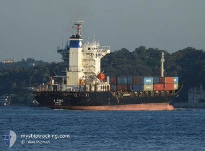
FESCO EKATERINA
Container Ship
Current Trip
| Time Travelled | 10 days |
|---|---|
| Remaining Time | 1 day |
| Distance Travelled | 1306.31 nm |
| Remaining Distance | 472.32 nm |
| AVG Speed | 10.6 Knots |
| MAX Speed | 10.6 Knots |
| AVG Wind | 7.5 knots |
| MAX Wind | 18.8 knots |
| MIN Temp | 13.7°C / 56.66°F |
| MAX Temp | 31.9°C / 89.42°F |
| Dybgang | 7.5 m |
| Position Modtaget | Nu |
Current Position
| Longitude | 25.75837° |
|---|---|
| Latitude | 38.02070° |
| Status | Under way using engine |
| Fart | 12 Knots |
| Kurs | 161° |
| Område | Aegean Sea |
| Station | T-AIS |
| Position Modtaget | Nu |
Info
Information
The current position of FESCO EKATERINA is in Aegean Sea with coordinates 38.02070° / 25.75837° as reported on 2024-06-08 00:12 by AIS to our vessel tracker app. The vessel's current speed is 12 Knots and is heading at the port of EL DEKHEILA. The estimated time of arrival as calculated by MyShipTracking vessel tracking app is 2024-06-09 14:45 LT
The vessel FESCO EKATERINA (IMO: 9343687, MMSI: 352297000) is a Container Ship that was built in 2007 ( 17 år gamle ). It's sailing under the flag of [PA] Panama.
In this page you can find informations about the vessels current position, last detected port calls, and current voyage information. If the vessels is not in coverage by AIS you will find the latest position.
The current position of FESCO EKATERINA is detected by our AIS receivers and we are not responsible for the reliability of the data. The last position was recorded while the vessel was in Coverage by the Ais receivers of our vessel tracking app.
The current draught of FESCO EKATERINA as reported by AIS is 7.5 meters
Weather
| Temperature | 23.4°C / 74.12°F |
|---|---|
| Wind Speed | 14 knots |
| Direction | 352° N |
| Pressure | 1009.7 hPa |
| Humidity | 77.6 % |
| Cloud Coverage | --- |
Featured Company
Last Port Calls
| Port | Arrival | Departure | Time In Port |
|---|---|---|---|
| 2024-05-27 19:28 | 2024-05-28 02:37 | 7 h | |
| 2024-05-24 03:05 | 2024-05-24 11:57 | 8 h | |
| 2024-05-12 23:20 | 2024-05-13 12:02 | 12 h | |
| 2024-05-10 14:28 | 2024-05-11 01:40 | 11 h | |
| 2024-04-30 00:56 | 2024-04-30 09:29 | 8 h | |
| 2024-04-26 11:21 | 2024-04-26 16:28 | 5 h | |
| 2024-04-22 00:27 | |||
| 2024-04-15 03:40 | 2024-04-15 13:26 | 9 h | |
| 2024-04-03 15:54 | 2024-04-04 01:06 | 9 h | |
| 2024-04-01 05:57 | 2024-04-01 17:57 | 11 h |
Most Visited Ports (Last year)
| Port | Arrivals | |
|---|---|---|
| 21 | ||
| 20 | ||
| 19 | ||
| 8 | ||
| 4 | ||
| 4 |
Last Trips
| Origin | Departure | Destination | Arrival | Distance | |
|---|---|---|---|---|---|
| 2024-05-13 17:32 | 2024-05-27 22:28 | 3855.80 nm | |||
| 2024-05-13 17:32 | 2024-05-24 05:05 | 2971.16 nm | |||
| 2024-05-11 07:10 | 2024-05-13 04:50 | 428.60 nm | |||
| 2024-04-26 19:28 | 2024-05-10 19:58 | 4056.02 nm | |||
| 2024-04-26 19:28 | 2024-04-30 02:56 | 807.06 nm | |||
| 2024-04-04 06:36 | 2024-04-22 03:27 | 4371.16 nm | |||
| 2024-04-04 06:36 | 2024-04-15 05:40 | 2915.91 nm | |||
| 2024-04-01 23:27 | 2024-04-03 21:24 | 431.67 nm | |||
| 2024-03-15 10:21 | 2024-04-01 11:27 | 4389.77 nm |
Events
| Tid | Hændelsen | Detaljer | Position / Dest | Info |
|---|---|---|---|---|
| 2024-06-07 23:17 | ETA er ændret | 2024/06/09 13:00 2024/06/10 12:00 |
38.20725 / 25.74352
EGEDK
|
Fart: 12.5 kn Kurs: 192° |
| 2024-06-07 15:17 | Ændre havområde | Greek part of the Aegean Sea Turkish part of the Aegean Sea |
39.89170 / 25.81820
Aegean Sea
EGEDK
|
Fart: 14 kn Kurs: 221° |
| 2024-06-07 14:50 | Status er ændret | Under way using engine Default |
39.96338 / 25.91433
EGEDK
|
Fart: 13.8 kn Kurs: 234° |
| 2024-06-07 14:22 | Status er ændret | Default Under way using engine |
40.01277 / 26.04520
EGEDK
|
Fart: 14.8 kn Kurs: 267° |
| 2024-06-07 13:59 | Ændre havområde | Turkish part of the Aegean Sea Turkish part of the Sea of Marmara |
40.02075 / 26.16550
Aegean Sea
EGEDK
|
Fart: 15.3 kn Kurs: 255° |
| 2024-06-07 11:41 | Status er ændret | Under way using engine Default |
40.31152 / 26.58620
EGEDK
|
Fart: 14.2 kn Kurs: 219° |
| 2024-06-07 11:30 | Status er ændret | Default Under way using engine |
40.33965 / 26.62758
EGEDK
|
Fart: 14.1 kn Kurs: 208° |
| 2024-06-07 11:26 | Status er ændret | Under way using engine Default |
40.35203 / 26.63753
EGEDK
|
Fart: 13.8 kn Kurs: 213° |
| 2024-06-07 11:18 | Indenfor Dækning |
40.34653 / 26.63360
Sea of Marmara
EGEDK
|
Fart: 14.1 kn Kurs: 208° |
|
| 2024-06-07 09:50 | Udenfor Dækning |
40.53300 / 27.03613
Sea of Marmara
EGEDK
|
Fart: 13.3 kn Kurs: 254° |