
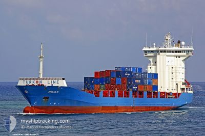
ZIM NEW ZEALAND
Container Ship
Current Trip
| Time Travelled | 19 h, 58 mins |
|---|---|
| Remaining Time | 2 days |
| Distance Travelled | 395.09 nm |
| Remaining Distance | 1246.86 nm |
| AVG Speed | 15.2 Knots |
| MAX Speed | 15.2 Knots |
| AVG Wind | 6.6 knots |
| MAX Wind | 9.8 knots |
| MIN Temp | 20.8°C / 69.44°F |
| MAX Temp | 22.6°C / 72.68°F |
| Draught | 6.2 m |
| Position Received | 1 m ago |
Current Position
| Longitude | 28.06818° |
|---|---|
| Latitude | 34.88077° |
| Status | Under way using engine |
| Speed | 15.9 Knots |
| Course | 293° |
| Area | Mediterranean Sea - Eastern Basin |
| Station | T-AIS |
| Position Received | 1 m ago |
Info
Information
The current position of ZIM NEW ZEALAND is in Mediterranean Sea - Eastern Basin with coordinates 34.88077° / 28.06818° as reported on 2024-05-18 13:01 by AIS to our vessel tracker app. The vessel's current speed is 15.9 Knots and is heading at the port of FOS. The estimated time of arrival as calculated by MyShipTracking vessel tracking app is 2024-05-21 06:12 LT
The vessel ZIM NEW ZEALAND (IMO: 9366471, MMSI: 636021506) is a Container Ship that was built in 2007 ( 17 years old ). It's sailing under the flag of [LR] Liberia.
In this page you can find informations about the vessels current position, last detected port calls, and current voyage information. If the vessels is not in coverage by AIS you will find the latest position.
The current position of ZIM NEW ZEALAND is detected by our AIS receivers and we are not responsible for the reliability of the data. The last position was recorded while the vessel was in Coverage by the Ais receivers of our vessel tracking app.
The current draught of ZIM NEW ZEALAND as reported by AIS is 6.2 meters
Weather
| Temperature | 22.2°C / 71.96°F |
|---|---|
| Wind Speed | 2 knots |
| Direction | 221° SW |
| Pressure | 1014.5 hPa |
| Humidity | 77.3 % |
| Cloud Coverage | 100 % |
Featured Company
Last Port Calls
| Port | Arrival | Departure | Time In Port |
|---|---|---|---|
| 2024-05-17 20:03 | 2024-05-17 20:05 | 1 m | |
| 2024-05-17 19:44 | 2024-05-17 19:52 | 7 m | |
| 2024-05-17 02:31 | |||
| 2024-05-15 20:03 | 2024-05-16 19:07 | 23 h | |
| 2024-05-09 19:14 | 2024-05-10 07:34 | 12 h | |
| 2024-05-08 07:26 | 2024-05-08 20:03 | 12 h | |
| 2024-05-07 05:05 | 2024-05-07 17:03 | 11 h | |
| 2024-05-02 10:39 | 2024-05-03 04:59 | 18 h | |
| 2024-04-25 06:41 | 2024-04-26 13:02 | 1 d | |
| 2024-04-24 06:55 | 2024-04-24 20:43 | 13 h |
Last Trips
| Origin | Departure | Destination | Arrival | Distance | |
|---|---|---|---|---|---|
| 2024-05-17 19:52 | 2024-05-17 20:03 | 5.69 nm | |||
| 2024-05-17 19:52 | 2024-05-17 19:44 | 5.69 nm | |||
| 2024-05-16 19:07 | 2024-05-17 02:31 | 196.39 nm | |||
| 2024-05-10 07:34 | 2024-05-15 20:03 | 1358.89 nm | |||
| 2024-05-08 20:03 | 2024-05-09 19:14 | 81.28 nm | |||
| 2024-05-07 17:03 | 2024-05-08 07:26 | 73.77 nm | |||
| 2024-05-03 04:59 | 2024-05-07 05:05 | 1402.45 nm | |||
| 2024-04-26 13:02 | 2024-05-02 10:39 | 1797.83 nm | |||
| 2024-04-24 20:43 | 2024-04-25 06:41 | 81.60 nm | |||
| 2024-04-23 15:56 | 2024-04-24 06:55 | 74.07 nm |
Events
| Time | Event | Details | Position / Dest | Info |
|---|---|---|---|---|
| 2024-05-18 12:55 | START Moving |
34.87089 / 28.09795
ILHFA-FRFOS
|
Speed: 15.6 kn Course: 291.6° |
|
| 2024-05-18 12:54 | STOP Moving |
34.86808 / 28.10561
ILHFA-FRFOS
|
Speed: Course: 292° |
|
| 2024-05-18 05:55 | Change Sea Area | Greek part of the Mediterranean Sea - Eastern Basin Cypriote part of the Mediterranean Sea - Eastern Basin |
34.25093 / 30.09007
Mediterranean Sea - Eastern Basin
ILHFA-FRFOS
|
Speed: 15 kn Course: 289.2° |
| 2024-05-18 04:56 | Status Changed | Under way using engine Default |
34.17110 / 30.36764
ILHFA-FRFOS
|
Speed: 11.7 kn Course: 320° |
| 2024-05-18 04:56 | IN Coverage |
34.17434 / 30.35682
Mediterranean Sea - Eastern Basin
ILHFA-FRFOS
|
Speed: 14.9 kn Course: 290.2° |
|
| 2024-05-18 03:31 | Status Changed | Default Under way using engine |
34.04644 / 30.76209
ILHFA-FRFOS
|
Speed: 14.8 kn Course: 288.9° |
| 2024-05-18 03:28 | OUT of Coverage |
34.04209 / 30.77721
Mediterranean Sea - Eastern Basin
ILHFA-FRFOS
|
Speed: 14.8 kn Course: 288.9° |
|
| 2024-05-18 03:27 | Status Changed | Under way using engine Default |
34.04116 / 30.78042
ILHFA-FRFOS
|
Speed: 14.7 kn Course: 289° |
| 2024-05-18 03:12 | IN Coverage |
34.04209 / 30.77721
Mediterranean Sea - Eastern Basin
ILHFA-FRFOS
|
Speed: 14.8 kn Course: 288.9° |
|
| 2024-05-18 02:21 | OUT of Coverage |
33.95359 / 31.08416
Mediterranean Sea - Eastern Basin
ILHFA-FRFOS
|
Speed: 14.6 kn Course: 288.8° |