
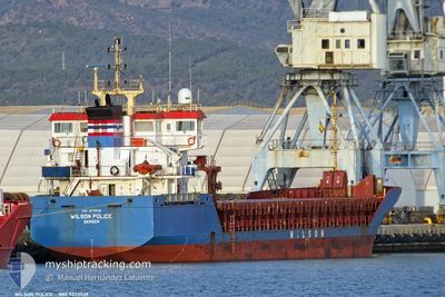
WILSON POLICE
General Cargo
Current Trip
| Time Travelled | 3 days |
|---|---|
| Remaining Time | 13 h, 43 mins |
| Distance Travelled | 880.97 nm |
| Remaining Distance | 150.52 nm |
| AVG Speed | 10.3 Knots |
| MAX Speed | 11.7 Knots |
| AVG Wind | 7.7 knots |
| MAX Wind | 15.9 knots |
| MIN Temp | 15°C / 59°F |
| MAX Temp | 27.1°C / 80.78°F |
| Draught | 4.2 m |
| Position Received | 2 h, 9 m ago |
Current Position
| Longitude | 26.44218° |
|---|---|
| Latitude | 40.21187° |
| Status | Under way using engine |
| Speed | 10 Knots |
| Course | 72° |
| Area | Sea of Marmara |
| Station | T-AIS |
| Position Received | 2 h, 9 m ago |
Info
Information
The current position of WILSON POLICE is in Sea of Marmara with coordinates 40.21187° / 26.44218° as reported on 2024-06-01 07:26 by AIS to our vessel tracker app. The vessel's current speed is 10 Knots and is heading at the port of DILISKELESI. The estimated time of arrival as calculated by MyShipTracking vessel tracking app is 2024-06-01 23:19 LT
The vessel WILSON POLICE (IMO: 9373539, MMSI: 257765000) is a General Cargo that was built in 2007 ( 17 years old ). It's sailing under the flag of [NO] Norway.
In this page you can find informations about the vessels current position, last detected port calls, and current voyage information. If the vessels is not in coverage by AIS you will find the latest position.
The current position of WILSON POLICE is detected by our AIS receivers and we are not responsible for the reliability of the data. The last position was recorded while the vessel was in Coverage by the Ais receivers of our vessel tracking app.
The current draught of WILSON POLICE as reported by AIS is 4.2 meters
Weather
| Temperature | 24.7°C / 76.46°F |
|---|---|
| Wind Speed | 6 knots |
| Direction | 288° WNW |
| Pressure | 1018 hPa |
| Humidity | 54.5 % |
| Cloud Coverage | --- |
Featured Company
Last Port Calls
| Port | Arrival | Departure | Time In Port |
|---|---|---|---|
| 2024-05-26 11:01 | 2024-05-28 20:22 | 2 d | |
| 2024-05-16 09:34 | 2024-05-16 23:25 | 13 h | |
| 2024-05-06 21:06 | 2024-05-09 22:16 | 3 d | |
| 2024-05-01 22:18 | 2024-05-03 10:44 | 1 d | |
| 2024-04-30 02:58 | 2024-05-01 00:22 | 21 h | |
| 2024-04-26 04:12 | 2024-04-26 15:36 | 11 h | |
| 2024-04-15 22:35 | 2024-04-18 00:22 | 2 d | |
| 2024-04-15 21:34 | 2024-04-15 22:18 | 44 m | |
| 2024-04-13 18:24 | 2024-04-15 20:16 | 2 d | |
| 2024-04-04 16:27 | 2024-04-09 20:09 | 5 d |
Last Trips
| Origin | Departure | Destination | Arrival | Distance | |
|---|---|---|---|---|---|
| 2024-05-17 01:25 | 2024-05-26 13:01 | 2321.76 nm | |||
| 2024-05-09 23:16 | 2024-05-16 11:34 | 786.79 nm | |||
| 2024-05-03 11:44 | 2024-05-06 22:06 | 850.57 nm | |||
| 2024-05-01 01:22 | 2024-05-01 23:18 | 210.05 nm | |||
| 2024-04-26 17:36 | 2024-04-30 03:58 | 711.52 nm | |||
| 2024-04-18 02:22 | 2024-04-26 06:12 | 1870.42 nm | |||
| 2024-04-16 00:18 | 2024-04-16 00:35 | 0.39 nm | |||
| 2024-04-15 22:16 | 2024-04-15 23:34 | 12.17 nm | |||
| 2024-04-09 22:09 | 2024-04-13 20:24 | 571.52 nm | |||
| 2024-03-29 03:27 | 2024-04-04 18:27 | 1624.83 nm |
Events
| Time | Event | Details | Position / Dest | Info |
|---|---|---|---|---|
| 2024-06-01 07:46 | Status Changed | Default Under way using engine |
40.23850 / 26.50579
TRDIL
|
Speed: 10 kn Course: 72° |
| 2024-06-01 07:26 | OUT of Coverage |
40.21187 / 26.44218
Sea of Marmara
TRDIL
|
Speed: 10 kn Course: 72° |
|
| 2024-06-01 06:00 | Change Sea Area | Turkish part of the Sea of Marmara Greek part of the Aegean Sea |
40.04753 / 26.30053
Sea of Marmara
TRDIL
|
Speed: 11.2 kn Course: 39° |
| 2024-06-01 06:00 | Status Changed | Under way using engine Default |
40.04753 / 26.30053
TRDIL
|
Speed: 8.8 kn Course: 91° |
| 2024-06-01 06:00 | IN Coverage |
40.04753 / 26.30053
Sea of Marmara
TRDIL
|
Speed: 11.2 kn Course: 39° |
|
| 2024-05-31 22:06 | Status Changed | Default Under way using engine |
39.21544 / 25.43595
TRDIL
|
Speed: 10.8 kn Course: 21.8° |
| 2024-05-31 21:51 | OUT of Coverage |
39.17681 / 25.40697
Aegean Sea
TRDIL
|
Speed: 10.8 kn Course: 21.8° |
|
| 2024-05-31 21:19 | Status Changed | Under way using engine Default |
39.09001 / 25.34899
TRDIL
|
Speed: 10.8 kn Course: 24° |
| 2024-05-31 20:53 | Status Changed | Default Under way using engine |
39.02087 / 25.30909
TRDIL
|
Speed: 10.8 kn Course: 24.3° |
| 2024-05-31 11:35 | Status Changed | Under way using engine Default |
37.51255 / 24.39541
TRDIL
|
Speed: 10.4 kn Course: 39° |