
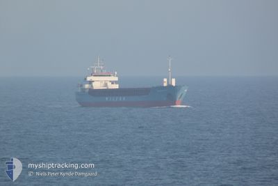
WILSON BLYTH
General Cargo
Current Trip
| Time Travelled | 13 days |
|---|---|
| Remaining Time | 2 days |
| Distance Travelled | 2909.04 nm |
| Remaining Distance | 523.43 nm |
| AVG Speed | 8.9 Knots |
| MAX Speed | 13 Knots |
| AVG Wind | 12.1 knots |
| MAX Wind | 30 knots |
| MIN Temp | 11.6°C / 52.88°F |
| MAX Temp | 20.8°C / 69.44°F |
| Draught | 5.9 m |
| Position Received | Now |
Current Position
| Longitude | 19.05429° |
|---|---|
| Latitude | 36.38793° |
| Status | Under way using engine |
| Speed | 8.9 Knots |
| Course | 89.9° |
| Area | Mediterranean Sea - Eastern Basin |
| Station | T-AIS |
| Position Received | Now |
Info
Information
The current position of WILSON BLYTH is in Mediterranean Sea - Eastern Basin with coordinates 36.38793° / 19.05429° as reported on 2024-05-22 19:45 by AIS to our vessel tracker app. The vessel's current speed is 8.9 Knots and is heading at the port of NEA KARVALI. The estimated time of arrival as calculated by MyShipTracking vessel tracking app is 2024-05-25 09:09 LT
The vessel WILSON BLYTH (IMO: 9124419, MMSI: 314544000) is a General Cargo that was built in 1995 ( 29 years old ). It's sailing under the flag of [BB] Barbados.
In this page you can find informations about the vessels current position, last detected port calls, and current voyage information. If the vessels is not in coverage by AIS you will find the latest position.
The current position of WILSON BLYTH is detected by our AIS receivers and we are not responsible for the reliability of the data. The last position was recorded while the vessel was in Coverage by the Ais receivers of our vessel tracking app.
The current draught of WILSON BLYTH as reported by AIS is 5.9 meters
Weather
| Temperature | 20.3°C / 68.54°F |
|---|---|
| Wind Speed | 8 knots |
| Direction | 293° WNW |
| Pressure | 1016.8 hPa |
| Humidity | 78.7 % |
| Cloud Coverage | --- |
Featured Company
Last Port Calls
| Port | Arrival | Departure | Time In Port |
|---|---|---|---|
| 2024-05-08 14:21 | 2024-05-09 11:28 | 21 h | |
| 2024-05-06 12:36 | 2024-05-08 00:51 | 1 d | |
| 2024-04-27 20:16 | 2024-04-28 11:29 | 15 h | |
| 2024-04-22 15:30 | 2024-04-23 20:14 | 1 d | |
| 2024-04-20 18:23 | 2024-04-20 18:48 | 25 m | |
| 2024-04-20 08:49 | 2024-04-20 09:42 | 53 m | |
| 2024-04-19 05:43 | 2024-04-19 15:19 | 9 h | |
| 2024-04-16 12:40 | 2024-04-16 22:18 | 9 h | |
| 2024-04-12 11:18 | 2024-04-13 16:31 | 1 d | |
| 2024-04-05 14:53 | 2024-04-06 13:19 | 22 h |
Most Visited Ports (Last year)
| Port | Arrivals | |
|---|---|---|
| 7 | ||
| 5 | ||
| 4 | ||
| 3 | ||
| 3 | ||
| 3 |
Last Trips
| Origin | Departure | Destination | Arrival | Distance | |
|---|---|---|---|---|---|
| 2024-05-08 00:51 | 2024-05-08 14:21 | 149.11 nm | |||
| 2024-04-28 11:29 | 2024-05-06 12:36 | 923.46 nm | |||
| 2024-04-23 20:14 | 2024-04-27 20:16 | 809.66 nm | |||
| 2024-04-20 18:48 | 2024-04-22 15:30 | 286.56 nm | |||
| 2024-04-20 09:42 | 2024-04-20 18:23 | 50.68 nm | |||
| 2024-04-19 15:19 | 2024-04-20 08:49 | 148.25 nm | |||
| 2024-04-16 22:18 | 2024-04-19 05:43 | 530.71 nm | |||
| 2024-04-13 16:31 | 2024-04-16 12:40 | 674.84 nm | |||
| 2024-04-06 13:19 | 2024-04-12 11:18 | 1160.84 nm | |||
| 2024-04-03 21:17 | 2024-04-05 14:53 | 357.27 nm |
Events
| Time | Event | Details | Position / Dest | Info |
|---|---|---|---|---|
| 2024-05-22 19:27 | Status Changed | Under way using engine Default |
36.38759 / 18.99860
NEA KARVALI
|
Speed: 9 kn Course: 88° |
| 2024-05-22 19:22 | Status Changed | Default Under way using engine |
36.38737 / 18.98096
NEA KARVALI
|
Speed: 9 kn Course: 88.2° |
| 2024-05-22 19:21 | Status Changed | Under way using engine Default |
36.38732 / 18.97745
NEA KARVALI
|
Speed: 9 kn Course: 89° |
| 2024-05-22 19:21 | Change Sea Area | Greek part of the Mediterranean Sea - Eastern Basin Italian part of the Mediterranean Sea - Eastern Basin |
36.38732 / 18.97745
Mediterranean Sea - Eastern Basin
NEA KARVALI
|
Speed: 9 kn Course: 88.2° |
| 2024-05-22 19:04 | IN Coverage |
36.38732 / 18.97745
Mediterranean Sea - Eastern Basin
NEA KARVALI
|
Speed: 9 kn Course: 88.2° |
|
| 2024-05-21 19:00 | Status Changed | Default Under way using engine |
36.46253 / 14.58701
NEA KARVALI
|
Speed: 8.7 kn Course: 98.4° |
| 2024-05-21 18:52 | OUT of Coverage |
36.46340 / 14.56355
Mediterranean Sea - Eastern Basin
NEA KARVALI
|
Speed: 8.7 kn Course: 98.4° |
|
| 2024-05-21 14:45 | Status Changed | Under way using engine Default |
36.63125 / 13.85572
NEA KARVALI
|
Speed: 8.8 kn Course: 106° |
| 2024-05-21 14:45 | IN Coverage |
36.63125 / 13.85572
Mediterranean Sea - Eastern Basin
NEA KARVALI
|
Speed: 8.7 kn Course: 106.6° |
|
| 2024-05-21 13:11 | OUT of Coverage |
36.69995 / 13.57497
Mediterranean Sea - Eastern Basin
NEA KARVALI
|
Speed: 9.3 kn Course: 106.2° |