
VOSTA
Tanker
Current Trip
| Time Travelled | 2 days |
|---|---|
| Remaining Time | 5 h, 22 mins |
| Distance Travelled | 232.62 nm |
| Remaining Distance | 63.86 nm |
| AVG Speed | 6.4 Knots |
| MAX Speed | 11.9 Knots |
| AVG Wind | 6.7 knots |
| MAX Wind | 10.9 knots |
| MIN Temp | 8.8°C / 47.84°F |
| MAX Temp | 18.9°C / 66.02°F |
| Draught | 2.2 m |
| Position Received | 1 m ago |
Current Position
| Longitude | 6.97144° |
|---|---|
| Latitude | 50.95247° |
| Status | Under way using engine |
| Speed | 10.9 Knots |
| Course | 35.8° |
| Area | North Sea |
| Station | T-AIS |
| Position Received | 1 m ago |
Info
Information
The current position of VOSTA is in North Sea with coordinates 50.95247° / 6.97144° as reported on 2024-05-31 02:11 by AIS to our vessel tracker app. The vessel's current speed is 10.9 Knots and is heading at the port of GELSENKIRCHEN. The estimated time of arrival as calculated by MyShipTracking vessel tracking app is 2024-05-31 09:34 LT
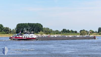
The vessel VOSTA (MMSI: 244780360) is a Tanker It's sailing under the flag of [NL] Netherlands.
In this page you can find informations about the vessels current position, last detected port calls, and current voyage information. If the vessels is not in coverage by AIS you will find the latest position.
The current position of VOSTA is detected by our AIS receivers and we are not responsible for the reliability of the data. The last position was recorded while the vessel was in Coverage by the Ais receivers of our vessel tracking app.
The current draught of VOSTA as reported by AIS is 2.2 meters
Weather
| Temperature | 10.1°C / 50.18°F |
|---|---|
| Wind Speed | 4 knots |
| Direction | 273° W |
| Pressure | 1009.7 hPa |
| Humidity | 95.7 % |
| Cloud Coverage | 100 % |
Featured Company
Last Port Calls
| Port | Arrival | Departure | Time In Port |
|---|---|---|---|
| 2024-05-28 08:39 | 2024-05-28 11:38 | 2 h | |
| 2024-05-26 21:22 | 2024-05-27 09:46 | 12 h | |
| 2024-05-26 20:52 | 2024-05-26 21:10 | 17 m | |
| 2024-05-24 22:36 | 2024-05-26 11:57 | 1 d | |
| 2024-05-22 10:03 | 2024-05-23 02:28 | 16 h | |
| 2024-05-20 02:58 | 2024-05-22 09:41 | 2 d | |
| 2024-05-20 01:14 | 2024-05-20 02:23 | 1 h | |
| 2024-05-16 17:45 | 2024-05-17 08:11 | 14 h | |
| 2024-05-15 19:32 | 2024-05-16 14:52 | 19 h | |
| 2024-05-15 16:19 | 2024-05-15 17:24 | 1 h |
Last Trips
| Origin | Departure | Destination | Arrival | Distance | |
|---|---|---|---|---|---|
| 2024-05-27 09:46 | 2024-05-28 08:39 | 125.03 nm | |||
| 2024-05-26 21:10 | 2024-05-26 21:22 | 0.89 nm | |||
| 2024-05-26 11:57 | 2024-05-26 20:52 | 73.86 nm | |||
| 2024-05-23 02:28 | 2024-05-24 22:36 | 324.06 nm | |||
| 2024-05-22 09:41 | 2024-05-22 10:03 | 3.19 nm | |||
| 2024-05-20 02:23 | 2024-05-20 02:58 | 2.88 nm | |||
| 2024-05-17 08:11 | 2024-05-20 01:14 | 332.75 nm | |||
| 2024-05-16 14:52 | 2024-05-16 17:45 | 24.14 nm | |||
| 2024-05-15 17:24 | 2024-05-15 19:32 | 3.01 nm | |||
| 2024-05-15 15:55 | 2024-05-15 16:19 | 2.83 nm |
Events
| Time | Event | Details | Position / Dest | Info |
|---|---|---|---|---|
| 2024-05-30 22:47 | IN Coverage |
50.47715 / 7.34207
North Sea
GELSENKIRCHEN
|
Speed: 11.4 kn Course: 323.4° |
|
| 2024-05-30 18:29 | OUT of Coverage |
49.97274 / 7.89151
North Sea
GELSENKIRCHEN
|
Speed: 10.5 kn Course: 284.8° |
|
| 2024-05-30 16:39 | Draught Changed | 2.2 2.7 |
49.99065 / 8.30805
GELSENKIRCHEN
|
Speed: 3.5 kn Course: 297° |
| 2024-05-30 16:39 | Destination Changed | GELSENKIRCHEN GUSTAVSBURG GINSHEIM |
49.99065 / 8.30805
GELSENKIRCHEN
|
Speed: 3.5 kn Course: 297° |
| 2024-05-30 16:39 | ETA Changed | 2024/05/31 09:49 2024/05/30 15:20 |
49.99065 / 8.30805
GELSENKIRCHEN
|
Speed: 3.5 kn Course: 297° |
| 2024-05-30 16:36 | IN Coverage |
49.99014 / 8.30942
North Sea
GUSTAVSBURG GINSHEIM
|
Speed: 2.4 kn Course: 281.9° |
|
| 2024-05-29 16:28 | OUT of Coverage |
49.99100 / 8.31054
North Sea
GUSTAVSBURG GINSHEIM
|
Speed: Course: 233.2° |
|
| 2024-05-29 15:41 | STOP Moving | 1.55 nm, South West of BISCHOFSHEIM |
49.98876 / 8.29839
GUSTAVSBURG GINSHEIM
|
Speed: 0.3 kn Course: 122° |
| 2024-05-29 12:47 | IN Coverage |
49.97223 / 7.89482
North Sea
GUSTAVSBURG GINSHEIM
|
Speed: 5.5 kn Course: 101.9° |
|
| 2024-05-29 02:25 | OUT of Coverage |
50.47354 / 7.34671
North Sea
GUSTAVSBURG GINSHEIM
|
Speed: 4.8 kn Course: 151° |