
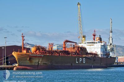
TRAMMO MARYCAM
Lpg Tanker
Current Trip
FOR ORDERS
| Time Travelled | 1 day |
|---|---|
| Remaining Time | --- |
| Distance Travelled | 527.94 nm |
| Remaining Distance | --- |
| AVG Speed | 13.3 Knots |
| MAX Speed | 15.7 Knots |
| AVG Wind | 12.9 knots |
| MAX Wind | 22 knots |
| MIN Temp | 19°C / 66.2°F |
| MAX Temp | 26°C / 78.8°F |
| Draught | 8.8 m |
| Position Received | 24 m ago |
Current Position
| Longitude | -12.11476° |
|---|---|
| Latitude | 29.82009° |
| Status | Under way using engine |
| Speed | 14.1 Knots |
| Course | 214.8° |
| Area | North Atlantic Ocean |
| Station | T-AIS |
| Position Received | 24 m ago |
Info
Information
The current position of TRAMMO MARYCAM is in North Atlantic Ocean with coordinates 29.82009° / -12.11476° as reported on 2024-06-14 01:49 by AIS to our vessel tracker app. The vessel's current speed is 14.1 Knots
The vessel TRAMMO MARYCAM (IMO: 9409168, MMSI: 563195100) is a Lpg Tanker that was built in 2009 ( 15 years old ). It's sailing under the flag of [SG] Singapore.
In this page you can find informations about the vessels current position, last detected port calls, and current voyage information. If the vessels is not in coverage by AIS you will find the latest position.
The current position of TRAMMO MARYCAM is detected by our AIS receivers and we are not responsible for the reliability of the data. The last position was recorded while the vessel was in Coverage by the Ais receivers of our vessel tracking app.
The current draught of TRAMMO MARYCAM as reported by AIS is 8.8 meters
Weather
| Temperature | 19.2°C / 66.56°F |
|---|---|
| Wind Speed | 16 knots |
| Direction | 13° NNE |
| Pressure | 1017.4 hPa |
| Humidity | 80.5 % |
| Cloud Coverage | 7 % |
Featured Company
Last Port Calls
| Port | Arrival | Departure | Time In Port |
|---|---|---|---|
| 2024-06-12 14:37 | 2024-06-12 14:40 | 3 m | |
| 2024-06-12 11:33 | 2024-06-12 13:51 | 2 h | |
| 2024-06-08 16:17 | 2024-06-10 21:58 | 2 d | |
| 2024-06-01 16:48 | 2024-06-03 16:09 | 1 d | |
| 2024-05-28 23:32 | 2024-05-29 20:13 | 20 h | |
| 2024-05-23 23:51 | 2024-05-24 22:36 | 22 h | |
| 2024-05-19 12:23 | 2024-05-21 19:42 | 2 d | |
| 2024-05-15 22:03 | 2024-05-16 14:43 | 16 h | |
| 2024-04-14 16:18 | 2024-05-03 19:03 | 19 d | |
| 2024-04-04 08:28 | 2024-04-06 12:57 | 2 d |
Most Visited Ports (Last year)
| Port | Arrivals | |
|---|---|---|
| 5 | ||
| 5 | ||
| 4 | ||
| 4 | ||
| 3 | ||
| 3 |
Last Trips
| Origin | Departure | Destination | Arrival | Distance | |
|---|---|---|---|---|---|
| 2024-06-12 13:51 | 2024-06-12 14:37 | 0.23 nm | |||
| 2024-06-10 21:58 | 2024-06-12 11:33 | 308.45 nm | |||
| 2024-06-03 16:09 | 2024-06-08 16:17 | 1523.27 nm | |||
| 2024-05-29 20:13 | 2024-06-01 16:48 | 671.44 nm | |||
| 2024-05-24 22:36 | 2024-05-28 23:32 | 1384.13 nm | |||
| 2024-05-21 19:42 | 2024-05-23 23:51 | 492.58 nm | |||
| 2024-05-16 14:43 | 2024-05-19 12:23 | 208.69 nm | |||
| 2024-05-03 19:03 | 2024-05-15 22:03 | 1829.52 nm | |||
| 2024-04-06 12:57 | 2024-04-14 16:18 | 1737.75 nm | |||
| 2024-04-03 07:12 | 2024-04-04 08:28 | 43.04 nm |
Events
| Time | Event | Details | Position / Dest | Info |
|---|---|---|---|---|
| 2024-06-14 01:55 | Status Changed | Default Under way using engine |
29.79933 / -12.13089
FOR ORDERS
|
Speed: 14.1 kn Course: 214.8° |
| 2024-06-14 01:40 | Detected in Sea | Spanish (Canary Islands) part of the North Atlantic Ocean |
29.84699 / -12.09380
North Atlantic Ocean
FOR ORDERS
|
Speed: 14.1 kn Course: 214.5° |
| 2024-06-14 01:40 | Status Changed | Under way using engine Default |
29.84699 / -12.09380
FOR ORDERS
|
Speed: 14.2 kn Course: 214° |
| 2024-06-14 01:38 | IN Coverage |
29.84699 / -12.09380
North Atlantic Ocean
FOR ORDERS
|
Speed: 14.1 kn Course: 214.5° |
|
| 2024-06-13 20:19 | Status Changed | Default Under way using engine |
30.92334 / -11.24297
FOR ORDERS
|
Speed: 14.9 kn Course: 214° |
| 2024-06-13 20:13 | OUT of Coverage |
30.94510 / -11.22550
North Atlantic Ocean
FOR ORDERS
|
Speed: 14.9 kn Course: 214° |
|
| 2024-06-13 19:01 | Status Changed | Under way using engine Default |
31.18802 / -11.02853
FOR ORDERS
|
Speed: 14.7 kn Course: 214° |
| 2024-06-13 18:55 | Status Changed | Default Under way using engine |
31.20763 / -11.01228
FOR ORDERS
|
Speed: 14.7 kn Course: 213.8° |
| 2024-06-13 18:44 | Status Changed | Under way using engine Default |
31.24461 / -10.98170
FOR ORDERS
|
Speed: 14.8 kn Course: 215° |
| 2024-06-13 18:43 | Status Changed | Default Under way using engine |
31.24798 / -10.97893
FOR ORDERS
|
Speed: 14.8 kn Course: 215.1° |