
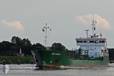
THUN GAZELLE
Oil/Chemical Tanker
Current Trip
| Time Travelled | 1 h, 45 mins |
|---|---|
| Remaining Time | --- |
| Distance Travelled | 19.52 nm |
| Remaining Distance | --- |
| AVG Speed | 11.7 Knots |
| MAX Speed | 12.7 Knots |
| AVG Wind | 6.4 knots |
| MAX Wind | 6.8 knots |
| MIN Temp | 7.6°C / 45.68°F |
| MAX Temp | 10.3°C / 50.54°F |
| Draught | 6.5 m |
| Position Received | Now |
Current Position
| Longitude | 17.26706° |
|---|---|
| Latitude | 59.45334° |
| Status | Under way using engine |
| Speed | 12.4 Knots |
| Course | 310.6° |
| Area | Baltic Sea |
| Station | T-AIS |
| Position Received | Now |
Info
Information
The current position of THUN GAZELLE is in Baltic Sea with coordinates 59.45334° / 17.26706° as reported on 2024-05-20 21:03 by AIS to our vessel tracker app. The vessel's current speed is 12.4 Knots and is heading at the port of VASTERAS. The estimated time of arrival as calculated by MyShipTracking vessel tracking app is 2024-05-20 12:00 LT
The vessel THUN GAZELLE (IMO: 9393333, MMSI: 246541000) is a Oil/Chemical Tanker that was built in 2008 ( 16 years old ). It's sailing under the flag of [NL] Netherlands.
In this page you can find informations about the vessels current position, last detected port calls, and current voyage information. If the vessels is not in coverage by AIS you will find the latest position.
The current position of THUN GAZELLE is detected by our AIS receivers and we are not responsible for the reliability of the data. The last position was recorded while the vessel was in Coverage by the Ais receivers of our vessel tracking app.
The current draught of THUN GAZELLE as reported by AIS is 6.5 meters
Weather
| Temperature | 7.9°C / 46.22°F |
|---|---|
| Wind Speed | 6 knots |
| Direction | 66° ENE |
| Pressure | 1023.4 hPa |
| Humidity | 49.6 % |
| Cloud Coverage | 33 % |
Featured Company
Last Port Calls
| Port | Arrival | Departure | Time In Port |
|---|---|---|---|
| 2024-05-20 20:40 | 2024-05-20 21:19 | 39 m | |
| 2024-05-18 03:46 | 2024-05-18 16:15 | 12 h | |
| 2024-05-14 08:39 | 2024-05-14 20:43 | 12 h | |
| 2024-05-13 13:08 | 2024-05-14 04:44 | 15 h | |
| 2024-05-11 13:57 | 2024-05-12 07:35 | 17 h | |
| 2024-05-10 07:22 | 2024-05-11 00:05 | 16 h | |
| 2024-05-07 21:41 | 2024-05-07 22:24 | 43 m | |
| 2024-05-07 03:04 | 2024-05-07 16:52 | 13 h | |
| 2024-05-06 22:04 | 2024-05-06 22:31 | 26 m | |
| 2024-05-04 12:41 | 2024-05-05 02:48 | 14 h |
Most Visited Ports (Last year)
| Port | Arrivals | |
|---|---|---|
| 60 | ||
| 26 | ||
| 18 | ||
| 16 | ||
| 13 | ||
| 10 |
Last Trips
| Origin | Departure | Destination | Arrival | Distance | |
|---|---|---|---|---|---|
| 2024-05-18 16:15 | 2024-05-20 20:40 | 508.01 nm | |||
| 2024-05-14 20:43 | 2024-05-18 03:46 | 56.38 nm | |||
| 2024-05-14 04:44 | 2024-05-14 08:39 | 46.64 nm | |||
| 2024-05-12 07:35 | 2024-05-13 13:08 | 154.41 nm | |||
| 2024-05-11 00:05 | 2024-05-11 13:57 | 146.64 nm | |||
| 2024-05-07 22:24 | 2024-05-10 07:22 | 555.84 nm | |||
| 2024-05-07 16:52 | 2024-05-07 21:41 | 47.97 nm | |||
| 2024-05-06 22:31 | 2024-05-07 03:04 | 48.87 nm | |||
| 2024-05-05 02:48 | 2024-05-06 22:04 | 506.06 nm | |||
| 2024-05-04 06:34 | 2024-05-04 12:41 | 46.75 nm |
Events
| Time | Event | Details | Position / Dest | Info |
|---|---|---|---|---|
| 2024-05-20 19:19 | PORT DEPARTURE |
|
59.20336 / 17.62476
SE VST
|
Speed: 6.3 kn Course: 334° |
| 2024-05-20 19:12 | START Moving |
59.19529 / 17.63197
[SE] SODERTALJE
|
Speed: 3.2 kn Course: 347° |
|
| 2024-05-20 18:44 | STOP Moving |
59.18954 / 17.63339
[SE] SODERTALJE
|
Speed: 0.3 kn Course: 344° |
|
| 2024-05-20 18:40 | PORT ARRIVAL |
|
59.18903 / 17.63395
[SE] SODERTALJE
|
Speed: 0.7 kn Course: 335° |
| 2024-05-20 17:42 | Status Changed | Under way using engine Default |
59.10436 / 17.69151
SE VST
|
Speed: 7.3 kn Course: 51° |
| 2024-05-20 17:41 | Status Changed | Default Under way using engine |
59.10252 / 17.68967
SE VST
|
Speed: 9.7 kn Course: 10.6° |
| 2024-05-20 14:42 | START Moving | 14.94 nm, South East of STUDSVIK |
58.62618 / 17.79580
SE VST
|
Speed: 3.9 kn Course: 54° |
| 2024-05-20 14:36 | Status Changed | Under way using engine At anchor |
58.62537 / 17.79183
SE VST
|
Speed: 0.7 kn Course: 60° |
| 2024-05-20 12:16 | Status Changed | At anchor Default |
58.62452 / 17.78950
SE VST
|
Speed: Course: 61° |
| 2024-05-20 12:10 | Status Changed | Default At anchor |
58.62455 / 17.78949
SE VST
|
Speed: Course: 66° |