
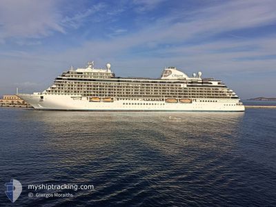
SEVEN SEAS SPLENDOR
Passenger
Current Trip
| Time Travelled | 1 day |
|---|---|
| Remaining Time | 3 h, 23 mins |
| Distance Travelled | 417.96 nm |
| Remaining Distance | 48.45 nm |
| AVG Speed | 14.1 Knots |
| MAX Speed | 18.7 Knots |
| AVG Wind | 10.9 knots |
| MAX Wind | 16 knots |
| MIN Temp | 9.5°C / 49.1°F |
| MAX Temp | 15.6°C / 60.08°F |
| Draught | 7.2 m |
| Position Received | 1 m ago |
Current Position
| Longitude | -5.13943° |
|---|---|
| Latitude | 54.23670° |
| Status | Under way using engine |
| Speed | 13.4 Knots |
| Course | 31.3° |
| Area | Irish Sea and St. George's Channel |
| Station | T-AIS |
| Position Received | 1 m ago |
Info
Information
The current position of SEVEN SEAS SPLENDOR is in Irish Sea and St. George's Channel with coordinates 54.23670° / -5.13943° as reported on 2024-06-17 02:03 by AIS to our vessel tracker app. The vessel's current speed is 13.4 Knots and is heading at the port of BELFAST. The estimated time of arrival as calculated by MyShipTracking vessel tracking app is 2024-06-17 06:27 LT
The vessel SEVEN SEAS SPLENDOR (IMO: 9807085, MMSI: 538007673) is a Passenger It's sailing under the flag of [MH] Marshall Is.
In this page you can find informations about the vessels current position, last detected port calls, and current voyage information. If the vessels is not in coverage by AIS you will find the latest position.
The current position of SEVEN SEAS SPLENDOR is detected by our AIS receivers and we are not responsible for the reliability of the data. The last position was recorded while the vessel was in Coverage by the Ais receivers of our vessel tracking app.
The current draught of SEVEN SEAS SPLENDOR as reported by AIS is 7.2 meters
Weather
| Temperature | 11.5°C / 52.7°F |
|---|---|
| Wind Speed | 14 knots |
| Direction | 280° W |
| Pressure | 1004.5 hPa |
| Humidity | 87.5 % |
| Cloud Coverage | 100 % |
Featured Company
Last Port Calls
| Port | Arrival | Departure | Time In Port |
|---|---|---|---|
| 2024-06-15 06:11 | 2024-06-15 14:27 | 8 h | |
| 2024-06-14 06:59 | 2024-06-14 17:57 | 10 h | |
| 2024-06-13 08:26 | 2024-06-13 19:09 | 10 h | |
| 2024-06-11 08:01 | 2024-06-11 21:00 | 12 h | |
| 2024-06-09 05:51 | 2024-06-09 19:26 | 13 h | |
| 2024-06-07 07:21 | 2024-06-07 17:52 | 10 h | |
| 2024-06-06 06:19 | 2024-06-06 20:54 | 14 h | |
| 2024-06-03 17:09 | 2024-06-04 18:17 | 1 d | |
| 2024-06-02 06:09 | 2024-06-02 16:10 | 10 h | |
| 2024-06-01 08:19 | 2024-06-01 19:11 | 10 h |
Most Visited Ports (Last year)
| Port | Arrivals | |
|---|---|---|
| 5 | ||
| 5 | ||
| 5 | ||
| 4 | ||
| 4 | ||
| 4 |
Last Trips
| Origin | Departure | Destination | Arrival | Distance | |
|---|---|---|---|---|---|
| 2024-06-14 17:57 | 2024-06-15 06:11 | 155.57 nm | |||
| 2024-06-13 19:09 | 2024-06-14 06:59 | 131.72 nm | |||
| 2024-06-11 21:00 | 2024-06-13 08:26 | 331.04 nm | |||
| 2024-06-09 19:26 | 2024-06-11 08:01 | 444.81 nm | |||
| 2024-06-07 17:52 | 2024-06-09 05:51 | 557.40 nm | |||
| 2024-06-06 20:54 | 2024-06-07 07:21 | 93.42 nm | |||
| 2024-06-04 18:17 | 2024-06-06 06:19 | 305.62 nm | |||
| 2024-06-02 16:10 | 2024-06-03 17:09 | 246.81 nm | |||
| 2024-06-01 19:11 | 2024-06-02 06:09 | 122.68 nm | |||
| 2024-05-30 17:54 | 2024-06-01 08:19 | 295.19 nm |
Events
| Time | Event | Details | Position / Dest | Info |
|---|---|---|---|---|
| 2024-06-17 00:39 | Status Changed | Under way using engine Default |
53.97010 / -5.29178
BELFAST, UK
|
Speed: 12.9 kn Course: 15° |
| 2024-06-17 00:31 | Status Changed | Default Under way using engine |
53.94231 / -5.30220
BELFAST, UK
|
Speed: 13.1 kn Course: 15.1° |
| 2024-06-17 00:23 | Status Changed | Under way using engine Default |
53.91311 / -5.31554
BELFAST, UK
|
Speed: 13.1 kn Course: 15° |
| 2024-06-16 23:59 | Status Changed | Default Under way using engine |
53.83588 / -5.36897
BELFAST, UK
|
Speed: 12.9 kn Course: 39.1° |
| 2024-06-16 23:35 | Change Sea Area | United Kingdom part of the Irish Sea and St. George's Channel Irish part of the Irish Sea and St. George's Channel |
53.76519 / -5.45014
Irish Sea and St. George's Channel
BELFAST, UK
|
Speed: 12.6 kn Course: 19.9° |
| 2024-06-16 20:03 | START Moving | 1.77 nm, East of DUN LAOGHAIRE |
53.30945 / -6.08570
BELFAST, UK
|
Speed: 3.2 kn Course: 100° |
| 2024-06-16 19:49 | Status Changed | Under way using engine At anchor |
53.30962 / -6.08958
BELFAST, UK
|
Speed: 0.2 kn Course: 317° |
| 2024-06-16 13:04 | Destination Changed | BELFAST, UK DUN LAOGHAIRE , IREL |
53.31097 / -6.09159
BELFAST, UK
|
Speed: 0.4 kn Course: 165° |
| 2024-06-16 13:04 | ETA Changed | 2024/06/17 05:30 2024/06/16 09:30 |
53.31097 / -6.09159
BELFAST, UK
|
Speed: 0.4 kn Course: 165° |
| 2024-06-16 10:17 | Status Changed | At anchor Under way using engine |
53.30965 / -6.08891
DUN LAOGHAIRE , IREL
|
Speed: 0.5 kn Course: 319° |