
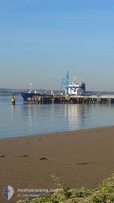
SARNIA CHERIE
Oil Products Tanker
Current Trip
| Time Travelled | 2 days |
|---|---|
| Remaining Time | 10 mins |
| Distance Travelled | 454.09 nm |
| Remaining Distance | 5.23 nm |
| AVG Speed | 8.4 Knots |
| MAX Speed | 11.4 Knots |
| AVG Wind | 7.6 knots |
| MAX Wind | 19.9 knots |
| MIN Temp | 9.9°C / 49.82°F |
| MAX Temp | 13.9°C / 57.02°F |
| Draught | 5.8 m |
| Position Received | 1 m ago |
Current Position
| Longitude | -2.20820° |
|---|---|
| Latitude | 49.16984° |
| Status | Under way using engine |
| Speed | 0.2 Knots |
| Course | 97° |
| Area | English Channel |
| Station | T-AIS |
| Position Received | 1 m ago |
Info
Information
The current position of SARNIA CHERIE is in English Channel with coordinates 49.16984° / -2.20820° as reported on 2024-05-05 18:31 by AIS to our vessel tracker app. The vessel's current speed is 0.2 Knots and is heading at the port of JERSEY. The estimated time of arrival as calculated by MyShipTracking vessel tracking app is 2024-05-05 18:42 LT
The vessel SARNIA CHERIE (IMO: 9322164, MMSI: 236401000) is a Oil Products Tanker that was built in 2007 ( 17 years old ). It's sailing under the flag of [GI] Gibraltar.
In this page you can find informations about the vessels current position, last detected port calls, and current voyage information. If the vessels is not in coverage by AIS you will find the latest position.
The current position of SARNIA CHERIE is detected by our AIS receivers and we are not responsible for the reliability of the data. The last position was recorded while the vessel was in Coverage by the Ais receivers of our vessel tracking app.
The current draught of SARNIA CHERIE as reported by AIS is 5.8 meters
Weather
| Temperature | 13.9°C / 57.02°F |
|---|---|
| Wind Speed | 9 knots |
| Direction | 152° SSE |
| Pressure | 1004.9 hPa |
| Humidity | 76.1 % |
| Cloud Coverage | 36 % |
Featured Company
Last Port Calls
| Port | Arrival | Departure | Time In Port |
|---|---|---|---|
| 2024-05-03 16:42 | 2024-05-03 17:30 | 47 m | |
| 2024-05-02 06:50 | 2024-05-03 16:10 | 1 d | |
| 2024-05-02 05:58 | 2024-05-02 06:33 | 34 m | |
| 2024-04-30 18:22 | 2024-05-02 02:37 | 1 d | |
| 2024-04-27 16:42 | 2024-04-28 06:42 | 13 h | |
| 2024-04-24 14:53 | 2024-04-25 14:30 | 23 h | |
| 2024-04-21 10:54 | 2024-04-22 18:22 | 1 d | |
| 2024-04-16 17:22 | 2024-04-17 07:41 | 14 h | |
| 2024-04-11 08:15 | 2024-04-11 18:44 | 10 h | |
| 2024-04-10 06:57 | 2024-04-10 19:10 | 12 h |
Last Trips
| Origin | Departure | Destination | Arrival | Distance | |
|---|---|---|---|---|---|
| 2024-05-03 17:10 | 2024-05-03 17:42 | 1.91 nm | |||
| 2024-05-02 07:33 | 2024-05-02 07:50 | 1.94 nm | |||
| 2024-04-28 07:42 | 2024-05-02 06:58 | 579.29 nm | |||
| 2024-04-28 07:42 | 2024-04-30 19:22 | 549.00 nm | |||
| 2024-04-25 15:30 | 2024-04-27 17:42 | 457.58 nm | |||
| 2024-04-22 19:22 | 2024-04-24 15:53 | 456.29 nm | |||
| 2024-04-17 08:41 | 2024-04-21 11:54 | 635.70 nm | |||
| 2024-04-11 19:44 | 2024-04-16 18:22 | 286.23 nm | |||
| 2024-04-10 20:10 | 2024-04-11 09:15 | 29.22 nm | |||
| 2024-04-07 21:36 | 2024-04-10 07:57 | 447.41 nm |
Events
| Time | Event | Details | Position / Dest | Info |
|---|---|---|---|---|
| 2024-05-05 18:30 | STOP Moving | 1.85 nm, South West of SAINT AUBIN |
49.16986 / -2.20820
JESTH
|
Speed: 0.3 kn Course: 99° |
| 2024-05-05 18:24 | Status Changed | Under way using engine Default |
49.17081 / -2.20775
JESTH
|
Speed: 1.4 kn Course: 199° |
| 2024-05-05 18:22 | Status Changed | Default Under way using engine |
49.17061 / -2.20646
JESTH
|
Speed: 3 kn Course: 99° |
| 2024-05-05 18:11 | Status Changed | Under way using engine Default |
49.17028 / -2.21107
JESTH
|
Speed: 2.7 kn Course: 93° |
| 2024-05-05 18:10 | Status Changed | Default Under way using engine |
49.17021 / -2.21163
JESTH
|
Speed: 7.2 kn Course: 94.7° |
| 2024-05-05 16:38 | Change Sea Area | Jersey part of the English Channel Guernsey part of the English Channel |
49.22854 / -2.53347
English Channel
JESTH
|
Speed: 10.3 kn Course: 107° |
| 2024-05-05 14:31 | ETA Changed | 2024/05/05 17:30 2024/05/05 15:30 |
49.34442 / -3.09652
JESTH
|
Speed: 11.2 kn Course: 104.8° |
| 2024-05-05 14:17 | Change Sea Area | Guernsey part of the English Channel United Kingdom part of the English Channel |
49.35612 / -3.15962
English Channel
JESTH
|
Speed: 11.1 kn Course: 105.6° |
| 2024-05-05 14:17 | Status Changed | Under way using engine Default |
49.35612 / -3.15962
JESTH
|
Speed: 11 kn Course: 106° |
| 2024-05-05 14:06 | IN Coverage |
49.35612 / -3.15962
English Channel
JESTH
|
Speed: 11.1 kn Course: 105.6° |