
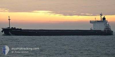
SAGAR SAMRAT
Cargo
Current Trip
| Time Travelled | 25 days |
|---|---|
| Remaining Time | --- |
| Distance Travelled | 2117.16 nm |
| Remaining Distance | 13.60 nm |
| AVG Speed | 8.6 Knots |
| MAX Speed | 16.4 Knots |
| AVG Wind | 13.9 knots |
| MAX Wind | 35.7 knots |
| MIN Temp | -4.6°C / 23.72°F |
| MAX Temp | 16.2°C / 61.16°F |
| Draught | 9.9 m |
| Position Received | 1 m ago |
Current Position
| Longitude | 4.23456° |
|---|---|
| Latitude | 52.53155° |
| Status | At anchor |
| Speed | 0.2 Knots |
| Course | 165° |
| Area | North Sea |
| Station | T-AIS |
| Position Received | 1 m ago |
Info
Information
The current position of SAGAR SAMRAT is in North Sea with coordinates 52.53155° / 4.23456° as reported on 2024-05-13 21:04 by AIS to our vessel tracker app. The vessel's current speed is 0.2 Knots and is heading at the port of IJMUIDEN.
The vessel SAGAR SAMRAT (IMO: 9727041, MMSI: 566014000) is a Cargo It's sailing under the flag of [SG] Singapore.
In this page you can find informations about the vessels current position, last detected port calls, and current voyage information. If the vessels is not in coverage by AIS you will find the latest position.
The current position of SAGAR SAMRAT is detected by our AIS receivers and we are not responsible for the reliability of the data. The last position was recorded while the vessel was in Coverage by the Ais receivers of our vessel tracking app.
The current draught of SAGAR SAMRAT as reported by AIS is 9.9 meters
Weather
| Temperature | 14.4°C / 57.92°F |
|---|---|
| Wind Speed | 7 knots |
| Direction | 95° E |
| Pressure | 1007.9 hPa |
| Humidity | 92 % |
| Cloud Coverage | 4 % |
Featured Company
Most Visited Ports (Last year)
| Port | Arrivals | |
|---|---|---|
| 6 | ||
| 3 | ||
| 3 | ||
| 2 | ||
| 1 | ||
| 1 |
Events
| Time | Event | Details | Position / Dest | Info |
|---|---|---|---|---|
| 2024-05-13 15:31 | Status Changed | At anchor Under way using engine |
52.52825 / 4.23249
IJMUIDEN, NL
|
Speed: 0.4 kn Course: 53° |
| 2024-05-13 15:20 | STOP Moving | 13.5 nm, West of IJMUIDEN |
52.52828 / 4.23351
IJMUIDEN, NL
|
Speed: 0.3 kn Course: 45° |
| 2024-05-12 14:57 | Status Changed | Under way using engine Default |
52.55090 / 3.93188
IJMUIDEN, NL
|
Speed: 8.4 kn Course: 45° |
| 2024-05-12 14:54 | Status Changed | Default Under way using engine |
52.54537 / 3.92243
IJMUIDEN, NL
|
Speed: 6.8 kn Course: 44.6° |
| 2024-05-12 13:16 | Status Changed | Under way using engine Default |
52.57292 / 3.96709
IJMUIDEN, NL
|
Speed: 8.6 kn Course: 51° |
| 2024-05-12 13:00 | Status Changed | Default Under way using engine |
52.54980 / 3.91923
IJMUIDEN, NL
|
Speed: 6.9 kn Course: 56.4° |
| 2024-05-12 07:23 | START Moving | 13.89 nm, West of IJMUIDEN |
52.53146 / 4.22407
IJMUIDEN, NL
|
Speed: 3.1 kn Course: 258° |
| 2024-05-12 06:59 | Status Changed | Under way using engine At anchor |
52.53614 / 4.22395
IJMUIDEN, NL
|
Speed: 0.1 kn Course: 175° |
| 2024-05-11 17:50 | Status Changed | At anchor Default |
52.53606 / 4.22406
IJMUIDEN, NL
|
Speed: 0.1 kn Course: 172° |
| 2024-05-11 17:47 | Status Changed | Default At anchor |
52.53603 / 4.22408
IJMUIDEN, NL
|
Speed: 0.1 kn Course: 172° |