
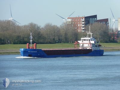
RDJ RIJNSTROOM
General Cargo
Current Trip
| Time Travelled | 2 days |
|---|---|
| Remaining Time | --- |
| Distance Travelled | 586.38 nm |
| Remaining Distance | --- |
| AVG Speed | 10.2 Knots |
| MAX Speed | 13.5 Knots |
| AVG Wind | 18.2 knots |
| MAX Wind | 25 knots |
| MIN Temp | 11.4°C / 52.52°F |
| MAX Temp | 14.5°C / 58.1°F |
| Draught | 5.4 m |
| Position Received | 4 h, 40 m ago |
Current Position
| Longitude | 2.23507° |
|---|---|
| Latitude | 56.30532° |
| Status | Under way using engine |
| Speed | 10.3 Knots |
| Course | 264.3° |
| Area | North Sea |
| Station | T-AIS |
| Position Received | 4 h, 40 m ago |
Info
Information
The current position of RDJ RIJNSTROOM is in North Sea with coordinates 56.30532° / 2.23507° as reported on 2024-05-18 14:14 by AIS to our vessel tracker app. The vessel's current speed is 10.3 Knots and is heading at the port of LEITH. The estimated time of arrival as calculated by MyShipTracking vessel tracking app is 2024-05-19 12:00 LT
The vessel RDJ RIJNSTROOM (IMO: 9197765, MMSI: 244397000) is a General Cargo that was built in 2000 ( 24 years old ). It's sailing under the flag of [NL] Netherlands.
In this page you can find informations about the vessels current position, last detected port calls, and current voyage information. If the vessels is not in coverage by AIS you will find the latest position.
The current position of RDJ RIJNSTROOM is detected by our AIS receivers and we are not responsible for the reliability of the data. The last position was recorded while the vessel was in Coverage by the Ais receivers of our vessel tracking app.
The current draught of RDJ RIJNSTROOM as reported by AIS is 5.4 meters
Weather
| Temperature | 14.2°C / 57.56°F |
|---|---|
| Wind Speed | 7 knots |
| Direction | 25° NNE |
| Pressure | 1016.3 hPa |
| Humidity | 77 % |
| Cloud Coverage | 4 % |
Featured Company
Last Port Calls
| Port | Arrival | Departure | Time In Port |
|---|---|---|---|
| 2024-05-07 13:25 | 2024-05-16 10:10 | 8 d | |
| 2024-05-04 03:50 | 2024-05-05 04:33 | 1 d | |
| 2024-05-03 13:52 | 2024-05-04 03:34 | 13 h | |
| 2024-04-28 07:42 | 2024-04-29 19:05 | 1 d | |
| 2024-04-18 05:22 | 2024-04-18 23:33 | 18 h | |
| 2024-04-12 21:03 | 2024-04-16 12:00 | 3 d | |
| 2024-04-07 14:57 | 2024-04-08 15:36 | 1 d | |
| 2024-03-30 16:35 | 2024-04-02 18:48 | 3 d | |
| 2024-03-27 23:11 | 2024-03-28 01:48 | 2 h | |
| 2024-03-27 01:57 | 2024-03-27 21:49 | 19 h |
Most Visited Ports (Last year)
| Port | Arrivals | |
|---|---|---|
| 7 | ||
| 4 | ||
| 3 | ||
| 3 | ||
| 3 | ||
| 2 |
Last Trips
| Origin | Departure | Destination | Arrival | Distance | |
|---|---|---|---|---|---|
| 2024-05-05 05:33 | 2024-05-07 15:25 | 563.02 nm | |||
| 2024-05-04 04:34 | 2024-05-04 04:50 | 0.47 nm | |||
| 2024-04-29 21:05 | 2024-05-03 14:52 | 492.37 nm | |||
| 2024-04-19 01:33 | 2024-04-28 09:42 | 1716.64 nm | |||
| 2024-04-16 13:00 | 2024-04-18 07:22 | 236.97 nm | |||
| 2024-04-08 17:36 | 2024-04-12 22:03 | 797.71 nm | |||
| 2024-04-02 19:48 | 2024-04-07 16:57 | 519.42 nm | |||
| 2024-03-28 02:48 | 2024-03-30 16:35 | 518.41 nm | |||
| 2024-03-27 22:49 | 2024-03-28 00:11 | 5.72 nm | |||
| 2024-03-27 02:22 | 2024-03-27 02:57 | 1.16 nm |
Events
| Time | Event | Details | Position / Dest | Info |
|---|---|---|---|---|
| 2024-05-18 14:27 | Status Changed | Default Under way using engine |
56.30276 / 2.16981
GBLEI
|
Speed: 10.3 kn Course: 264.3° |
| 2024-05-18 14:14 | Detected in Sea | United Kingdom part of the North Sea |
56.30532 / 2.23507
North Sea
GBLEI
|
Speed: 10.3 kn Course: 264.3° |
| 2024-05-18 14:14 | Status Changed | Under way using engine Default |
56.30532 / 2.23507
GBLEI
|
Speed: 10.2 kn Course: 264° |
| 2024-05-18 14:14 | OUT of Coverage |
56.30532 / 2.23507
North Sea
GBLEI
|
Speed: 10.3 kn Course: 264.3° |
|
| 2024-05-18 13:55 | IN Coverage |
56.30532 / 2.23507
North Sea
GBLEI
|
Speed: 10.3 kn Course: 264.3° |
|
| 2024-05-18 10:56 | Status Changed | Default Under way using engine |
56.45823 / 3.22642
GBLEI
|
Speed: 10.7 kn Course: 250.7° |
| 2024-05-18 10:50 | Status Changed | Under way using engine Default |
56.46388 / 3.25212
GBLEI
|
Speed: 10.8 kn Course: 249° |
| 2024-05-18 10:50 | OUT of Coverage |
56.46388 / 3.25212
North Sea
GBLEI
|
Speed: 10.7 kn Course: 250.7° |
|
| 2024-05-18 10:37 | IN Coverage |
56.46388 / 3.25212
North Sea
GBLEI
|
Speed: 10.7 kn Course: 250.7° |
|
| 2024-05-18 09:50 | OUT of Coverage |
56.52708 / 3.55136
North Sea
GBLEI
|
Speed: 10.7 kn Course: 249° |