
RANTANPLAN
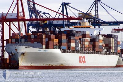
Container Ship
Current Trip
| Time Travelled | 12 days |
|---|---|
| Remaining Time | --- |
| Distance Travelled | 4048.17 nm |
| Remaining Distance | 24.50 nm |
| AVG Speed | 13.9 Knots |
| MAX Speed | 13.9 Knots |
| AVG Wind | 10.9 knots |
| MAX Wind | 28.8 knots |
| MIN Temp | 22.5°C / 72.5°F |
| MAX Temp | 34.3°C / 93.74°F |
| Draught | 12.9 m |
| Position Received | Now |
Current Position
| Longitude | 26.46772° |
|---|---|
| Latitude | 38.87847° |
| Status | Under way using engine |
| Speed | 0.4 Knots |
| Course | 87° |
| Area | Aegean Sea |
| Station | T-AIS |
| Position Received | Now |
Info
Information
The current position of RANTANPLAN is in Aegean Sea with coordinates 38.87847° / 26.46772° as reported on 2024-06-05 07:32 by AIS to our vessel tracker app. The vessel's current speed is 0.4 Knots and is heading at the port of ALIAGA. The estimated time of arrival as calculated by MyShipTracking vessel tracking app is 2024-06-04 09:00 LT
The vessel RANTANPLAN (IMO: 9307023, MMSI: 636021101) is a Container Ship that was built in 2006 ( 18 years old ). It's sailing under the flag of [LR] Liberia.
In this page you can find informations about the vessels current position, last detected port calls, and current voyage information. If the vessels is not in coverage by AIS you will find the latest position.
The current position of RANTANPLAN is detected by our AIS receivers and we are not responsible for the reliability of the data. The last position was recorded while the vessel was in Coverage by the Ais receivers of our vessel tracking app.
The current draught of RANTANPLAN as reported by AIS is 12.9 meters
Weather
| Temperature | 27.4°C / 81.32°F |
|---|---|
| Wind Speed | 3 knots |
| Direction | 61° ENE |
| Pressure | 1012.6 hPa |
| Humidity | 45.6 % |
| Cloud Coverage | --- |
Featured Company
Last Port Calls
| Port | Arrival | Departure | Time In Port |
|---|---|---|---|
| 2024-06-02 02:47 | 2024-06-02 11:52 | 9 h | |
| 2024-05-22 18:08 | 2024-05-23 14:44 | 20 h | |
| 2024-05-13 16:52 | 2024-05-14 17:04 | 1 d | |
| 2024-05-06 12:33 | 2024-05-07 00:08 | 11 h | |
| 2024-05-03 02:36 | 2024-05-03 17:40 | 15 h |
Last Trips
| Origin | Departure | Destination | Arrival | Distance | |
|---|---|---|---|---|---|
| 2024-05-23 20:14 | 2024-06-02 04:47 | 3325.53 nm | |||
| 2024-05-15 01:04 | 2024-05-22 23:38 | 2335.48 nm | |||
| 2024-05-07 08:08 | 2024-05-14 00:52 | 1725.92 nm | |||
| 2024-05-04 01:40 | 2024-05-06 20:33 | 845.27 nm | |||
| 2024-03-10 20:18 | 2024-05-03 10:36 | 523.27 nm |
Events
| Time | Event | Details | Position / Dest | Info |
|---|---|---|---|---|
| 2024-06-05 03:54 | STOP Moving | 8.02 nm, South East of PLOMARI |
38.86251 / 26.46614
ALIAGA,TURKEY
|
Speed: 0.2 kn Course: 26° |
| 2024-06-05 03:04 | START Moving | 6.76 nm, South East of PLOMARI |
38.90391 / 26.48356
ALIAGA,TURKEY
|
Speed: 3.1 kn Course: 293° |
| 2024-06-04 14:19 | STOP Moving | 7.48 nm, South East of PLOMARI |
38.87521 / 26.46856
ALIAGA,TURKEY
|
Speed: 0.3 kn Course: 271° |
| 2024-06-04 13:14 | START Moving | 12.31 nm, South East of PERAMA MYT |
38.85607 / 26.62200
ALIAGA,TURKEY
|
Speed: 3.1 kn Course: 327° |
| 2024-06-04 08:19 | STOP Moving | 10.84 nm, South of PERAMA MYT |
38.86557 / 26.56293
ALIAGA,TURKEY
|
Speed: 0.3 kn Course: 27° |
| 2024-06-04 07:53 | Change Sea Area | Greek part of the Aegean Sea Turkish part of the Aegean Sea |
38.80362 / 26.55715
Aegean Sea
ALIAGA,TURKEY
|
Speed: 12.1 kn Course: 1.7° |
| 2024-06-04 07:38 | Detected in Sea | Turkish part of the Aegean Sea |
38.78362 / 26.51289
Aegean Sea
ALIAGA,TURKEY
|
Speed: 12.8 kn Course: 88.5° |
| 2024-06-04 04:16 | ETA Changed | 2024/06/04 09:00 2024/06/04 08:00 |
38.50191 / 25.73634
ALIAGA,TURKEY
|
Speed: 13.6 kn Course: 0.1° |
| 2024-06-03 14:02 | Change Sea Area | Greek part of the Aegean Sea Greek part of the Mediterranean Sea - Eastern Basin |
35.78710 / 27.56692
Aegean Sea
ALIAGA,TURKEY
|
Speed: 13.4 kn Course: 322.2° |
| 2024-06-03 02:47 | Change Sea Area | Greek part of the Mediterranean Sea - Eastern Basin Egyptian part of the Mediterranean Sea - Eastern Basin |
33.79321 / 29.74689
Mediterranean Sea - Eastern Basin
ALIAGA,TURKEY
|
Speed: 14.4 kn Course: 315° |