
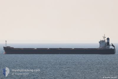
PANAMAX CHRISTINA
Bulk Carrier
Current Trip
| Time Travelled | 4 days |
|---|---|
| Remaining Time | --- |
| Distance Travelled | 1299.03 nm |
| Remaining Distance | --- |
| AVG Speed | 11.8 Knots |
| MAX Speed | 13.5 Knots |
| AVG Wind | 10.7 knots |
| MAX Wind | 23 knots |
| MIN Temp | 25.2°C / 77.36°F |
| MAX Temp | 33°C / 91.4°F |
| Draught | 6.6 m |
| Position Received | 1 d ago |
Current Position
| Longitude | 34.65431° |
|---|---|
| Latitude | 26.84510° |
| Status | Under way using engine |
| Speed | 12.5 Knots |
| Course | 326.1° |
| Area | Red Sea |
| Station | T-AIS |
| Position Received | 1 d ago |
Info
Information
The current position of PANAMAX CHRISTINA is in Red Sea with coordinates 26.84510° / 34.65431° as reported on 2024-05-26 15:12 by AIS to our vessel tracker app. The vessel's current speed is 12.5 Knots
The vessel PANAMAX CHRISTINA (IMO: 9510319, MMSI: 212921000) is a Bulk Carrier that was built in 2010 ( 14 years old ). It's sailing under the flag of [CY] Cyprus.
In this page you can find informations about the vessels current position, last detected port calls, and current voyage information. If the vessels is not in coverage by AIS you will find the latest position.
The current position of PANAMAX CHRISTINA is detected by our AIS receivers and we are not responsible for the reliability of the data. The last position was recorded while the vessel was in Coverage by the Ais receivers of our vessel tracking app.
The current draught of PANAMAX CHRISTINA as reported by AIS is 6.6 meters
Weather
| Temperature | 25.2°C / 77.36°F |
|---|---|
| Wind Speed | 18 knots |
| Direction | 10° N |
| Pressure | 1010.7 hPa |
| Humidity | 56.1 % |
| Cloud Coverage | --- |
Featured Company
Last Port Calls
| Port | Arrival | Departure | Time In Port |
|---|---|---|---|
| 2024-04-30 22:57 | 2024-05-23 00:23 | 22 d | |
| 2024-04-25 14:40 | 2024-04-26 00:04 | 9 h | |
| 2024-04-14 16:12 | 2024-04-16 07:42 | 1 d | |
| 2024-04-02 23:50 | 2024-04-09 13:32 | 6 d | |
| 2024-03-13 09:21 | 2024-03-26 14:47 | 13 d |
Most Visited Ports (Last year)
| Port | Arrivals | |
|---|---|---|
| 8 | ||
| 2 | ||
| 2 | ||
| 1 | ||
| 1 | ||
| 1 |
Last Trips
| Origin | Departure | Destination | Arrival | Distance | |
|---|---|---|---|---|---|
| 2024-04-16 07:42 | 2024-04-30 22:57 | 3622.11 nm | |||
| 2024-04-16 07:42 | 2024-04-25 14:40 | 2231.41 nm | |||
| 2024-04-09 13:32 | 2024-04-14 16:12 | 98.06 nm | |||
| 2024-03-26 14:47 | 2024-04-02 23:50 | 905.44 nm | |||
| 2024-02-26 07:26 | 2024-03-13 09:21 | 2009.94 nm |
Events
| Time | Event | Details | Position / Dest | Info |
|---|---|---|---|---|
| 2024-05-27 17:53 | STOP Moving | 4.78 nm, South East of AL ADABIYAH |
29.84786 / 32.55967
EGSUZ
|
Speed: 0.1 kn Course: 348° |
| 2024-05-27 17:25 | START Moving | 4.38 nm, South East of AL ADABIYAH |
29.83338 / 32.53845
EGSUZ
|
Speed: 3.2 kn Course: 50° |
| 2024-05-27 09:45 | STOP Moving | 4.28 nm, South East of AL ADABIYAH |
29.83414 / 32.53665
EGSUZ
|
Speed: 0.2 kn Course: 80° |
| 2024-05-26 15:15 | Status Changed | Default Under way using engine |
26.85167 / 34.64834
EGSUZ
|
Speed: 12.5 kn Course: 326.1° |
| 2024-05-26 15:12 | OUT of Coverage |
26.84510 / 34.65431
Red Sea
EGSUZ
|
Speed: 12.5 kn Course: 326.1° |
|
| 2024-05-26 14:30 | Status Changed | Under way using engine Default |
26.72271 / 34.74639
EGSUZ
|
Speed: 12 kn Course: 324° |
| 2024-05-26 14:21 | IN Coverage |
26.72963 / 34.74102
Red Sea
EGSUZ
|
Speed: 12.1 kn Course: 325.3° |
|
| 2024-05-26 12:42 | Status Changed | Default Under way using engine |
26.42231 / 34.97548
EGSUZ
|
Speed: 11.9 kn Course: 320.1° |
| 2024-05-26 12:40 | Change Sea Area | Egyptian part of the Red Sea Disputed Sudan-Egypt part of the Red Sea |
26.41503 / 34.98222
Red Sea
EGSUZ
|
Speed: 11.9 kn Course: 320.1° |
| 2024-05-26 12:40 | OUT of Coverage |
26.41503 / 34.98222
Red Sea
EGSUZ
|
Speed: 11.9 kn Course: 320.1° |