
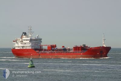
OCEAN MOON
Oil/Chemical Tanker
Current Trip
SEALOT-TTPOS
| Time Travelled | 14 h, 49 mins |
|---|---|
| Remaining Time | --- |
| Distance Travelled | 20.41 nm |
| Remaining Distance | --- |
| AVG Speed | 7.5 Knots |
| MAX Speed | 7.9 Knots |
| AVG Wind | 5.2 knots |
| MAX Wind | 8 knots |
| MIN Temp | 26°C / 78.8°F |
| MAX Temp | 33°C / 91.4°F |
| Draught | 5 m |
| Position Received | 2024-04-16 10:27 |
Current Position
| Longitude | -61.52706° |
|---|---|
| Latitude | 10.63005° |
| Status | Under way using engine |
| Speed | 7.3 Knots |
| Course | 237.3° |
| Area | Caribbean Sea |
| Station | T-AIS |
| Position Received | 2024-04-16 10:27 |
Info
Information
The current position of OCEAN MOON is in Caribbean Sea with coordinates 10.63005° / -61.52706° as reported on 2024-04-16 10:27 by AIS to our vessel tracker app. The vessel's current speed is 7.3 Knots
The vessel OCEAN MOON (IMO: 9427512, MMSI: 538009114) is a Oil/Chemical Tanker that was built in 2010 ( 14 years old ). It's sailing under the flag of [MH] Marshall Is.
In this page you can find informations about the vessels current position, last detected port calls, and current voyage information. If the vessels is not in coverage by AIS you will find the latest position.
The current position of OCEAN MOON is detected by our AIS receivers and we are not responsible for the reliability of the data. The last position was recorded while the vessel was in Coverage by the Ais receivers of our vessel tracking app.
The current draught of OCEAN MOON as reported by AIS is 5 meters
Weather
| Temperature | 26°C / 78.8°F |
|---|---|
| Wind Speed | 7 knots |
| Direction | 78° ENE |
| Pressure | 1013.2 hPa |
| Humidity | 87.7 % |
| Cloud Coverage | 8 % |
Featured Company
Last Port Calls
| Port | Arrival | Departure | Time In Port |
|---|---|---|---|
| 2024-05-13 16:53 | 2024-05-16 09:18 | 2 d | |
| 2024-05-11 14:50 | 2024-05-12 05:22 | 14 h | |
| 2024-05-09 07:09 | 2024-05-11 06:18 | 1 d | |
| 2024-05-07 14:18 | 2024-05-08 08:41 | 18 h | |
| 2024-05-07 08:26 | |||
| 2024-05-04 16:20 | 2024-05-05 08:30 | 16 h | |
| 2024-05-02 09:21 | 2024-05-03 16:40 | 1 d | |
| 2024-05-01 11:26 | 2024-05-01 23:14 | 11 h | |
| 2024-04-30 07:02 | 2024-05-01 07:55 | 1 d | |
| 2024-04-28 12:18 | 2024-04-29 00:50 | 12 h |
Most Visited Ports (Last year)
| Port | Arrivals | |
|---|---|---|
| 104 | ||
| 102 | ||
| 1 |
Last Trips
| Origin | Departure | Destination | Arrival | Distance | |
|---|---|---|---|---|---|
| 2024-05-12 05:22 | 2024-05-13 16:53 | 26.18 nm | |||
| 2024-05-11 06:18 | 2024-05-11 14:50 | 22.14 nm | |||
| 2024-05-08 08:41 | 2024-05-09 07:09 | 23.56 nm | |||
| 2024-05-07 08:26 | 2024-05-07 14:18 | 22.46 nm | |||
| 2024-05-03 16:40 | 2024-05-04 16:20 | 22.37 nm | |||
| 2024-05-01 23:14 | 2024-05-02 09:21 | 22.11 nm | |||
| 2024-05-01 07:55 | 2024-05-01 11:26 | 21.65 nm | |||
| 2024-04-29 00:50 | 2024-04-30 07:02 | 25.95 nm | |||
| 2024-04-28 07:38 | 2024-04-28 12:18 | 22.04 nm | |||
| 2024-04-25 20:26 | 2024-04-26 12:13 | 23.79 nm |
Events
| Time | Event | Details | Position / Dest | Info |
|---|---|---|---|---|
| 2024-05-16 16:06 | STOP Moving | 1.09 nm, South West of POINTE A PIERRE |
10.31523 / -61.49983
SEALOT-TTPOS
|
Speed: Course: 70° |
| 2024-05-16 13:18 | PORT DEPARTURE |
|
10.63408 / -61.51622
SEALOT-TTPOS
|
Speed: 6.6 kn Course: 252° |
| 2024-05-13 20:53 | STOP Moving |
10.64039 / -61.49894
[TT] PORT OF SPAIN
|
Speed: 0.2 kn Course: 174° |
|
| 2024-05-13 20:53 | PORT ARRIVAL |
|
10.64039 / -61.49894
[TT] PORT OF SPAIN
|
Speed: 6.1 kn Course: 70° |
| 2024-05-13 17:31 | START Moving | 0.87 nm, West of POINTE A PIERRE |
10.32039 / -61.49775
SEALOT-TTPOS
|
Speed: 5.6 kn Course: 312° |
| 2024-05-12 09:34 | STOP Moving | 0.89 nm, South West of POINTE A PIERRE |
10.31638 / -61.49652
SEALOT-TTPOS
|
Speed: 0.1 kn Course: 64° |
| 2024-05-12 09:22 | PORT DEPARTURE |
|
10.31492 / -61.49585
SEALOT-TTPOS
|
Speed: 5.7 kn Course: 279° |
| 2024-05-12 09:14 | START Moving |
10.31419 / -61.48403
[TT] POINTE A PIERRE
|
Speed: 5.1 kn Course: 260° |
|
| 2024-05-11 18:55 | STOP Moving |
10.31672 / -61.47778
[TT] POINTE A PIERRE
|
Speed: 0.1 kn Course: 239° |
|
| 2024-05-11 18:50 | PORT ARRIVAL |
|
10.31604 / -61.47810
[TT] POINTE A PIERRE
|
Speed: 1.7 kn Course: 61° |