
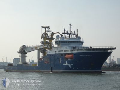
NORTH SEA ATLANTIC
Offshore Supply Ship
Current Trip
MARIA FIELD
| Time Travelled | 1 day |
|---|---|
| Remaining Time | --- |
| Distance Travelled | 206.53 nm |
| Remaining Distance | --- |
| AVG Speed | 11.3 Knots |
| MAX Speed | 13.3 Knots |
| AVG Wind | 5.1 knots |
| MAX Wind | 15.3 knots |
| MIN Temp | 7.7°C / 45.86°F |
| MAX Temp | 11.9°C / 53.42°F |
| Draught | 6.8 m |
| Position Received | 4 m ago |
Current Position
| Longitude | 7.55913° |
|---|---|
| Latitude | 64.96689° |
| Status | Restricted manoeuverability |
| Speed | 0.1 Knots |
| Course | 280° |
| Area | Norwegian Sea |
| Station | T-AIS |
| Position Received | 4 m ago |
Info
Information
The current position of NORTH SEA ATLANTIC is in Norwegian Sea with coordinates 64.96689° / 7.55913° as reported on 2024-05-18 23:46 by AIS to our vessel tracker app. The vessel's current speed is 0.1 Knots
The vessel NORTH SEA ATLANTIC (IMO: 9665073, MMSI: 258955000) is a Offshore Supply Ship that was built in 2014 ( 10 years old ). It's sailing under the flag of [NO] Norway.
In this page you can find informations about the vessels current position, last detected port calls, and current voyage information. If the vessels is not in coverage by AIS you will find the latest position.
The current position of NORTH SEA ATLANTIC is detected by our AIS receivers and we are not responsible for the reliability of the data. The last position was recorded while the vessel was in Coverage by the Ais receivers of our vessel tracking app.
The current draught of NORTH SEA ATLANTIC as reported by AIS is 6.8 meters
Weather
| Temperature | 8°C / 46.4°F |
|---|---|
| Wind Speed | 14 knots |
| Direction | 236° SW |
| Pressure | 1012 hPa |
| Humidity | 84.5 % |
| Cloud Coverage | 79 % |
Featured Company
Last Port Calls
| Port | Arrival | Departure | Time In Port |
|---|---|---|---|
| 2024-05-15 08:11 | 2024-05-17 06:30 | 1 d | |
| 2024-05-05 10:37 | 2024-05-07 20:13 | 2 d | |
| 2024-04-27 19:18 | 2024-04-29 01:16 | 1 d | |
| 2024-04-26 06:32 | 2024-04-27 08:44 | 1 d | |
| 2024-04-18 23:44 | 2024-04-19 01:07 | 1 h | |
| 2024-03-22 17:45 |
Most Visited Ports (Last year)
| Port | Arrivals | |
|---|---|---|
| 5 | ||
| 3 | ||
| 3 | ||
| 3 | ||
| 2 | ||
| 2 |
Last Trips
| Origin | Departure | Destination | Arrival | Distance | |
|---|---|---|---|---|---|
| 2024-05-07 20:13 | 2024-05-15 08:11 | 689.06 nm | |||
| 2024-04-29 01:16 | 2024-05-05 10:37 | 941.92 nm | |||
| 2024-04-27 08:44 | 2024-04-27 19:18 | 25.03 nm | |||
| 2024-04-19 01:07 | 2024-04-26 06:32 | 2162.69 nm | |||
| 2024-03-22 17:45 | 2024-04-18 23:44 | 3781.99 nm |
Events
| Time | Event | Details | Position / Dest | Info |
|---|---|---|---|---|
| 2024-05-18 19:09 | IN Coverage |
64.97403 / 7.55463
Norwegian Sea
|
Speed: 0.1 kn Course: 266° |
|
| 2024-05-18 15:19 | OUT of Coverage |
64.98665 / 7.54196
Norwegian Sea
|
Speed: 0.4 kn Course: 277.3° |
|
| 2024-05-18 14:35 | IN Coverage |
64.98628 / 7.54446
Norwegian Sea
|
Speed: 0.1 kn Course: 33.7° |
|
| 2024-05-18 13:02 | OUT of Coverage |
64.94478 / 6.96695
Norwegian Sea
|
Speed: 2.7 kn Course: 105.8° |
|
| 2024-05-18 13:02 | IN Coverage |
64.94478 / 6.96695
Norwegian Sea
|
Speed: 2.7 kn Course: 105.8° |
|
| 2024-05-18 09:59 | OUT of Coverage |
64.94697 / 6.95024
Norwegian Sea
|
Speed: 0.2 kn Course: 39.8° |
|
| 2024-05-17 21:49 | STOP Moving |
64.94153 / 6.93854
MARIA FIELD
|
Speed: Course: 209° |
|
| 2024-05-17 21:40 | Status Changed | Restricted manoeuverability Under way using engine |
64.93849 / 6.93716
MARIA FIELD
|
Speed: 8.4 kn Course: 353.8° |
| 2024-05-17 14:30 | ETA Changed | 2024/05/17 22:00 2024/05/17 19:00 |
63.49432 / 7.50968
MARIA FIELD
|
Speed: 12.1 kn Course: 346.9° |
| 2024-05-17 12:15 | START Moving | 1.16 nm, North of AVEROY |
63.07637 / 7.67581
MARIA FIELD
|
Speed: 5.3 kn Course: 32.5° |