
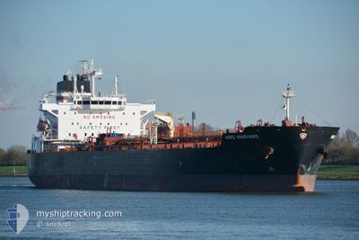
NORD VANGUARD
Tanker
Current Trip
LAST UPDATE TIME
| Time Travelled | 14 days |
|---|---|
| Remaining Time | --- |
| Distance Travelled | 2172.54 nm |
| Remaining Distance | --- |
| AVG Speed | 13 Knots |
| MAX Speed | 15.5 Knots |
| AVG Wind | 9.1 knots |
| MAX Wind | 18 knots |
| MIN Temp | 23.1°C / 73.58°F |
| MAX Temp | 31.7°C / 89.06°F |
| Draught | 0 m |
| Position Received | 2 d ago |
Current Position
| Longitude | -79.49265° |
|---|---|
| Latitude | 8.77168° |
| Status | Under way using engine |
| Speed | 10 Knots |
| Course | 122° |
| Area | North Pacific Ocean |
| Station | T-AIS |
| Position Received | 2 d ago |
Info
Information
The current position of NORD VANGUARD is in North Pacific Ocean with coordinates 8.77168° / -79.49265° as reported on 2024-05-13 19:22 by AIS to our vessel tracker app. The vessel's current speed is 10 Knots
The vessel NORD VANGUARD (IMO: 9838216, MMSI: 538008516) is a Tanker It's sailing under the flag of [MH] Marshall Is.
In this page you can find informations about the vessels current position, last detected port calls, and current voyage information. If the vessels is not in coverage by AIS you will find the latest position.
The current position of NORD VANGUARD is detected by our AIS receivers and we are not responsible for the reliability of the data. The last position was recorded while the vessel was in Coverage by the Ais receivers of our vessel tracking app.
Weather
| Temperature | 29.5°C / 85.1°F |
|---|---|
| Wind Speed | 8 knots |
| Direction | 178° S |
| Pressure | 1009.2 hPa |
| Humidity | 76 % |
| Cloud Coverage | 100 % |
Featured Company
Last Port Calls
| Port | Arrival | Departure | Time In Port |
|---|---|---|---|
| 2024-04-28 18:52 | 2024-05-01 22:40 | 3 d | |
| 2024-04-01 09:57 | 2024-04-02 04:49 | 18 h | |
| 2024-03-23 09:49 | 2024-03-24 06:31 | 20 h | |
| 2024-03-20 21:10 | 2024-03-21 16:20 | 19 h |
Most Visited Ports (Last year)
| Port | Arrivals | |
|---|---|---|
| 2 | ||
| 2 | ||
| 2 | ||
| 1 | ||
| 1 | ||
| 1 |
Last Trips
| Origin | Departure | Destination | Arrival | Distance | |
|---|---|---|---|---|---|
| 2024-04-01 21:49 | 2024-04-28 14:52 | 6055.97 nm | |||
| 2024-03-23 23:31 | 2024-04-01 02:57 | 835.87 nm | |||
| 2024-03-21 09:20 | 2024-03-23 02:49 | 232.61 nm | |||
| 2024-02-15 17:21 | 2024-03-20 14:10 | 3946.21 nm |
Events
| Time | Event | Details | Position / Dest | Info |
|---|---|---|---|---|
| 2024-05-13 19:34 | Status Changed | Default Under way using engine |
8.74779 / -79.46158
LAST UPDATE TIME
|
Speed: 10 kn Course: 122° |
| 2024-05-13 19:22 | Status Changed | Under way using engine Default |
8.77168 / -79.49265
LAST UPDATE TIME
|
Speed: 8 kn Course: 134° |
| 2024-05-13 19:22 | IN Coverage |
8.77168 / -79.49265
North Pacific Ocean
|
Speed: 10 kn Course: 122° |
|
| 2024-05-13 19:22 | OUT of Coverage |
8.77168 / -79.49265
North Pacific Ocean
|
Speed: 10 kn Course: 122° |
|
| 2024-05-13 18:46 | START Moving | 1.41 nm, North West of TABOGA |
8.81429 / -79.57085
LAST UPDATE TIME
|
Speed: 3.4 kn Course: 100° |
| 2024-05-13 13:50 | Status Changed | Default At anchor |
8.81333 / -79.57667
LAST UPDATE TIME
|
Speed: Course: 286° |
| 2024-05-13 13:45 | ETA Changed | 2024/05/13 13:41 2024/05/13 13:38 |
8.81333 / -79.57670
LAST UPDATE TIME
|
Speed: Course: 286° |
| 2024-05-13 13:45 | OUT of Coverage |
8.81333 / -79.57670
North Pacific Ocean
LAST UPDATE TIME
|
Speed: Course: 286° |
|
| 2024-05-13 13:43 | ETA Changed | 2024/05/13 13:38 2024/05/13 13:35 |
8.81333 / -79.57670
LAST UPDATE TIME
|
Speed: Course: 286° |
| 2024-05-13 13:39 | ETA Changed | 2024/05/13 13:35 2024/05/13 13:32 |
8.81333 / -79.57670
LAST UPDATE TIME
|
Speed: Course: 286° |