
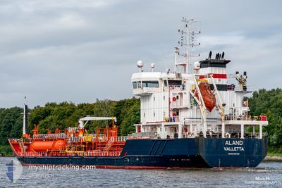
ALAND
Oil/Chemical Tanker
Current Trip
BEANR
| Time Travelled | 6 days |
|---|---|
| Remaining Time | --- |
| Distance Travelled | 1020.71 nm |
| Remaining Distance | --- |
| AVG Speed | 8.5 Knots |
| MAX Speed | 11.7 Knots |
| AVG Wind | 8.8 knots |
| MAX Wind | 27 knots |
| MIN Temp | 5.1°C / 41.18°F |
| MAX Temp | 19.4°C / 66.92°F |
| Draught | 4.5 m |
| Position Received | 1 m ago |
Current Position
| Longitude | 9.15709° |
|---|---|
| Latitude | 53.90013° |
| Status | Under way using engine |
| Speed | 3.9 Knots |
| Course | 226° |
| Area | Baltic Sea |
| Station | T-AIS |
| Position Received | 1 m ago |
Info
Information
The current position of ALAND is in Baltic Sea with coordinates 53.90013° / 9.15709° as reported on 2024-05-08 12:05 by AIS to our vessel tracker app. The vessel's current speed is 3.9 Knots
The vessel ALAND (IMO: 9487380, MMSI: 249581000) is a Oil/Chemical Tanker that was built in 2013 ( 11 years old ). It's sailing under the flag of [MT] Malta.
In this page you can find informations about the vessels current position, last detected port calls, and current voyage information. If the vessels is not in coverage by AIS you will find the latest position.
The current position of ALAND is detected by our AIS receivers and we are not responsible for the reliability of the data. The last position was recorded while the vessel was in Coverage by the Ais receivers of our vessel tracking app.
The current draught of ALAND as reported by AIS is 4.5 meters
Weather
| Temperature | 16.5°C / 61.7°F |
|---|---|
| Wind Speed | 3 knots |
| Direction | 72° ENE |
| Pressure | 1026.5 hPa |
| Humidity | 49.6 % |
| Cloud Coverage | 8 % |
Featured Company
Last Port Calls
| Port | Arrival | Departure | Time In Port |
|---|---|---|---|
| 2024-05-01 08:16 | 2024-05-01 17:13 | 8 h | |
| 2024-04-30 00:36 | 2024-04-30 17:59 | 17 h | |
| 2024-04-25 15:39 | 2024-04-28 13:49 | 2 d | |
| 2024-04-21 14:51 | 2024-04-23 00:16 | 1 d | |
| 2024-04-15 13:47 | 2024-04-16 12:30 | 22 h | |
| 2024-04-11 14:39 | 2024-04-12 18:59 | 1 d | |
| 2024-04-08 10:22 | 2024-04-08 12:50 | 2 h | |
| 2024-04-07 09:22 | 2024-04-08 07:36 | 22 h | |
| 2024-04-03 19:34 | 2024-04-05 03:58 | 1 d | |
| 2024-04-01 11:07 | 2024-04-02 14:22 | 1 d |
Most Visited Ports (Last year)
| Port | Arrivals | |
|---|---|---|
| 7 | ||
| 7 | ||
| 5 | ||
| 5 | ||
| 4 | ||
| 4 |
Last Trips
| Origin | Departure | Destination | Arrival | Distance | |
|---|---|---|---|---|---|
| 2024-04-30 19:59 | 2024-05-01 10:16 | 114.14 nm | |||
| 2024-04-28 15:49 | 2024-04-30 02:36 | 169.98 nm | |||
| 2024-04-23 01:16 | 2024-04-25 17:39 | 537.01 nm | |||
| 2024-04-16 14:30 | 2024-04-21 15:51 | 113.08 nm | |||
| 2024-04-12 20:59 | 2024-04-15 15:47 | 262.00 nm | |||
| 2024-04-08 14:50 | 2024-04-11 16:39 | 605.55 nm | |||
| 2024-04-08 09:36 | 2024-04-08 12:22 | 1.49 nm | |||
| 2024-04-05 05:58 | 2024-04-07 11:22 | 527.01 nm | |||
| 2024-04-02 15:22 | 2024-04-03 21:34 | 170.91 nm | |||
| 2024-03-28 04:54 | 2024-04-01 12:07 | 208.88 nm |
Events
| Time | Event | Details | Position / Dest | Info |
|---|---|---|---|---|
| 2024-05-08 10:43 | Status Changed | Under way using engine Default |
54.01857 / 9.29775
BEANR
|
Speed: 6.5 kn Course: 190° |
| 2024-05-08 10:16 | Status Changed | Default Under way using engine |
54.06649 / 9.31208
BEANR
|
Speed: 6.6 kn Course: 197.7° |
| 2024-05-08 10:06 | Status Changed | Under way using engine Default |
54.08466 / 9.32157
BEANR
|
Speed: 6.6 kn Course: 182° |
| 2024-05-08 09:50 | Status Changed | Default Under way using engine |
54.11385 / 9.32848
BEANR
|
Speed: 6.6 kn Course: 192.2° |
| 2024-05-08 04:26 | START Moving | 1.4 nm, South West of STICKENHΟRN SPORT |
54.36642 / 10.13953
BEANR
|
Speed: 5.4 kn Course: 285.8° |
| 2024-05-08 04:09 | STOP Moving | 1.35 nm, South West of STICKENHΟRN SPORT |
54.36594 / 10.14270
BEANR
|
Speed: 0.3 kn Course: 281° |
| 2024-05-08 01:53 | Change Sea Area | German part of the Baltic Sea Danish part of the Baltic Sea |
54.56920 / 10.55670
Baltic Sea
|
Speed: 9.4 kn Course: 246.4° |
| 2024-05-08 00:56 | Detected in Sea | Danish part of the Baltic Sea |
54.58955 / 10.81559
Baltic Sea
|
Speed: 9.7 kn Course: 265.7° |
| 2024-05-07 23:08 | Change Sea Area | German part of the Baltic Sea Danish part of the Baltic Sea |
54.56818 / 11.32373
Baltic Sea
|
Speed: 9.7 kn Course: 296.6° |
| 2024-05-07 23:02 | Status Changed | Under way using engine At anchor |
54.56159 / 11.34592
BEANR
|
Speed: 3.4 kn Course: 299° |