
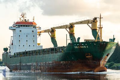
MSC WAVE F
General Cargo
Current Trip
PORT HARCOURT
| Time Travelled | 4 days |
|---|---|
| Remaining Time | --- |
| Distance Travelled | 509.40 nm |
| Remaining Distance | --- |
| AVG Speed | 11.8 Knots |
| MAX Speed | 13.7 Knots |
| AVG Wind | 7.5 knots |
| MAX Wind | 12.7 knots |
| MIN Temp | 24.9°C / 76.82°F |
| MAX Temp | 34°C / 93.2°F |
| Draught | 7 m |
| Position Received | 3 d ago |
Current Position
| Longitude | 3.45003° |
|---|---|
| Latitude | 6.34860° |
| Status | Under way using engine |
| Speed | 0.5 Knots |
| Course | 330° |
| Area | Gulf of Guinea |
| Station | T-AIS |
| Position Received | 3 d ago |
Info
Information
The current position of MSC WAVE F is in Gulf of Guinea with coordinates 6.34860° / 3.45003° as reported on 2024-05-06 14:12 by AIS to our vessel tracker app. The vessel's current speed is 0.5 Knots
The vessel MSC WAVE F (IMO: 9232462, MMSI: 636021255) is a General Cargo that was built in 2001 ( 23 years old ). It's sailing under the flag of [LR] Liberia.
In this page you can find informations about the vessels current position, last detected port calls, and current voyage information. If the vessels is not in coverage by AIS you will find the latest position.
The current position of MSC WAVE F is detected by our AIS receivers and we are not responsible for the reliability of the data. The last position was recorded while the vessel was in Coverage by the Ais receivers of our vessel tracking app.
The current draught of MSC WAVE F as reported by AIS is 7 meters
Weather
| Temperature | 34°C / 93.2°F |
|---|---|
| Wind Speed | 7 knots |
| Direction | 153° SSE |
| Pressure | 1007 hPa |
| Humidity | 53.5 % |
| Cloud Coverage | 100 % |
Featured Company
Last Port Calls
| Port | Arrival | Departure | Time In Port |
|---|---|---|---|
| 2024-05-04 18:00 | 2024-05-05 23:28 | 1 d | |
| 2024-04-28 11:58 | 2024-04-30 18:18 | 2 d | |
| 2024-04-26 03:36 | 2024-04-27 16:04 | 1 d | |
| 2024-04-23 11:20 | 2024-04-24 15:36 | 1 d | |
| 2024-04-21 11:40 | 2024-04-22 18:28 | 1 d | |
| 2024-04-14 20:56 | 2024-04-17 18:59 | 2 d | |
| 2024-04-12 22:42 | 2024-04-13 17:50 | 19 h | |
| 2024-04-04 00:17 | 2024-04-04 19:01 | 18 h | |
| 2024-03-29 19:03 | 2024-03-31 19:33 | 2 d | |
| 2024-03-20 08:32 | 2024-03-21 08:39 | 1 d |
Last Trips
| Origin | Departure | Destination | Arrival | Distance | |
|---|---|---|---|---|---|
| 2024-04-30 18:18 | 2024-05-04 18:00 | 238.45 nm | |||
| 2024-04-27 16:04 | 2024-04-28 11:58 | 226.88 nm | |||
| 2024-04-24 16:36 | 2024-04-26 03:36 | 189.09 nm | |||
| 2024-04-22 18:28 | 2024-04-23 12:20 | 158.21 nm | |||
| 2024-04-17 18:59 | 2024-04-21 11:40 | 233.72 nm | |||
| 2024-04-13 17:50 | 2024-04-14 20:56 | 229.27 nm | |||
| 2024-04-04 19:01 | 2024-04-12 22:42 | 1018.31 nm | |||
| 2024-03-31 20:33 | 2024-04-04 00:17 | 591.20 nm | |||
| 2024-03-21 08:39 | 2024-03-29 20:03 | 648.26 nm | |||
| 2024-03-09 21:43 | 2024-03-14 22:13 | 596.31 nm |
Events
| Time | Event | Details | Position / Dest | Info |
|---|---|---|---|---|
| 2024-05-09 15:00 | STOP Moving | 10.24 nm, North West of ONNE |
4.76570 / 7.00727
PORT HARCOURT
|
Speed: Course: 213° |
| 2024-05-09 11:28 | START Moving | 4.58 nm, North East of BONNY |
4.48240 / 7.18108
PORT HARCOURT
|
Speed: 5.6 kn Course: 351° |
| 2024-05-08 09:56 | STOP Moving | 4.43 nm, North East of BONNY |
4.47942 / 7.18122
PORT HARCOURT
|
Speed: 0.2 kn Course: 4° |
| 2024-05-08 07:20 | START Moving | 17.19 nm, South West of BONNY |
4.20682 / 6.94423
PORT HARCOURT
|
Speed: 8.5 kn Course: 97° |
| 2024-05-07 17:30 | STOP Moving | 17.44 nm, South West of BONNY |
4.20593 / 6.93893
PORT HARCOURT
|
Speed: 0.3 kn Course: 264° |
| 2024-05-06 18:00 | START Moving | 6.67 nm, South East of LAGOS |
6.35815 / 3.44860
PORT HARCOURT
|
Speed: 5.8 kn Course: 167° |
| 2024-05-06 14:12 | Status Changed | Default Under way using engine |
6.34860 / 3.45003
PORT HARCOURT
|
Speed: 0.5 kn Course: 330° |
| 2024-05-06 14:12 | Status Changed | Under way using engine Default |
6.34860 / 3.45003
PORT HARCOURT
|
Speed: 0.2 kn Course: 335° |
| 2024-05-06 14:12 | OUT of Coverage |
6.34860 / 3.45003
Gulf of Guinea
|
Speed: 0.5 kn Course: 42° |
|
| 2024-05-06 14:08 | Status Changed | Default Under way using engine |
6.34833 / 3.44990
PORT HARCOURT
|
Speed: 0.3 kn Course: 337° |