
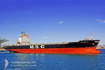
MSC MARIA PIA
Container Ship
Current Trip
| Time Travelled | 1 day |
|---|---|
| Remaining Time | 9 h, 20 mins |
| Distance Travelled | 136.41 nm |
| Remaining Distance | 160.09 nm |
| AVG Speed | 11.8 Knots |
| MAX Speed | 17.3 Knots |
| AVG Wind | 7.8 knots |
| MAX Wind | 14 knots |
| MIN Temp | 11.2°C / 52.16°F |
| MAX Temp | 22.6°C / 72.68°F |
| Draught | 9.5 m |
| Position Received | Now |
Current Position
| Longitude | 19.03900° |
|---|---|
| Latitude | 58.85998° |
| Status | Under way using engine |
| Speed | 16.7 Knots |
| Course | 53.9° |
| Area | Baltic Sea |
| Station | T-AIS |
| Position Received | Now |
Info
Information
The current position of MSC MARIA PIA is in Baltic Sea with coordinates 58.85998° / 19.03900° as reported on 2024-05-28 20:53 by AIS to our vessel tracker app. The vessel's current speed is 16.7 Knots and is heading at the port of GAVLE. The estimated time of arrival as calculated by MyShipTracking vessel tracking app is 2024-05-29 06:14 LT
The vessel MSC MARIA PIA (IMO: 9155107, MMSI: 354711000) is a Container Ship that was built in 1997 ( 27 years old ). It's sailing under the flag of [PA] Panama.
In this page you can find informations about the vessels current position, last detected port calls, and current voyage information. If the vessels is not in coverage by AIS you will find the latest position.
The current position of MSC MARIA PIA is detected by our AIS receivers and we are not responsible for the reliability of the data. The last position was recorded while the vessel was in Coverage by the Ais receivers of our vessel tracking app.
The current draught of MSC MARIA PIA as reported by AIS is 9.5 meters
Weather
| Temperature | 12.5°C / 54.5°F |
|---|---|
| Wind Speed | 11 knots |
| Direction | 159° SSE |
| Pressure | 1015 hPa |
| Humidity | 78.6 % |
| Cloud Coverage | 7 % |
Featured Company
Last Port Calls
| Port | Arrival | Departure | Time In Port |
|---|---|---|---|
| 2024-05-27 03:25 | 2024-05-27 16:27 | 13 h | |
| 2024-05-21 10:27 | 2024-05-23 00:49 | 1 d | |
| 2024-05-19 03:44 | 2024-05-19 13:53 | 10 h | |
| 2024-05-15 13:55 | 2024-05-16 17:44 | 1 d | |
| 2024-05-13 03:20 | 2024-05-14 01:48 | 22 h | |
| 2024-05-08 11:32 | 2024-05-09 18:44 | 1 d | |
| 2024-05-06 18:37 | 2024-05-07 11:56 | 17 h | |
| 2024-05-01 11:47 | 2024-05-02 22:00 | 1 d | |
| 2024-04-29 11:18 | 2024-04-30 00:35 | 13 h | |
| 2024-04-25 03:35 | 2024-04-26 09:08 | 1 d |
Most Visited Ports (Last year)
| Port | Arrivals | |
|---|---|---|
| 14 | ||
| 12 | ||
| 12 | ||
| 7 | ||
| 6 | ||
| 4 |
Last Trips
| Origin | Departure | Destination | Arrival | Distance | |
|---|---|---|---|---|---|
| 2024-05-23 02:49 | 2024-05-27 05:25 | 1206.16 nm | |||
| 2024-05-19 15:53 | 2024-05-21 12:27 | 596.65 nm | |||
| 2024-05-16 19:44 | 2024-05-19 05:44 | 805.45 nm | |||
| 2024-05-14 03:48 | 2024-05-15 15:55 | 324.29 nm | |||
| 2024-05-09 20:44 | 2024-05-13 05:20 | 1206.43 nm | |||
| 2024-05-07 13:56 | 2024-05-08 13:32 | 379.95 nm | |||
| 2024-05-03 00:00 | 2024-05-06 20:37 | 1164.61 nm | |||
| 2024-04-30 02:35 | 2024-05-01 13:47 | 322.93 nm | |||
| 2024-04-26 11:08 | 2024-04-29 13:18 | 1205.23 nm | |||
| 2024-04-22 14:10 | 2024-04-25 05:35 | 550.44 nm |
Events
| Time | Event | Details | Position / Dest | Info |
|---|---|---|---|---|
| 2024-05-28 17:06 | START Moving | 2.11 nm, North of NYNASHAMN |
58.93517 / 17.98178
SE GVX
|
Speed: 3.1 kn Course: 181° |
| 2024-05-28 16:25 | Draught Changed | 9.5 9.2 |
58.93605 / 17.98034
SE GVX
|
Speed: Course: 197° |
| 2024-05-28 16:20 | Status Changed | Under way using engine Moored |
58.93603 / 17.98036
SE GVX
|
Speed: Course: 197° |
| 2024-05-28 16:19 | Draught Changed | 9.2 9 |
58.93606 / 17.98036
SE GVX
|
Speed: Course: 197° |
| 2024-05-28 10:36 | ETA Changed | 2024/05/29 11:00 2024/05/27 22:00 |
58.93607 / 17.98036
SE GVX
|
Speed: Course: 197° |
| 2024-05-28 10:30 | Destination Changed | SE GVX SE STO |
58.93621 / 17.98037
SE GVX
|
Speed: Course: 197° |
| 2024-05-27 23:56 | Status Changed | Moored Under way using engine |
58.93601 / 17.98056
SE STO
|
Speed: 0.1 kn Course: 189° |
| 2024-05-27 23:22 | STOP Moving | 1.7 nm, North East of NYNASHAMN |
58.92717 / 17.98351
SE STO
|
Speed: 0.3 kn Course: 355° |
| 2024-05-27 16:27 | PORT DEPARTURE |
|
58.62052 / 16.25929
SE STO
|
Speed: 3.1 kn Course: 84° |
| 2024-05-27 16:27 | START Moving |
58.62048 / 16.25868
[SE] NORRKOPING
|
Speed: 3.1 kn Course: 84° |