
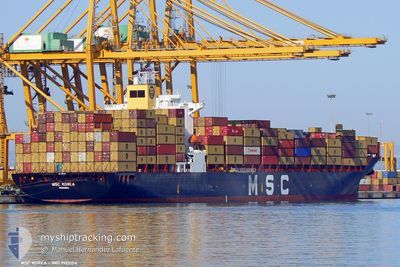
MSC KOREA
Container Ship
Current Trip
| Time Travelled | 17 h, 32 mins |
|---|---|
| Remaining Time | 9 h, 53 mins |
| Distance Travelled | 270.32 nm |
| Remaining Distance | 160.23 nm |
| AVG Speed | 15.3 Knots |
| MAX Speed | 16.5 Knots |
| AVG Wind | 10.6 knots |
| MAX Wind | 13.9 knots |
| MIN Temp | 25.3°C / 77.54°F |
| MAX Temp | 29.2°C / 84.56°F |
| Draught | 10.4 m |
| Position Received | 1 h, 49 m ago |
Current Position
| Longitude | -91.21350° |
|---|---|
| Latitude | 27.94614° |
| Status | Under way using engine |
| Speed | 15.9 Knots |
| Course | 81.9° |
| Area | Gulf of Mexico |
| Station | T-AIS |
| Position Received | 1 h, 49 m ago |
Info
Information
The current position of MSC KOREA is in Gulf of Mexico with coordinates 27.94614° / -91.21350° as reported on 2024-05-20 14:39 by AIS to our vessel tracker app. The vessel's current speed is 15.9 Knots and is heading at the port of NEW ORLEANS. The estimated time of arrival as calculated by MyShipTracking vessel tracking app is 2024-05-20 21:21 LT
The vessel MSC KOREA (IMO: 9123154, MMSI: 371243000) is a Container Ship that was built in 1996 ( 28 years old ). It's sailing under the flag of [PA] Panama.
In this page you can find informations about the vessels current position, last detected port calls, and current voyage information. If the vessels is not in coverage by AIS you will find the latest position.
The current position of MSC KOREA is detected by our AIS receivers and we are not responsible for the reliability of the data. The last position was recorded while the vessel was in Coverage by the Ais receivers of our vessel tracking app.
The current draught of MSC KOREA as reported by AIS is 10.4 meters
Weather
| Temperature | 25.9°C / 78.62°F |
|---|---|
| Wind Speed | 14 knots |
| Direction | 111° ESE |
| Pressure | 1012.9 hPa |
| Humidity | 83.1 % |
| Cloud Coverage | --- |
Featured Company
Last Port Calls
| Port | Arrival | Departure | Time In Port |
|---|---|---|---|
| 2024-05-18 10:47 | 2024-05-19 17:56 | 1 d | |
| 2024-05-14 22:05 | 2024-05-15 13:17 | 15 h | |
| 2024-05-13 12:05 | 2024-05-13 22:53 | 10 h | |
| 2024-05-08 20:38 | 2024-05-10 21:53 | 2 d | |
| 2024-05-06 18:02 | 2024-05-08 18:02 | 2 d | |
| 2024-05-02 09:17 | 2024-05-03 00:53 | 15 h | |
| 2024-05-01 19:42 | 2024-05-02 02:26 | 6 h | |
| 2024-04-29 13:17 | 2024-04-30 02:10 | 12 h | |
| 2024-04-28 01:41 | 2024-04-28 09:38 | 7 h | |
| 2024-04-22 01:07 | 2024-04-23 16:06 | 1 d |
Most Visited Ports (Last year)
| Port | Arrivals | |
|---|---|---|
| 12 | ||
| 10 | ||
| 8 | ||
| 6 | ||
| 6 | ||
| 4 |
Last Trips
| Origin | Departure | Destination | Arrival | Distance | |
|---|---|---|---|---|---|
| 2024-05-15 13:17 | 2024-05-18 10:47 | 1085.48 nm | |||
| 2024-05-13 22:53 | 2024-05-14 22:05 | 96.64 nm | |||
| 2024-05-10 21:53 | 2024-05-13 12:05 | 930.03 nm | |||
| 2024-05-08 18:02 | 2024-05-08 20:38 | 11.27 nm | |||
| 2024-05-03 00:53 | 2024-05-06 18:02 | 888.19 nm | |||
| 2024-05-02 02:26 | 2024-05-02 09:17 | 72.38 nm | |||
| 2024-04-30 02:10 | 2024-05-01 19:42 | 31.34 nm | |||
| 2024-04-28 09:38 | 2024-04-29 13:17 | 76.08 nm | |||
| 2024-04-23 16:06 | 2024-04-28 01:41 | 1041.16 nm | |||
| 2024-04-20 12:18 | 2024-04-22 01:07 | 443.91 nm |
Events
| Time | Event | Details | Position / Dest | Info |
|---|---|---|---|---|
| 2024-05-20 14:45 | Status Changed | Default Under way using engine |
27.94847 / -91.18042
USMSY
|
Speed: 15.9 kn Course: 81.9° |
| 2024-05-20 14:39 | OUT of Coverage |
27.94614 / -91.21350
Gulf of Mexico
USMSY
|
Speed: 15.9 kn Course: 81.9° |
|
| 2024-05-20 14:05 | Status Changed | Under way using engine Default |
27.92891 / -91.38305
USMSY
|
Speed: 16.1 kn Course: 89° |
| 2024-05-20 13:50 | Status Changed | Default Under way using engine |
27.92715 / -91.45548
USMSY
|
Speed: 16.1 kn Course: 87.4° |
| 2024-05-20 13:32 | Status Changed | Under way using engine Default |
27.92338 / -91.54633
USMSY
|
Speed: 16 kn Course: 87° |
| 2024-05-20 13:15 | IN Coverage |
27.92377 / -91.53726
Gulf of Mexico
USMSY
|
Speed: 16.1 kn Course: 87.1° |
|
| 2024-05-20 11:13 | Status Changed | Default Under way using engine |
27.87500 / -92.23333
USMSY
|
Speed: 16.2 kn Course: 82.9° |
| 2024-05-20 11:08 | OUT of Coverage |
27.87237 / -92.26174
Gulf of Mexico
USMSY
|
Speed: 16.2 kn Course: 82.9° |
|
| 2024-05-20 11:04 | Status Changed | Under way using engine Default |
27.87051 / -92.27942
USMSY
|
Speed: 16 kn Course: 82° |
| 2024-05-20 11:01 | IN Coverage |
27.87183 / -92.26680
Gulf of Mexico
USMSY
|
Speed: 16.2 kn Course: 83.3° |