
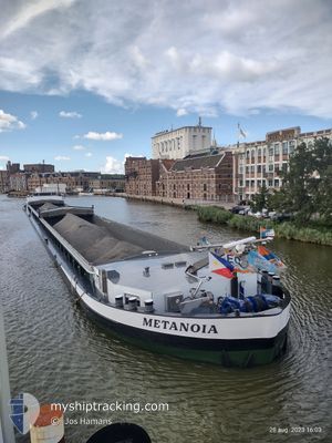
METANOIA
Cargo
Current Trip
| Time Travelled | 4 days |
|---|---|
| Remaining Time | --- |
| Distance Travelled | 219.64 nm |
| Remaining Distance | --- |
| AVG Speed | 4.8 Knots |
| MAX Speed | 7 Knots |
| AVG Wind | 6.6 knots |
| MAX Wind | 10 knots |
| MIN Temp | 10.2°C / 50.36°F |
| MAX Temp | 17.8°C / 64.04°F |
| Draught | 3 m |
| Position Received | 2 d ago |
Current Position
| Longitude | 10.21336° |
|---|---|
| Latitude | 49.86851° |
| Status | Under way using engine |
| Speed | 5.7 Knots |
| Course | 309.4° |
| Area | North Sea |
| Station | T-AIS |
| Position Received | 2 d ago |
Info
Information
The current position of METANOIA is in North Sea with coordinates 49.86851° / 10.21336° as reported on 2024-05-30 16:52 by AIS to our vessel tracker app. The vessel's current speed is 5.7 Knots and is heading at the port of STRAUBING. The estimated time of arrival as calculated by MyShipTracking vessel tracking app is 2024-06-04 10:48 LT
The vessel METANOIA (MMSI: 244750218) is a Cargo It's sailing under the flag of [NL] Netherlands.
In this page you can find informations about the vessels current position, last detected port calls, and current voyage information. If the vessels is not in coverage by AIS you will find the latest position.
The current position of METANOIA is detected by our AIS receivers and we are not responsible for the reliability of the data. The last position was recorded while the vessel was in Coverage by the Ais receivers of our vessel tracking app.
The current draught of METANOIA as reported by AIS is 3 meters
Weather
| Temperature | 13.8°C / 56.84°F |
|---|---|
| Wind Speed | 4 knots |
| Direction | 264° W |
| Pressure | 1017 hPa |
| Humidity | 94.8 % |
| Cloud Coverage | 100 % |
Featured Company
Last Port Calls
| Port | Arrival | Departure | Time In Port |
|---|---|---|---|
| 2024-05-28 16:52 | 2024-05-28 17:03 | 10 m | |
| 2024-05-28 10:08 | 2024-05-28 10:39 | 30 m | |
| 2024-05-28 09:03 | 2024-05-28 09:19 | 15 m | |
| 2024-05-27 22:18 | 2024-05-28 06:10 | 7 h | |
| 2024-05-27 17:13 | 2024-05-27 18:20 | 1 h | |
| 2024-05-27 05:49 | 2024-05-27 17:09 | 11 h | |
| 2024-05-25 22:46 | 2024-05-27 05:33 | 1 d | |
| 2024-05-22 19:24 | 2024-05-24 14:31 | 1 d | |
| 2024-05-22 11:18 | 2024-05-22 11:23 | 5 m | |
| 2024-05-21 22:17 | 2024-05-22 06:49 | 8 h |
Most Visited Ports (Last year)
| Port | Arrivals | |
|---|---|---|
| 9 | ||
| 8 | ||
| 7 | ||
| 6 | ||
| 5 | ||
| 5 |
Last Trips
| Origin | Departure | Destination | Arrival | Distance | |
|---|---|---|---|---|---|
| 2024-05-28 10:39 | 2024-05-28 16:52 | 24.40 nm | |||
| 2024-05-28 09:19 | 2024-05-28 10:08 | 4.57 nm | |||
| 2024-05-28 06:10 | 2024-05-28 09:03 | 12.54 nm | |||
| 2024-05-27 18:20 | 2024-05-27 22:18 | 37.35 nm | |||
| 2024-05-27 17:09 | 2024-05-27 17:13 | 0.47 nm | |||
| 2024-05-27 05:33 | 2024-05-27 05:49 | 1.58 nm | |||
| 2024-05-24 14:31 | 2024-05-25 22:46 | 177.22 nm | |||
| 2024-05-22 11:23 | 2024-05-22 19:24 | 38.61 nm | |||
| 2024-05-22 06:49 | 2024-05-22 11:18 | 24.15 nm | |||
| 2024-05-18 09:37 | 2024-05-21 22:17 | 62.69 nm |
Events
| Time | Event | Details | Position / Dest | Info |
|---|---|---|---|---|
| 2024-06-01 19:58 | STOP Moving | 1.16 nm, East of KELHEIM |
48.90833 / 11.91667
STRAUBING
|
Speed: Course: -1° |
| 2024-06-01 12:05 | STOP Moving | 20.76 nm, South East of NUREMBERG |
49.15333 / 11.43500
STRAUBING
|
Speed: Course: -1° |
| 2024-06-01 03:46 | START Moving | 7.4 nm, North West of NUREMBERG |
49.49667 / 10.94667
STRAUBING
|
Speed: 5 kn Course: 213° |
| 2024-05-31 17:08 | START Moving | 13.01 nm, South East of BAMBERG |
49.70667 / 11.05333
STRAUBING
|
Speed: 4 kn Course: -1° |
| 2024-05-31 15:02 | START Moving | 5.29 nm, South East of BAMBERG |
49.82500 / 10.97166
STRAUBING
|
Speed: 6 kn Course: 142° |
| 2024-05-31 14:47 | STOP Moving | 4.3 nm, South East of BAMBERG |
49.83833 / 10.95667
STRAUBING
|
Speed: Course: -1° |
| 2024-05-31 12:50 | START Moving | 2.69 nm, North West of BAMBERG |
49.91500 / 10.82833
STRAUBING
|
Speed: 6 kn Course: 109° |
| 2024-05-31 03:21 | START Moving | 6.92 nm, South of SCHWEINFURT |
49.92667 / 10.17833
STRAUBING
|
Speed: 5 kn Course: 356° |
| 2024-05-30 17:13 | Status Changed | Default Under way using engine |
49.86833 / 10.16833
STRAUBING
|
Speed: 5.7 kn Course: 309.4° |
| 2024-05-30 16:52 | OUT of Coverage |
49.86851 / 10.21336
North Sea
STRAUBING
|
Speed: 5.7 kn Course: 309.4° |