
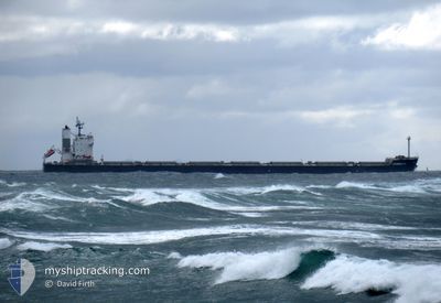
LEONIDAS P.C.
Cargo
Current Trip
| Time Travelled | 22 days |
|---|---|
| Remaining Time | 13 days |
| Distance Travelled | 5360.56 nm |
| Remaining Distance | 3678.30 nm |
| AVG Speed | 9.8 Knots |
| MAX Speed | 12.6 Knots |
| AVG Wind | 16.3 knots |
| MAX Wind | 34.9 knots |
| MIN Temp | 13.7°C / 56.66°F |
| MAX Temp | 24.5°C / 76.1°F |
| Draught | 6.9 m |
| Position Received | 7 d ago |
Current Position
| Longitude | 19.08762° |
|---|---|
| Latitude | -34.94202° |
| Status | Under way using engine |
| Speed | 10 Knots |
| Course | 109.8° |
| Area | South Atlantic Ocean |
| Station | T-AIS |
| Position Received | 7 d ago |
Info
Information
The current position of LEONIDAS P.C. is in South Atlantic Ocean with coordinates -34.94202° / 19.08762° as reported on 2024-06-08 05:39 by AIS to our vessel tracker app. The vessel's current speed is 10 Knots and is heading at the port of SINGAPORE. The estimated time of arrival as calculated by MyShipTracking vessel tracking app is 2024-06-29 15:52 LT
The vessel LEONIDAS P.C. (IMO: 9461233, MMSI: 538009568) is a Cargo It's sailing under the flag of [MH] Marshall Is.
In this page you can find informations about the vessels current position, last detected port calls, and current voyage information. If the vessels is not in coverage by AIS you will find the latest position.
The current position of LEONIDAS P.C. is detected by our AIS receivers and we are not responsible for the reliability of the data. The last position was recorded while the vessel was in Coverage by the Ais receivers of our vessel tracking app.
The current draught of LEONIDAS P.C. as reported by AIS is 6.9 meters
Weather
| Temperature | 22.2°C / 71.96°F |
|---|---|
| Wind Speed | 12 knots |
| Direction | 233° SW |
| Pressure | 1016.3 hPa |
| Humidity | 78.5 % |
| Cloud Coverage | 4 % |
Featured Company
Events
| Time | Event | Details | Position / Dest | Info |
|---|---|---|---|---|
| 2024-06-08 05:43 | Status Changed | Default Under way using engine |
-34.94452 / 19.09923
SGSIN
|
Speed: 10 kn Course: 109.8° |
| 2024-06-08 05:39 | Status Changed | Under way using engine Default |
-34.94202 / 19.08762
SGSIN
|
Speed: 9 kn Course: 102° |
| 2024-06-08 05:39 | OUT of Coverage |
-34.94202 / 19.08762
South Atlantic Ocean
SGSIN
|
Speed: 10 kn Course: 109.8° |
|
| 2024-06-08 05:22 | IN Coverage |
-34.94202 / 19.08762
South Atlantic Ocean
SGSIN
|
Speed: 10 kn Course: 109.8° |
|
| 2024-06-08 04:11 | Status Changed | Default Under way using engine |
-34.88798 / 18.79731
SGSIN
|
Speed: 10.2 kn Course: 106.4° |
| 2024-06-08 04:05 | Status Changed | Under way using engine Default |
-34.88397 / 18.77504
SGSIN
|
Speed: 10 kn Course: 99° |
| 2024-06-08 04:05 | OUT of Coverage |
-34.88397 / 18.77504
South Atlantic Ocean
SGSIN
|
Speed: 10.2 kn Course: 106.4° |
|
| 2024-06-08 03:48 | IN Coverage |
-34.88397 / 18.77504
South Atlantic Ocean
SGSIN
|
Speed: 10.2 kn Course: 106.4° |
|
| 2024-06-08 02:26 | Status Changed | Default Under way using engine |
-34.82333 / 18.44833
SGSIN
|
Speed: 9.7 kn Course: 109.7° |
| 2024-06-08 02:20 | OUT of Coverage |
-34.81902 / 18.42801
South Atlantic Ocean
SGSIN
|
Speed: 9.7 kn Course: 109.7° |