
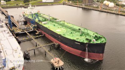
LANCING
Tanker
Current Trip
GBTEE>GBTTL
| Time Travelled | 2 days |
|---|---|
| Remaining Time | --- |
| Distance Travelled | 96.27 nm |
| Remaining Distance | --- |
| AVG Speed | 11.7 Knots |
| MAX Speed | 13.1 Knots |
| AVG Wind | 14 knots |
| MAX Wind | 23 knots |
| MIN Temp | 8.9°C / 48.02°F |
| MAX Temp | 13.1°C / 55.58°F |
| Draught | 13.7 m |
| Position Received | 1 m ago |
Current Position
| Longitude | 0.37570° |
|---|---|
| Latitude | 53.73204° |
| Status | At anchor |
| Speed | |
| Course | 350° |
| Area | North Sea |
| Station | T-AIS |
| Position Received | 1 m ago |
Info
Information
The current position of LANCING is in North Sea with coordinates 53.73204° / 0.37570° as reported on 2024-06-09 19:52 by AIS to our vessel tracker app. The vessel's current speed is 0 Knots
The vessel LANCING (IMO: 9792046, MMSI: 311000766) is a Tanker It's sailing under the flag of [BS] Bahamas.
In this page you can find informations about the vessels current position, last detected port calls, and current voyage information. If the vessels is not in coverage by AIS you will find the latest position.
The current position of LANCING is detected by our AIS receivers and we are not responsible for the reliability of the data. The last position was recorded while the vessel was in Coverage by the Ais receivers of our vessel tracking app.
The current draught of LANCING as reported by AIS is 13.7 meters
Weather
| Temperature | 11°C / 51.8°F |
|---|---|
| Wind Speed | 4 knots |
| Direction | 103° ESE |
| Pressure | 1008.1 hPa |
| Humidity | 78.5 % |
| Cloud Coverage | 100 % |
Featured Company
Last Port Calls
| Port | Arrival | Departure | Time In Port |
|---|---|---|---|
| 2024-06-06 09:54 | 2024-06-07 14:34 | 1 d | |
| 2024-05-28 08:44 | 2024-05-29 19:41 | 1 d | |
| 2024-05-14 05:20 | 2024-05-15 06:02 | 1 d | |
| 2024-05-07 11:24 | 2024-05-08 16:08 | 1 d | |
| 2024-04-27 01:18 | 2024-04-28 11:35 | 1 d | |
| 2024-04-15 09:43 | 2024-04-17 01:49 | 1 d | |
| 2024-04-07 08:50 | 2024-04-08 04:46 | 19 h | |
| 2024-04-03 02:45 | 2024-04-04 04:18 | 1 d |
Last Trips
| Origin | Departure | Destination | Arrival | Distance | |
|---|---|---|---|---|---|
| 2024-05-29 19:41 | 2024-06-06 09:54 | 251.63 nm | |||
| 2024-05-15 06:02 | 2024-05-28 08:44 | 263.33 nm | |||
| 2024-05-08 16:08 | 2024-05-14 05:20 | 234.92 nm | |||
| 2024-04-28 11:35 | 2024-05-07 11:24 | 331.21 nm | |||
| 2024-04-17 01:49 | 2024-04-27 01:18 | 747.93 nm | |||
| 2024-04-08 04:46 | 2024-04-15 09:43 | 495.36 nm | |||
| 2024-04-04 04:18 | 2024-04-07 08:50 | 775.10 nm | |||
| 2024-03-28 12:16 | 2024-04-03 02:45 | 824.08 nm |
Events
| Time | Event | Details | Position / Dest | Info |
|---|---|---|---|---|
| 2024-06-09 19:52 | Status Changed | At anchor Default |
53.73204 / .37570
GBTEE>GBTTL
|
Speed: Course: 349° |
| 2024-06-09 19:46 | Status Changed | Default At anchor |
53.73196 / .37574
GBTEE>GBTTL
|
Speed: Course: 349° |
| 2024-06-09 19:39 | Status Changed | At anchor Default |
53.73198 / .37575
GBTEE>GBTTL
|
Speed: Course: 349° |
| 2024-06-09 19:36 | Status Changed | Default At anchor |
53.73201 / .37576
GBTEE>GBTTL
|
Speed: Course: 349° |
| 2024-06-09 19:22 | Status Changed | At anchor Default |
53.73204 / .37568
GBTEE>GBTTL
|
Speed: Course: 353° |
| 2024-06-09 19:16 | Status Changed | Default At anchor |
53.73190 / .37554
GBTEE>GBTTL
|
Speed: Course: 353° |
| 2024-06-09 18:21 | Status Changed | At anchor Default |
53.73195 / .37542
GBTEE>GBTTL
|
Speed: 0.3 kn Course: 3° |
| 2024-06-09 18:16 | Status Changed | Default At anchor |
53.73145 / .37465
GBTEE>GBTTL
|
Speed: 0.1 kn Course: 354° |
| 2024-06-09 18:10 | Status Changed | At anchor Default |
53.73148 / .37499
GBTEE>GBTTL
|
Speed: 0.3 kn Course: 343° |
| 2024-06-09 18:04 | Status Changed | Default At anchor |
53.73179 / .37550
GBTEE>GBTTL
|
Speed: 0.1 kn Course: 344° |