
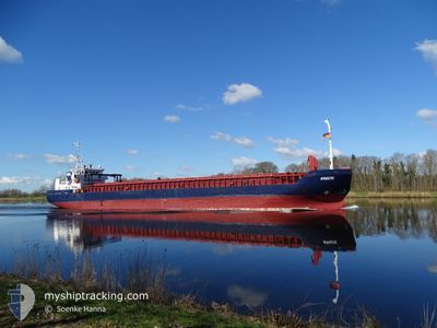
KREETE
General Cargo
Current Trip
| Time Travelled | 1 day |
|---|---|
| Remaining Time | 32 mins |
| Distance Travelled | 332.88 nm |
| Remaining Distance | 8.90 nm |
| AVG Speed | 10.5 Knots |
| MAX Speed | 11.5 Knots |
| AVG Wind | 5.6 knots |
| MAX Wind | 8.1 knots |
| MIN Temp | 7.3°C / 45.14°F |
| MAX Temp | 11.1°C / 51.98°F |
| Draught | 3.4 m |
| Position Received | 20 h, 58 m ago |
Current Position
| Longitude | 23.86511° |
|---|---|
| Latitude | 59.50483° |
| Status | Under way using engine |
| Speed | 10.5 Knots |
| Course | 241.3° |
| Area | Gulf of Finland |
| Station | T-AIS |
| Position Received | 20 h, 58 m ago |
Info
Information
The current position of KREETE is in Gulf of Finland with coordinates 59.50483° / 23.86511° as reported on 2024-05-15 07:52 by AIS to our vessel tracker app. The vessel's current speed is 10.5 Knots and is heading at the port of LIEPAJA. The estimated time of arrival as calculated by MyShipTracking vessel tracking app is 2024-05-16 05:23 LT
The vessel KREETE (IMO: 9279408, MMSI: 305967000) is a General Cargo that was built in 2003 ( 21 years old ). It's sailing under the flag of [AG] Antigua Barbuda.
In this page you can find informations about the vessels current position, last detected port calls, and current voyage information. If the vessels is not in coverage by AIS you will find the latest position.
The current position of KREETE is detected by our AIS receivers and we are not responsible for the reliability of the data. The last position was recorded while the vessel was in Coverage by the Ais receivers of our vessel tracking app.
The current draught of KREETE as reported by AIS is 3.4 meters
Weather
| Temperature | 9.7°C / 49.46°F |
|---|---|
| Wind Speed | 8 knots |
| Direction | 155° SSE |
| Pressure | 1025.2 hPa |
| Humidity | 85.9 % |
| Cloud Coverage | 18 % |
Featured Company
Last Port Calls
| Port | Arrival | Departure | Time In Port |
|---|---|---|---|
| 2024-05-14 04:27 | 2024-05-14 21:19 | 16 h | |
| 2024-05-09 20:35 | 2024-05-11 18:40 | 1 d | |
| 2024-05-07 12:08 | 2024-05-08 17:36 | 1 d | |
| 2024-05-03 00:15 | 2024-05-06 14:35 | 3 d | |
| 2024-04-30 19:20 | 2024-05-02 18:12 | 1 d | |
| 2024-04-29 08:12 | 2024-04-30 13:49 | 1 d | |
| 2024-04-27 08:28 | 2024-04-27 23:41 | 15 h | |
| 2024-04-26 07:28 | 2024-04-26 16:01 | 8 h | |
| 2024-04-24 06:57 | 2024-04-25 12:34 | 1 d | |
| 2024-04-21 13:04 | 2024-04-23 13:42 | 2 d |
Last Trips
| Origin | Departure | Destination | Arrival | Distance | |
|---|---|---|---|---|---|
| 2024-05-11 20:40 | 2024-05-14 07:27 | 604.36 nm | |||
| 2024-05-08 19:36 | 2024-05-09 22:35 | 280.85 nm | |||
| 2024-05-06 16:35 | 2024-05-07 14:08 | 216.11 nm | |||
| 2024-05-02 20:12 | 2024-05-03 02:15 | 58.15 nm | |||
| 2024-04-30 15:49 | 2024-04-30 21:20 | 55.74 nm | |||
| 2024-04-28 02:41 | 2024-04-29 10:12 | 348.56 nm | |||
| 2024-04-26 18:01 | 2024-04-27 11:28 | 174.92 nm | |||
| 2024-04-25 14:34 | 2024-04-26 09:28 | 186.52 nm | |||
| 2024-04-23 15:42 | 2024-04-24 08:57 | 158.33 nm | |||
| 2024-04-18 09:28 | 2024-04-21 15:04 | 172.03 nm |
Events
| Time | Event | Details | Position / Dest | Info |
|---|---|---|---|---|
| 2024-05-15 07:57 | Status Changed | Default Under way using engine |
59.49810 / 23.84061
LV LPX
|
Speed: 10.5 kn Course: 241.3° |
| 2024-05-15 07:52 | OUT of Coverage |
59.50483 / 23.86511
Gulf of Finland
LV LPX
|
Speed: 10.5 kn Course: 241.3° |
|
| 2024-05-15 04:16 | Status Changed | Under way using engine Default |
59.76477 / 24.99818
LV LPX
|
Speed: 10.7 kn Course: 256° |
| 2024-05-15 04:08 | Status Changed | Default Under way using engine |
59.77014 / 25.04125
LV LPX
|
Speed: 10.4 kn Course: 256.5° |
| 2024-05-15 04:02 | Status Changed | Under way using engine Default |
59.77457 / 25.07575
LV LPX
|
Speed: 10.3 kn Course: 256° |
| 2024-05-15 03:32 | Status Changed | Default Under way using engine |
59.79786 / 25.23903
LV LPX
|
Speed: 10.4 kn Course: 237.3° |
| 2024-05-15 03:26 | Status Changed | Under way using engine Default |
59.80726 / 25.26794
LV LPX
|
Speed: 10.4 kn Course: 237° |
| 2024-05-15 03:25 | Status Changed | Default Under way using engine |
59.81003 / 25.27705
LV LPX
|
Speed: 10.4 kn Course: 237.2° |
| 2024-05-15 03:17 | Status Changed | Under way using engine Default |
59.82150 / 25.31339
LV LPX
|
Speed: 10.3 kn Course: 239° |
| 2024-05-15 03:00 | Status Changed | Default Under way using engine |
59.84683 / 25.39390
LV LPX
|
Speed: 10.2 kn Course: 237.6° |