
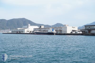
KEISHINMARU
Cargo
Current Trip
JP KNM RS
| Time Travelled | 1 day |
|---|---|
| Remaining Time | --- |
| Distance Travelled | 418.96 nm |
| Remaining Distance | --- |
| AVG Speed | 12 Knots |
| MAX Speed | 12.8 Knots |
| AVG Wind | 8.1 knots |
| MAX Wind | 18 knots |
| MIN Temp | 19.2°C / 66.56°F |
| MAX Temp | 25.8°C / 78.44°F |
| Draught | 4.7 m |
| Position Received | 4 d ago |
Current Position
| Longitude | 137.52469° |
|---|---|
| Latitude | 34.48270° |
| Status | Under way using engine |
| Speed | 12 Knots |
| Course | 252.8° |
| Area | Philippine Sea |
| Station | T-AIS |
| Position Received | 4 d ago |
Info
Information
The current position of KEISHINMARU is in Philippine Sea with coordinates 34.48270° / 137.52469° as reported on 2024-06-11 21:25 by AIS to our vessel tracker app. The vessel's current speed is 12 Knots
The vessel KEISHINMARU (IMO: 9859454, MMSI: 431012798) is a Cargo It's sailing under the flag of [JP] Japan.
In this page you can find informations about the vessels current position, last detected port calls, and current voyage information. If the vessels is not in coverage by AIS you will find the latest position.
The current position of KEISHINMARU is detected by our AIS receivers and we are not responsible for the reliability of the data. The last position was recorded while the vessel was in Coverage by the Ais receivers of our vessel tracking app.
The current draught of KEISHINMARU as reported by AIS is 4.7 meters
Weather
| Temperature | 21.1°C / 69.98°F |
|---|---|
| Wind Speed | 15 knots |
| Direction | 242° WSW |
| Pressure | 1007.2 hPa |
| Humidity | 84.6 % |
| Cloud Coverage | 27 % |
Featured Company
Last Port Calls
| Port | Arrival | Departure | Time In Port |
|---|---|---|---|
| 2024-06-14 15:03 | 2024-06-15 04:29 | 13 h | |
| 2024-06-10 21:49 | 2024-06-11 07:53 | 10 h | |
| 2024-06-07 22:09 | 2024-06-10 21:29 | 2 d | |
| 2024-06-07 02:45 | 2024-06-07 21:41 | 18 h | |
| 2024-06-03 01:22 | 2024-06-04 23:28 | 1 d | |
| 2024-05-30 03:18 | 2024-06-02 11:10 | 3 d | |
| 2024-05-26 22:25 | 2024-05-28 02:33 | 1 d | |
| 2024-05-23 22:08 | 2024-05-25 04:00 | 1 d | |
| 2024-05-22 22:28 | 2024-05-23 19:29 | 21 h | |
| 2024-05-16 18:00 | 2024-05-19 01:12 | 2 d |
Last Trips
| Origin | Departure | Destination | Arrival | Distance | |
|---|---|---|---|---|---|
| 2024-06-11 16:53 | 2024-06-15 00:03 | 558.25 nm | |||
| 2024-06-11 06:29 | 2024-06-11 06:49 | 3.52 nm | |||
| 2024-06-08 06:41 | 2024-06-08 07:09 | 4.89 nm | |||
| 2024-06-05 08:28 | 2024-06-07 11:45 | 536.11 nm | |||
| 2024-06-02 20:10 | 2024-06-03 10:22 | 126.06 nm | |||
| 2024-05-28 11:33 | 2024-05-30 12:18 | 262.01 nm | |||
| 2024-05-25 13:00 | 2024-05-27 07:25 | 312.69 nm | |||
| 2024-05-24 04:29 | 2024-05-24 07:08 | 32.99 nm | |||
| 2024-05-19 10:12 | 2024-05-23 07:28 | 945.28 nm | |||
| 2024-05-14 06:32 | 2024-05-17 03:00 | 771.93 nm |
Events
| Time | Event | Details | Position / Dest | Info |
|---|---|---|---|---|
| 2024-06-15 04:29 | PORT DEPARTURE |
|
33.95477 / 130.84293
JP KNM RS
|
Speed: 7.2 kn Course: 65° |
| 2024-06-15 04:21 | START Moving |
33.94809 / 130.82506
[JP] KITAKYUSHU
|
Speed: 3.5 kn Course: 36° |
|
| 2024-06-14 15:03 | STOP Moving |
33.94681 / 130.81593
[JP] KITAKYUSHU
|
Speed: Course: 260° |
|
| 2024-06-14 15:03 | PORT ARRIVAL |
|
33.94681 / 130.81593
[JP] KITAKYUSHU
|
Speed: 0.6 kn Course: 261° |
| 2024-06-14 14:14 | START Moving | 1.92 nm, East of TOBATA |
33.91153 / 130.85847
JP KNM RS
|
Speed: 7.7 kn Course: 60° |
| 2024-06-13 08:45 | STOP Moving | 1.71 nm, East of TOBATA |
33.90477 / 130.85440
JP KNM RS
|
Speed: Course: 49° |
| 2024-06-13 08:13 | START Moving | 2.08 nm, North of KOKURA |
33.92882 / 130.88417
JP KNM RS
|
Speed: 9.3 kn Course: 229° |
| 2024-06-13 07:09 | STOP Moving | 2.25 nm, West of SHIMONOSEKI |
33.93337 / 130.88765
JP KNM RS
|
Speed: 0.2 kn Course: 62° |
| 2024-06-11 21:25 | Status Changed | Default Under way using engine |
34.48239 / 137.52339
JP KNM RS
|
Speed: 12 kn Course: 252.8° |
| 2024-06-11 21:25 | OUT of Coverage |
34.48270 / 137.52469
Philippine Sea
JP KNM RS
|
Speed: 12 kn Course: 252.8° |