
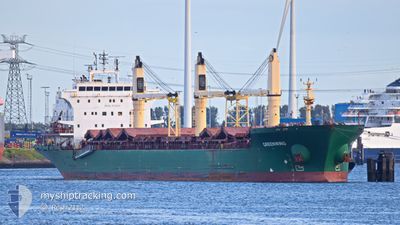
GREENWING
Bulk Carrier
Current Trip
| Time Travelled | 7 days |
|---|---|
| Remaining Time | --- |
| Distance Travelled | 2025.69 nm |
| Remaining Distance | --- |
| AVG Speed | 11.6 Knots |
| MAX Speed | 15.5 Knots |
| AVG Wind | 7.1 knots |
| MAX Wind | 18.5 knots |
| MIN Temp | 5.5°C / 41.9°F |
| MAX Temp | 25.7°C / 78.26°F |
| Draught | 8.1 m |
| Position Received | 1 d ago |
Current Position
| Longitude | -53.08966° |
|---|---|
| Latitude | 33.15416° |
| Status | Under way using engine |
| Speed | 10.9 Knots |
| Course | 171.4° |
| Area | North Atlantic Ocean |
| Station | T-AIS |
| Position Received | 1 d ago |
Info
Information
The current position of GREENWING is in North Atlantic Ocean with coordinates 33.15416° / -53.08966° as reported on 2024-05-25 14:12 by AIS to our vessel tracker app. The vessel's current speed is 10.9 Knots and is heading at the port of SANTAREM. The estimated time of arrival as calculated by MyShipTracking vessel tracking app is 2024-06-03 09:00 LT
The vessel GREENWING (IMO: 9230921, MMSI: 538008597) is a Bulk Carrier that was built in 2002 ( 22 years old ). It's sailing under the flag of [MH] Marshall Is.
In this page you can find informations about the vessels current position, last detected port calls, and current voyage information. If the vessels is not in coverage by AIS you will find the latest position.
The current position of GREENWING is detected by our AIS receivers and we are not responsible for the reliability of the data. The last position was recorded while the vessel was in Coverage by the Ais receivers of our vessel tracking app.
The current draught of GREENWING as reported by AIS is 8.1 meters
Weather
| Temperature | 25.7°C / 78.26°F |
|---|---|
| Wind Speed | 11 knots |
| Direction | 168° SSE |
| Pressure | 1020.8 hPa |
| Humidity | 79.3 % |
| Cloud Coverage | 100 % |
Featured Company
Last Port Calls
| Port | Arrival | Departure | Time In Port |
|---|---|---|---|
| 2024-05-18 12:37 | 2024-05-19 10:56 | 22 h | |
| 2024-05-17 00:09 | 2024-05-17 00:48 | 38 m | |
| 2024-05-12 11:11 | 2024-05-13 15:24 | 1 d | |
| 2024-05-04 15:58 | 2024-05-04 16:31 | 33 m | |
| 2024-05-03 05:30 | 2024-05-03 06:36 | 1 h | |
| 2024-04-25 00:50 | 2024-05-02 20:42 | 7 d | |
| 2024-04-10 11:14 | 2024-04-12 22:19 | 2 d | |
| 2024-04-07 12:07 | 2024-04-09 15:51 | 2 d | |
| 2024-03-29 18:11 | 2024-04-06 16:28 | 7 d |
Most Visited Ports (Last year)
| Port | Arrivals | |
|---|---|---|
| 6 | ||
| 6 | ||
| 6 | ||
| 4 | ||
| 3 | ||
| 2 |
Last Trips
| Origin | Departure | Destination | Arrival | Distance | |
|---|---|---|---|---|---|
| 2024-05-17 00:48 | 2024-05-18 12:37 | 297.57 nm | |||
| 2024-05-13 15:24 | 2024-05-17 00:09 | 763.13 nm | |||
| 2024-05-04 16:31 | 2024-05-12 11:11 | 768.02 nm | |||
| 2024-05-03 06:36 | 2024-05-04 15:58 | 296.16 nm | |||
| 2024-05-02 20:42 | 2024-05-03 05:30 | 77.90 nm | |||
| 2024-04-12 22:19 | 2024-04-25 00:50 | 2983.33 nm | |||
| 2024-04-09 15:51 | 2024-04-10 11:14 | 183.97 nm | |||
| 2024-04-06 16:28 | 2024-04-07 12:07 | 161.24 nm | |||
| 2024-02-21 07:39 | 2024-03-29 18:11 | 6600.49 nm |
Events
| Time | Event | Details | Position / Dest | Info |
|---|---|---|---|---|
| 2024-05-25 14:22 | Status Changed | Default Under way using engine |
33.12363 / -53.08376
SANTAREM / BRAZIL
|
Speed: 10.9 kn Course: 171.4° |
| 2024-05-25 14:12 | OUT of Coverage |
33.15416 / -53.08966
North Atlantic Ocean
SANTAREM / BRAZIL
|
Speed: 10.9 kn Course: 171.4° |
|
| 2024-05-25 14:10 | Status Changed | Under way using engine Default |
33.15819 / -53.09032
SANTAREM / BRAZIL
|
Speed: 10.9 kn Course: 173° |
| 2024-05-25 14:05 | Status Changed | Default Under way using engine |
33.17523 / -53.09306
SANTAREM / BRAZIL
|
Speed: 10.8 kn Course: 172.2° |
| 2024-05-25 13:46 | Status Changed | Under way using engine Default |
33.23110 / -53.10203
SANTAREM / BRAZIL
|
Speed: 10.7 kn Course: 171° |
| 2024-05-25 13:42 | Status Changed | Default Under way using engine |
33.24194 / -53.10411
SANTAREM / BRAZIL
|
Speed: 10.7 kn Course: 171.9° |
| 2024-05-25 13:07 | Status Changed | Under way using engine Default |
33.34734 / -53.12402
SANTAREM / BRAZIL
|
Speed: 10.7 kn Course: 172° |
| 2024-05-25 12:28 | Status Changed | Default Under way using engine |
33.46318 / -53.14600
SANTAREM / BRAZIL
|
Speed: 11 kn Course: 169.6° |
| 2024-05-25 12:23 | Status Changed | Under way using engine Default |
33.47870 / -53.14944
SANTAREM / BRAZIL
|
Speed: 11.2 kn Course: 169° |
| 2024-05-25 12:09 | Status Changed | Default Under way using engine |
33.52343 / -53.15889
SANTAREM / BRAZIL
|
Speed: 11 kn Course: 170.6° |