
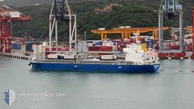
GREEN FUTURE
Cargo
Current Trip
VN SGN
| Time Travelled | 3 days |
|---|---|
| Remaining Time | --- |
| Distance Travelled | 899.87 nm |
| Remaining Distance | --- |
| AVG Speed | 10.6 Knots |
| MAX Speed | 12.6 Knots |
| AVG Wind | 9 knots |
| MAX Wind | 17 knots |
| MIN Temp | 27.5°C / 81.5°F |
| MAX Temp | 36.1°C / 96.98°F |
| Draught | 7.3 m |
| Position Received | Now |
Current Position
| Longitude | 106.74659° |
|---|---|
| Latitude | 10.74054° |
| Status | Under way using engine |
| Speed | 0.2 Knots |
| Course | 300° |
| Area | South China Sea |
| Station | T-AIS |
| Position Received | Now |
Info
Information
The current position of GREEN FUTURE is in South China Sea with coordinates 10.74054° / 106.74659° as reported on 2024-06-14 04:14 by AIS to our vessel tracker app. The vessel's current speed is 0.2 Knots
The vessel GREEN FUTURE (IMO: 9889631, MMSI: 538009104) is a Cargo It's sailing under the flag of [MH] Marshall Is.
In this page you can find informations about the vessels current position, last detected port calls, and current voyage information. If the vessels is not in coverage by AIS you will find the latest position.
The current position of GREEN FUTURE is detected by our AIS receivers and we are not responsible for the reliability of the data. The last position was recorded while the vessel was in Coverage by the Ais receivers of our vessel tracking app.
The current draught of GREEN FUTURE as reported by AIS is 7.3 meters
Weather
| Temperature | 36°C / 96.8°F |
|---|---|
| Wind Speed | 6 knots |
| Direction | 310° NW |
| Pressure | 1006.8 hPa |
| Humidity | 42 % |
| Cloud Coverage | 93 % |
Featured Company
Last Port Calls
| Port | Arrival | Departure | Time In Port |
|---|---|---|---|
| 2024-06-10 10:26 | 2024-06-11 06:02 | 19 h | |
| 2024-05-27 01:07 | 2024-05-27 13:11 | 12 h | |
| 2024-05-25 06:22 | 2024-05-25 18:22 | 12 h | |
| 2024-05-21 09:08 | 2024-05-24 11:20 | 3 d | |
| 2024-05-10 05:54 | 2024-05-13 20:15 | 3 d | |
| 2024-04-22 08:32 | 2024-04-23 04:04 | 19 h | |
| 2024-04-09 07:05 | 2024-04-12 12:42 | 3 d | |
| 2024-04-01 09:45 |
Most Visited Ports (Last year)
| Port | Arrivals | |
|---|---|---|
| 3 | ||
| 3 | ||
| 3 | ||
| 3 | ||
| 2 | ||
| 2 |
Last Trips
| Origin | Departure | Destination | Arrival | Distance | |
|---|---|---|---|---|---|
| 2024-05-27 13:11 | 2024-06-10 10:26 | 2793.36 nm | |||
| 2024-05-25 18:22 | 2024-05-27 01:07 | 351.66 nm | |||
| 2024-05-24 11:20 | 2024-05-25 06:22 | 112.96 nm | |||
| 2024-05-13 20:15 | 2024-05-21 09:08 | 648.30 nm | |||
| 2024-04-23 04:04 | 2024-05-10 05:54 | 3772.12 nm | |||
| 2024-04-12 12:42 | 2024-04-22 08:32 | 2565.39 nm | |||
| 2024-04-01 09:45 | 2024-04-09 07:05 | 1232.18 nm |
Events
| Time | Event | Details | Position / Dest | Info |
|---|---|---|---|---|
| 2024-06-14 04:08 | STOP Moving | 18.45 nm, North West of PHU MY |
10.74088 / 106.74685
VN SGN
|
Speed: 0.3 kn Course: 298° |
| 2024-06-14 03:31 | ETA Changed | 2024/06/14 00:00 2024/06/14 00:06 |
10.69697 / 106.75363
VN SGN
|
Speed: 10.6 kn Course: 327.9° |
| 2024-06-14 03:13 | Draught Changed | 7.3 7.2 |
10.66567 / 106.79409
VN SGN
|
Speed: 10 kn Course: 308.4° |
| 2024-06-14 03:13 | ETA Changed | 2024/06/14 00:06 2024/06/14 03:00 |
10.66567 / 106.79409
VN SGN
|
Speed: 10 kn Course: 308.4° |
| 2024-06-14 02:06 | Status Changed | Under way using engine Default |
10.53840 / 106.85229
VN SGN
|
Speed: 12.1 kn Course: 320° |
| 2024-06-14 01:38 | Status Changed | Default Under way using engine |
10.53035 / 106.92609
VN SGN
|
Speed: 10.6 kn Course: 321.5° |
| 2024-06-14 01:31 | Change Sea Area | Vietnamese part of the South China Sea Philippines part of the South China Sea |
10.51992 / 106.94697
South China Sea
VN SGN
|
Speed: 10.6 kn Course: 321.5° |
| 2024-06-14 01:31 | Status Changed | Under way using engine Default |
10.51992 / 106.94697
VN SGN
|
Speed: 12.2 kn Course: 352° |
| 2024-06-14 01:31 | IN Coverage |
10.51992 / 106.94697
South China Sea
VN SGN
|
Speed: 10.6 kn Course: 321.5° |
|
| 2024-06-10 23:46 | OUT of Coverage |
14.44966 / 120.65830
South China Sea
VN SGN
|
Speed: 12.3 kn Course: 243.7° |