
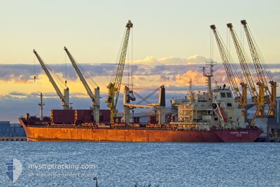
FEDERAL SPRUCE
Bulk Carrier
Current Trip
| Time Travelled | 4 days |
|---|---|
| Remaining Time | 14 h, 41 mins |
| Distance Travelled | 1219.79 nm |
| Remaining Distance | 167.19 nm |
| AVG Speed | 12.4 Knots |
| MAX Speed | 14.2 Knots |
| AVG Wind | 8.9 knots |
| MAX Wind | 22 knots |
| MIN Temp | 15.9°C / 60.62°F |
| MAX Temp | 22.1°C / 71.78°F |
| Draught | 6.7 m |
| Position Received | 1 m ago |
Current Position
| Longitude | 29.25603° |
|---|---|
| Latitude | 41.38414° |
| Status | Under way using engine |
| Speed | 11.1 Knots |
| Course | 8.9° |
| Area | Black Sea |
| Station | T-AIS |
| Position Received | 1 m ago |
Info
Information
The current position of FEDERAL SPRUCE is in Black Sea with coordinates 41.38414° / 29.25603° as reported on 2024-05-29 08:43 by AIS to our vessel tracker app. The vessel's current speed is 11.1 Knots and is heading at the port of CONSTANTA. The estimated time of arrival as calculated by MyShipTracking vessel tracking app is 2024-05-30 02:25 LT
The vessel FEDERAL SPRUCE (IMO: 9610468, MMSI: 538004387) is a Bulk Carrier that was built in 2012 ( 12 years old ). It's sailing under the flag of [MH] Marshall Is.
In this page you can find informations about the vessels current position, last detected port calls, and current voyage information. If the vessels is not in coverage by AIS you will find the latest position.
The current position of FEDERAL SPRUCE is detected by our AIS receivers and we are not responsible for the reliability of the data. The last position was recorded while the vessel was in Coverage by the Ais receivers of our vessel tracking app.
The current draught of FEDERAL SPRUCE as reported by AIS is 6.7 meters
Weather
| Temperature | 17.4°C / 63.32°F |
|---|---|
| Wind Speed | 2 knots |
| Direction | 153° SSE |
| Pressure | 1013.5 hPa |
| Humidity | 71.1 % |
| Cloud Coverage | 4 % |
Featured Company
Last Port Calls
| Port | Arrival | Departure | Time In Port |
|---|---|---|---|
| 2024-05-20 19:56 | 2024-05-25 01:39 | 4 d | |
| 2024-05-13 06:21 | 2024-05-16 18:44 | 3 d | |
| 2024-04-10 19:02 | 2024-04-19 17:00 | 8 d | |
| 2024-03-05 19:14 | 2024-03-09 01:25 | 3 d |
Most Visited Ports (Last year)
| Port | Arrivals | |
|---|---|---|
| 1 | ||
| 1 | ||
| 1 | ||
| 1 | ||
| 1 | ||
| 1 |
Last Trips
| Origin | Departure | Destination | Arrival | Distance | |
|---|---|---|---|---|---|
| 2024-05-16 18:44 | 2024-05-20 19:56 | 303.21 nm | |||
| 2024-04-19 17:00 | 2024-05-13 06:21 | 4660.75 nm | |||
| 2024-03-09 01:25 | 2024-04-10 19:02 | 5350.32 nm | |||
| 2024-02-14 05:25 | 2024-03-05 19:14 | 5329.21 nm |
Events
| Time | Event | Details | Position / Dest | Info |
|---|---|---|---|---|
| 2024-05-29 07:47 | Change Sea Area | Turkish part of the Black Sea Turkish part of the Sea of Marmara |
41.23183 / 29.14571
Black Sea
RO CND
|
Speed: 11 kn Course: 42.2° |
| 2024-05-29 04:17 | ETA Changed | 2024/05/30 15:00 2024/05/29 12:00 |
40.86809 / 28.89516
RO CND
|
Speed: 4.3 kn Course: 47° |
| 2024-05-29 03:07 | START Moving | 9.79 nm, South of YESILKOY |
40.79211 / 28.82821
RO CND
|
Speed: 3.1 kn Course: 106° |
| 2024-05-28 19:16 | STOP Moving | 9.6 nm, South of YESILKOY |
40.80134 / 28.76866
RO CND
|
Speed: 0.3 kn Course: 187° |
| 2024-05-28 12:14 | Status Changed | Under way using engine Default |
40.52732 / 27.04046
RO CND
|
Speed: 13.3 kn Course: 64° |
| 2024-05-28 12:14 | IN Coverage |
40.52732 / 27.04046
Sea of Marmara
RO CND
|
Speed: 13.7 kn Course: 62.9° |
|
| 2024-05-28 10:52 | Status Changed | Default Under way using engine |
40.39143 / 26.69146
RO CND
|
Speed: 9.7 kn Course: 34.2° |
| 2024-05-28 10:31 | OUT of Coverage |
40.35495 / 26.66121
Sea of Marmara
RO CND
|
Speed: 9.7 kn Course: 34.2° |
|
| 2024-05-28 07:32 | Change Sea Area | Turkish part of the Sea of Marmara Turkish part of the Aegean Sea |
40.01809 / 26.19236
Sea of Marmara
RO CND
|
Speed: 5.1 kn Course: 82.6° |
| 2024-05-28 06:49 | Status Changed | Under way using engine Default |
39.99186 / 26.07588
RO CND
|
Speed: 8.9 kn Course: 69° |