
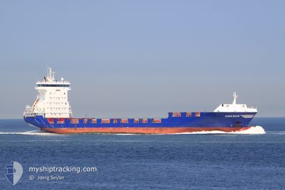
ENDEAVOR
Container Ship
Current Trip
| Time Travelled | 1 day |
|---|---|
| Remaining Time | 18 h, 40 mins |
| Distance Travelled | 511.14 nm |
| Remaining Distance | 283.56 nm |
| AVG Speed | 14.7 Knots |
| MAX Speed | 18.5 Knots |
| AVG Wind | 8.1 knots |
| MAX Wind | 15.8 knots |
| MIN Temp | 12°C / 53.6°F |
| MAX Temp | 15.6°C / 60.08°F |
| Draught | 7.1 m |
| Position Received | 5 h, 9 m ago |
Current Position
| Longitude | -5.55851° |
|---|---|
| Latitude | 48.96017° |
| Status | Under way using engine |
| Speed | 16.9 Knots |
| Course | 239.5° |
| Area | Celtic Sea |
| Station | T-AIS |
| Position Received | 5 h, 9 m ago |
Info
Information
The current position of ENDEAVOR is in Celtic Sea with coordinates 48.96017° / -5.55851° as reported on 2024-05-11 10:23 by AIS to our vessel tracker app. The vessel's current speed is 16.9 Knots and is heading at the port of EL FERROL. The estimated time of arrival as calculated by MyShipTracking vessel tracking app is 2024-05-12 10:12 LT
The vessel ENDEAVOR (IMO: 9312195, MMSI: 245222000) is a Container Ship that was built in 2005 ( 19 years old ). It's sailing under the flag of [NL] Netherlands.
In this page you can find informations about the vessels current position, last detected port calls, and current voyage information. If the vessels is not in coverage by AIS you will find the latest position.
The current position of ENDEAVOR is detected by our AIS receivers and we are not responsible for the reliability of the data. The last position was recorded while the vessel was in Coverage by the Ais receivers of our vessel tracking app.
The current draught of ENDEAVOR as reported by AIS is 7.1 meters
Weather
| Temperature | 15.5°C / 59.9°F |
|---|---|
| Wind Speed | 5 knots |
| Direction | 142° SE |
| Pressure | 1015.2 hPa |
| Humidity | 91 % |
| Cloud Coverage | 19 % |
Featured Company
Last Port Calls
| Port | Arrival | Departure | Time In Port |
|---|---|---|---|
| 2024-05-09 00:50 | 2024-05-10 05:49 | 1 d | |
| 2024-05-07 02:22 | 2024-05-07 17:47 | 15 h | |
| 2024-05-03 08:47 | 2024-05-04 13:07 | 1 d | |
| 2024-04-27 23:36 | 2024-04-28 12:43 | 13 h | |
| 2024-04-27 10:02 | 2024-04-27 19:23 | 9 h | |
| 2024-04-26 12:50 | 2024-04-26 21:18 | 8 h | |
| 2024-04-24 11:11 | 2024-04-24 17:38 | 6 h | |
| 2024-04-23 03:10 | 2024-04-24 06:30 | 1 d | |
| 2024-04-16 20:55 | 2024-04-17 17:24 | 20 h | |
| 2024-04-14 17:54 | 2024-04-15 21:51 | 1 d |
Most Visited Ports (Last year)
| Port | Arrivals | |
|---|---|---|
| 41 | ||
| 27 | ||
| 25 | ||
| 25 | ||
| 7 | ||
| 7 |
Last Trips
| Origin | Departure | Destination | Arrival | Distance | |
|---|---|---|---|---|---|
| 2024-05-07 19:47 | 2024-05-09 02:50 | 323.89 nm | |||
| 2024-05-04 14:07 | 2024-05-07 04:22 | 434.63 nm | |||
| 2024-04-28 14:43 | 2024-05-03 09:47 | 1282.35 nm | |||
| 2024-04-27 21:23 | 2024-04-28 01:36 | 50.08 nm | |||
| 2024-04-26 22:18 | 2024-04-27 12:02 | 191.56 nm | |||
| 2024-04-24 18:38 | 2024-04-26 13:50 | 561.89 nm | |||
| 2024-04-24 07:30 | 2024-04-24 12:11 | 53.81 nm | |||
| 2024-04-17 19:24 | 2024-04-23 04:10 | 1828.91 nm | |||
| 2024-04-15 23:51 | 2024-04-16 22:55 | 325.63 nm | |||
| 2024-04-13 14:19 | 2024-04-14 19:54 | 420.44 nm |
Events
| Time | Event | Details | Position / Dest | Info |
|---|---|---|---|---|
| 2024-05-11 10:30 | Status Changed | Default Under way using engine |
48.94103 / -5.60578
FERROL
|
Speed: 16.9 kn Course: 239.5° |
| 2024-05-11 10:23 | OUT of Coverage |
48.96017 / -5.55851
Celtic Sea
FERROL
|
Speed: 16.9 kn Course: 239.5° |
|
| 2024-05-11 08:49 | Change Sea Area | French part of the Celtic Sea French part of the English Channel |
49.17375 / -5.00610
Celtic Sea
FERROL
|
Speed: 15.4 kn Course: 240.3° |
| 2024-05-11 05:56 | Change Sea Area | French part of the English Channel United Kingdom part of the English Channel |
49.52833 / -4.07843
English Channel
FERROL
|
Speed: 14.7 kn Course: 239.4° |
| 2024-05-11 03:40 | Status Changed | Under way using engine Default |
49.84011 / -3.27551
FERROL
|
Speed: 17.7 kn Course: 241° |
| 2024-05-11 03:26 | Status Changed | Default Under way using engine |
49.87236 / -3.18744
FERROL
|
Speed: 18.1 kn Course: 241.2° |
| 2024-05-11 03:10 | Change Sea Area | United Kingdom part of the English Channel Guernsey part of the English Channel |
49.91038 / -3.07913
English Channel
FERROL
|
Speed: 18.3 kn Course: 242.4° |
| 2024-05-11 02:48 | Status Changed | Under way using engine Default |
49.96189 / -2.92144
FERROL
|
Speed: 18.4 kn Course: 242° |
| 2024-05-11 02:46 | Status Changed | Default Under way using engine |
49.96546 / -2.91023
FERROL
|
Speed: 18.5 kn Course: 252.9° |
| 2024-05-11 02:18 | Status Changed | Under way using engine Default |
50.00899 / -2.69918
FERROL
|
Speed: 18.3 kn Course: 253° |