
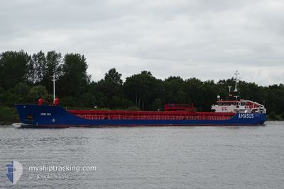
EEMS SEA
General Cargo
Current Trip
| Time Travelled | 4 days |
|---|---|
| Remaining Time | 1 day |
| Distance Travelled | 928.83 nm |
| Remaining Distance | 298.17 nm |
| AVG Speed | 8 Knots |
| MAX Speed | 10.2 Knots |
| AVG Wind | 15.5 knots |
| MAX Wind | 30.8 knots |
| MIN Temp | 14.7°C / 58.46°F |
| MAX Temp | 22.9°C / 73.22°F |
| Draught | 4.6 m |
| Position Received | 1 m ago |
Current Position
| Longitude | -7.70967° |
|---|---|
| Latitude | 44.09846° |
| Status | Under way using engine |
| Speed | 9.2 Knots |
| Course | 66° |
| Area | North Atlantic Ocean |
| Station | T-AIS |
| Position Received | 1 m ago |
Info
Information
The current position of EEMS SEA is in North Atlantic Ocean with coordinates 44.09846° / -7.70967° as reported on 2024-05-13 00:59 by AIS to our vessel tracker app. The vessel's current speed is 9.2 Knots and is heading at the port of LES SABLES D OLONNE. The estimated time of arrival as calculated by MyShipTracking vessel tracking app is 2024-05-14 12:03 LT
The vessel EEMS SEA (IMO: 9503536, MMSI: 245471000) is a General Cargo that was built in 2010 ( 14 years old ). It's sailing under the flag of [NL] Netherlands.
In this page you can find informations about the vessels current position, last detected port calls, and current voyage information. If the vessels is not in coverage by AIS you will find the latest position.
The current position of EEMS SEA is detected by our AIS receivers and we are not responsible for the reliability of the data. The last position was recorded while the vessel was in Coverage by the Ais receivers of our vessel tracking app.
The current draught of EEMS SEA as reported by AIS is 4.6 meters
Weather
| Temperature | 14.7°C / 58.46°F |
|---|---|
| Wind Speed | 12 knots |
| Direction | 207° SSW |
| Pressure | 1013.7 hPa |
| Humidity | 90.6 % |
| Cloud Coverage | 99 % |
Featured Company
Last Port Calls
| Port | Arrival | Departure | Time In Port |
|---|---|---|---|
| 2024-05-05 11:34 | 2024-05-08 10:06 | 2 d | |
| 2024-04-30 17:44 | 2024-05-03 15:46 | 2 d | |
| 2024-04-29 18:44 | 2024-04-29 19:20 | 35 m | |
| 2024-04-28 13:00 | 2024-04-28 13:32 | 32 m | |
| 2024-04-18 00:15 | 2024-04-20 13:40 | 2 d | |
| 2024-04-13 04:42 | 2024-04-16 10:30 | 3 d | |
| 2024-04-05 12:24 | 2024-04-10 17:21 | 5 d | |
| 2024-03-24 12:06 | 2024-03-28 13:16 | 4 d | |
| 2024-03-21 08:16 | 2024-03-21 14:14 | 5 h | |
| 2024-03-14 04:27 | 2024-03-16 06:36 | 2 d |
Most Visited Ports (Last year)
| Port | Arrivals | |
|---|---|---|
| 8 | ||
| 5 | ||
| 4 | ||
| 4 | ||
| 3 | ||
| 2 |
Last Trips
| Origin | Departure | Destination | Arrival | Distance | |
|---|---|---|---|---|---|
| 2024-05-03 17:46 | 2024-05-05 12:34 | 362.27 nm | |||
| 2024-04-29 21:20 | 2024-04-30 19:44 | 191.38 nm | |||
| 2024-04-28 15:32 | 2024-04-29 20:44 | 51.99 nm | |||
| 2024-04-20 15:40 | 2024-04-28 15:00 | 1731.95 nm | |||
| 2024-04-16 12:30 | 2024-04-18 02:15 | 241.11 nm | |||
| 2024-04-10 19:21 | 2024-04-13 06:42 | 253.13 nm | |||
| 2024-03-28 14:16 | 2024-04-05 14:24 | 1225.11 nm | |||
| 2024-03-21 15:14 | 2024-03-24 13:06 | 252.62 nm | |||
| 2024-03-16 07:36 | 2024-03-21 09:16 | 1029.93 nm | |||
| 2024-03-12 20:10 | 2024-03-14 05:27 | 241.76 nm |
Events
| Time | Event | Details | Position / Dest | Info |
|---|---|---|---|---|
| 2024-05-13 00:59 | Status Changed | Under way using engine Default |
44.09846 / -7.70967
FRLSO
|
Speed: 9 kn Course: 64° |
| 2024-05-13 00:35 | Status Changed | Default Under way using engine |
44.07131 / -7.78664
FRLSO
|
Speed: 8.8 kn Course: 63.7° |
| 2024-05-12 23:55 | Status Changed | Under way using engine Default |
44.02614 / -7.90932
FRLSO
|
Speed: 8 kn Course: 64° |
| 2024-05-12 23:40 | IN Coverage |
44.02614 / -7.90932
North Atlantic Ocean
FRLSO
|
Speed: 8.8 kn Course: 62.8° |
|
| 2024-05-12 22:19 | Status Changed | Default Under way using engine |
43.91833 / -8.19167
FRLSO
|
Speed: 7.8 kn Course: 63.7° |
| 2024-05-12 22:12 | Status Changed | Under way using engine Default |
43.91204 / -8.21340
FRLSO
|
Speed: 8 kn Course: 64° |
| 2024-05-12 22:12 | OUT of Coverage |
43.91204 / -8.21340
North Atlantic Ocean
FRLSO
|
Speed: 7.8 kn Course: 63.7° |
|
| 2024-05-12 21:41 | Status Changed | Default Under way using engine |
43.88157 / -8.30895
FRLSO
|
Speed: 8.8 kn Course: 62.7° |
| 2024-05-12 21:24 | Status Changed | Under way using engine Default |
43.86408 / -8.35702
FRLSO
|
Speed: 8 kn Course: 62° |
| 2024-05-12 21:19 | Status Changed | Default Under way using engine |
43.85667 / -8.37167
FRLSO
|
Speed: 8.6 kn Course: 63.3° |