
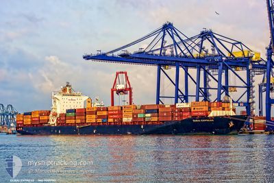
SEASPAN DUBAI
Container Ship
Current Trip
CNTAO-CNSHA
| Time Travelled | 2 days |
|---|---|
| Remaining Time | --- |
| Distance Travelled | 415.39 nm |
| Remaining Distance | --- |
| AVG Speed | 11.6 Knots |
| MAX Speed | 14.4 Knots |
| AVG Wind | 13.8 knots |
| MAX Wind | 22.6 knots |
| MIN Temp | 14.3°C / 57.74°F |
| MAX Temp | 18.8°C / 65.84°F |
| Draught | 9.5 m |
| Position Received | 2 d ago |
Current Position
| Longitude | 122.10619° |
|---|---|
| Latitude | 34.49462° |
| Status | Under way using engine |
| Speed | 12.5 Knots |
| Course | 135.3° |
| Area | Yellow Sea |
| Station | T-AIS |
| Position Received | 2 d ago |
Info
Information
The current position of SEASPAN DUBAI is in Yellow Sea with coordinates 34.49462° / 122.10619° as reported on 2024-05-10 16:27 by AIS to our vessel tracker app. The vessel's current speed is 12.5 Knots
The vessel SEASPAN DUBAI (IMO: 9301782, MMSI: 477097400) is a Container Ship that was built in 2006 ( 18 years old ). It's sailing under the flag of [HK] Hong Kong.
In this page you can find informations about the vessels current position, last detected port calls, and current voyage information. If the vessels is not in coverage by AIS you will find the latest position.
The current position of SEASPAN DUBAI is detected by our AIS receivers and we are not responsible for the reliability of the data. The last position was recorded while the vessel was in Coverage by the Ais receivers of our vessel tracking app.
The current draught of SEASPAN DUBAI as reported by AIS is 9.5 meters
Weather
| Temperature | 16.6°C / 61.88°F |
|---|---|
| Wind Speed | 11 knots |
| Direction | 358° N |
| Pressure | 1017.1 hPa |
| Humidity | 69.5 % |
| Cloud Coverage | 33 % |
Featured Company
Last Port Calls
| Port | Arrival | Departure | Time In Port |
|---|---|---|---|
| 2024-05-09 14:04 | 2024-05-10 06:12 | 16 h | |
| 2024-05-01 10:53 | 2024-05-02 03:53 | 16 h | |
| 2024-04-29 13:36 | 2024-04-30 05:32 | 15 h | |
| 2024-04-04 23:37 | 2024-04-05 19:24 | 19 h | |
| 2024-03-27 07:25 | 2024-03-31 06:17 | 3 d | |
| 2024-03-01 16:07 | 2024-03-02 02:05 | 9 h | |
| 2024-03-01 00:51 |
Last Trips
| Origin | Departure | Destination | Arrival | Distance | |
|---|---|---|---|---|---|
| 2024-05-02 11:53 | 2024-05-09 22:04 | 2600.53 nm | |||
| 2024-04-30 13:32 | 2024-05-01 18:53 | 210.76 nm | |||
| 2024-04-05 19:24 | 2024-04-29 21:36 | 8081.47 nm | |||
| 2024-03-31 07:17 | 2024-04-04 23:37 | 432.74 nm | |||
| 2024-03-02 10:05 | 2024-03-27 08:25 | 8033.95 nm | |||
| 2024-03-01 08:51 | 2024-03-02 00:07 | 194.10 nm |
Events
| Time | Event | Details | Position / Dest | Info |
|---|---|---|---|---|
| 2024-05-12 19:51 | STOP Moving |
31.39157 / 122.91722
CNTAO-CNSHA
|
Speed: Course: 113° |
|
| 2024-05-12 10:44 | START Moving |
31.41521 / 122.86394
CNTAO-CNSHA
|
Speed: 5.8 kn Course: 110° |
|
| 2024-05-11 19:43 | STOP Moving |
31.45622 / 122.94167
CNTAO-CNSHA
|
Speed: Course: 71° |
|
| 2024-05-11 18:38 | START Moving |
31.55225 / 122.91685
CNTAO-CNSHA
|
Speed: 11.3 kn Course: 175° |
|
| 2024-05-11 14:15 | STOP Moving |
31.48333 / 122.94833
CNTAO-CNSHA
|
Speed: Course: -1° |
|
| 2024-05-11 13:13 | START Moving |
31.37121 / 122.92953
CNTAO-CNSHA
|
Speed: 9 kn Course: 75° |
|
| 2024-05-11 12:08 | STOP Moving |
31.38333 / 122.93333
CNTAO-CNSHA
|
Speed: Course: -1° |
|
| 2024-05-10 16:29 | Status Changed | Default Under way using engine |
34.48833 / 122.11166
CNTAO-CNSHA
|
Speed: 12.5 kn Course: 135.3° |
| 2024-05-10 16:27 | OUT of Coverage |
34.49462 / 122.10619
Yellow Sea
CNTAO-CNSHA
|
Speed: 12.5 kn Course: 135.3° |
|
| 2024-05-10 16:14 | Status Changed | Under way using engine Default |
34.52748 / 122.07017
CNTAO-CNSHA
|
Speed: 12 kn Course: 146° |