
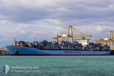
COLUMBINE MAERSK
Container Ship
Current Trip
| Time Travelled | 11 days |
|---|---|
| Remaining Time | 20 days |
| Distance Travelled | 5055.82 nm |
| Remaining Distance | 7404.73 nm |
| AVG Speed | 17.6 Knots |
| MAX Speed | 21 Knots |
| AVG Wind | 13.8 knots |
| MAX Wind | 33 knots |
| MIN Temp | 22°C / 71.6°F |
| MAX Temp | 30.5°C / 86.9°F |
| Draught | 13.8 m |
| Position Received | 14 h, 44 m ago |
Current Position
| Longitude | 32.59389° |
|---|---|
| Latitude | -30.42768° |
| Status | Under way using engine |
| Speed | 14.2 Knots |
| Course | 238.5° |
| Area | Indian Ocean |
| Station | T-AIS |
| Position Received | 14 h, 44 m ago |
Info
Information
The current position of COLUMBINE MAERSK is in Indian Ocean with coordinates -30.42768° / 32.59389° as reported on 2024-06-02 11:12 by AIS to our vessel tracker app. The vessel's current speed is 14.2 Knots and is heading at the port of NEW YORK. The estimated time of arrival as calculated by MyShipTracking vessel tracking app is 2024-06-23 14:19 LT
The vessel COLUMBINE MAERSK (IMO: 9245768, MMSI: 220129000) is a Container Ship that was built in 2002 ( 22 years old ). It's sailing under the flag of [DK] Denmark.
In this page you can find informations about the vessels current position, last detected port calls, and current voyage information. If the vessels is not in coverage by AIS you will find the latest position.
The current position of COLUMBINE MAERSK is detected by our AIS receivers and we are not responsible for the reliability of the data. The last position was recorded while the vessel was in Coverage by the Ais receivers of our vessel tracking app.
The current draught of COLUMBINE MAERSK as reported by AIS is 13.8 meters
Weather
| Temperature | 22.2°C / 71.96°F |
|---|---|
| Wind Speed | 31 knots |
| Direction | 41° NE |
| Pressure | 1010.4 hPa |
| Humidity | 84.2 % |
| Cloud Coverage | 100 % |
Featured Company
Last Port Calls
| Port | Arrival | Departure | Time In Port |
|---|---|---|---|
| 2024-05-21 04:08 | 2024-05-22 12:46 | 1 d | |
| 2024-05-10 12:54 | 2024-05-11 16:08 | 1 d | |
| 2024-05-09 08:26 | 2024-05-10 02:28 | 18 h | |
| 2024-05-04 21:56 | 2024-05-05 23:23 | 1 d | |
| 2024-04-02 01:11 |
Most Visited Ports (Last year)
| Port | Arrivals | |
|---|---|---|
| 6 | ||
| 5 | ||
| 4 | ||
| 4 | ||
| 4 | ||
| 4 |
Last Trips
| Origin | Departure | Destination | Arrival | Distance | |
|---|---|---|---|---|---|
| 2024-05-11 16:08 | 2024-05-21 04:08 | 1645.09 nm | |||
| 2024-05-10 02:28 | 2024-05-10 12:54 | 116.09 nm | |||
| 2024-05-05 23:23 | 2024-05-09 08:26 | 1493.33 nm | |||
| 2024-04-02 01:11 | 2024-05-04 21:56 | 12241.03 nm |
Events
| Time | Event | Details | Position / Dest | Info |
|---|---|---|---|---|
| 2024-06-02 11:15 | Status Changed | Default Under way using engine |
-30.43450 / 32.58094
SGSIN=>USNWK
|
Speed: 14.2 kn Course: 238.5° |
| 2024-06-02 11:12 | OUT of Coverage |
-30.42768 / 32.59389
Indian Ocean
SGSIN=>USNWK
|
Speed: 14.2 kn Course: 238.5° |
|
| 2024-06-02 11:09 | Status Changed | Under way using engine Default |
-30.42323 / 32.60237
SGSIN=>USNWK
|
Speed: 14 kn Course: 240° |
| 2024-06-02 10:59 | Status Changed | Default Under way using engine |
-30.40167 / 32.64333
SGSIN=>USNWK
|
Speed: 13.5 kn Course: 241.8° |
| 2024-06-02 10:51 | Change Sea Area | South African part of the Indian Ocean R�union part of the Indian Ocean |
-30.38690 / 32.67128
Indian Ocean
SGSIN=>USNWK
|
Speed: 12.6 kn Course: 236.4° |
| 2024-06-02 10:51 | Status Changed | Under way using engine Default |
-30.38690 / 32.67128
SGSIN=>USNWK
|
Speed: 13.6 kn Course: 254° |
| 2024-06-02 10:51 | IN Coverage |
-30.38690 / 32.67128
Indian Ocean
SGSIN=>USNWK
|
Speed: 12.6 kn Course: 236.4° |
|
| 2024-05-29 22:21 | Status Changed | Default Under way using engine |
-21.02833 / 54.57167
SGSIN=>USNWK
|
Speed: 18.2 kn Course: 232.3° |
| 2024-05-29 22:19 | OUT of Coverage |
-21.02235 / 54.58181
Indian Ocean
SGSIN=>USNWK
|
Speed: 18.2 kn Course: 232.3° |
|
| 2024-05-29 18:36 | Change Sea Area | R�union part of the Indian Ocean Malaysian part of the Singapore Strait |
-20.35355 / 55.59765
Indian Ocean
SGSIN=>USNWK
|
Speed: 19 kn Course: 233.9° |