
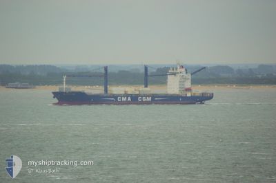
CMA CGM PLATON
Container Ship
Current Trip
| Time Travelled | 1 day |
|---|---|
| Remaining Time | 16 h, 33 mins |
| Distance Travelled | 569.10 nm |
| Remaining Distance | 200.99 nm |
| AVG Speed | 12.5 Knots |
| MAX Speed | 13.8 Knots |
| AVG Wind | 6.8 knots |
| MAX Wind | 12.8 knots |
| MIN Temp | 12.2°C / 53.96°F |
| MAX Temp | 19.3°C / 66.74°F |
| Draught | 8.3 m |
| Position Received | 1 d ago |
Current Position
| Longitude | -54.80688° |
|---|---|
| Latitude | -36.35204° |
| Status | Under way using engine |
| Speed | 13.2 Knots |
| Course | 44.7° |
| Area | South Atlantic Ocean |
| Station | T-AIS |
| Position Received | 1 d ago |
Info
Information
The current position of CMA CGM PLATON is in South Atlantic Ocean with coordinates -36.35204° / -54.80688° as reported on 2024-06-14 12:47 by AIS to our vessel tracker app. The vessel's current speed is 13.2 Knots and is heading at the port of IMBITUBA. The estimated time of arrival as calculated by MyShipTracking vessel tracking app is 2024-06-16 14:14 LT
The vessel CMA CGM PLATON (IMO: 9362437, MMSI: 215157000) is a Container Ship that was built in 2007 ( 17 years old ). It's sailing under the flag of [MT] Malta.
In this page you can find informations about the vessels current position, last detected port calls, and current voyage information. If the vessels is not in coverage by AIS you will find the latest position.
The current position of CMA CGM PLATON is detected by our AIS receivers and we are not responsible for the reliability of the data. The last position was recorded while the vessel was in Coverage by the Ais receivers of our vessel tracking app.
The current draught of CMA CGM PLATON as reported by AIS is 8.3 meters
Weather
| Temperature | 18.7°C / 65.66°F |
|---|---|
| Wind Speed | 9 knots |
| Direction | 173° S |
| Pressure | 1016.7 hPa |
| Humidity | 96.2 % |
| Cloud Coverage | 100 % |
Featured Company
Last Port Calls
| Port | Arrival | Departure | Time In Port |
|---|---|---|---|
| 2024-06-13 13:48 | 2024-06-13 23:43 | 9 h | |
| 2024-06-10 20:27 | 2024-06-11 12:22 | 15 h | |
| 2024-06-09 00:50 | 2024-06-09 16:29 | 15 h | |
| 2024-06-04 23:21 | 2024-06-05 16:39 | 17 h | |
| 2024-05-30 10:55 | 2024-05-30 20:34 | 9 h | |
| 2024-05-26 23:04 | 2024-05-27 19:45 | 20 h | |
| 2024-05-22 14:45 | 2024-05-23 14:05 | 23 h | |
| 2024-05-16 18:27 | 2024-05-17 18:10 | 23 h | |
| 2024-05-14 21:25 | 2024-05-15 13:48 | 16 h | |
| 2024-05-13 15:02 | 2024-05-14 05:45 | 14 h |
Most Visited Ports (Last year)
| Port | Arrivals | |
|---|---|---|
| 9 | ||
| 9 | ||
| 8 | ||
| 8 | ||
| 6 | ||
| 5 |
Last Trips
| Origin | Departure | Destination | Arrival | Distance | |
|---|---|---|---|---|---|
| 2024-06-11 09:22 | 2024-06-13 10:48 | 294.35 nm | |||
| 2024-06-09 13:29 | 2024-06-10 17:27 | 141.29 nm | |||
| 2024-06-05 13:39 | 2024-06-08 21:50 | 1008.81 nm | |||
| 2024-05-30 17:34 | 2024-06-04 20:21 | 1046.83 nm | |||
| 2024-05-27 16:45 | 2024-05-30 07:55 | 402.59 nm | |||
| 2024-05-23 11:05 | 2024-05-26 20:04 | 1009.50 nm | |||
| 2024-05-17 15:10 | 2024-05-22 11:45 | 1047.55 nm | |||
| 2024-05-15 10:48 | 2024-05-16 15:27 | 292.47 nm | |||
| 2024-05-14 02:45 | 2024-05-14 18:25 | 156.04 nm | |||
| 2024-05-12 09:30 | 2024-05-13 12:02 | 381.99 nm |
Events
| Time | Event | Details | Position / Dest | Info |
|---|---|---|---|---|
| 2024-06-14 12:54 | Status Changed | Default Under way using engine |
-36.33244 / -54.78266
BRIBB
|
Speed: 13.2 kn Course: 44.7° |
| 2024-06-14 12:47 | OUT of Coverage |
-36.35204 / -54.80688
South Atlantic Ocean
BRIBB
|
Speed: 13.2 kn Course: 44.7° |
|
| 2024-06-14 12:44 | Status Changed | Under way using engine Default |
-36.35988 / -54.81656
BRIBB
|
Speed: 13.3 kn Course: 45° |
| 2024-06-14 12:20 | Status Changed | Default Under way using engine |
-36.42333 / -54.89500
BRIBB
|
Speed: 13.2 kn Course: 44.4° |
| 2024-06-14 11:39 | Status Changed | Under way using engine Default |
-36.52783 / -55.02560
BRIBB
|
Speed: 13.2 kn Course: 46° |
| 2024-06-14 11:24 | IN Coverage |
-36.52783 / -55.02560
South Atlantic Ocean
BRIBB
|
Speed: 13.2 kn Course: 46.7° |
|
| 2024-06-14 08:49 | Status Changed | Default Under way using engine |
-36.97254 / -55.57701
BRIBB
|
Speed: 13.3 kn Course: 45.2° |
| 2024-06-14 08:43 | OUT of Coverage |
-36.98957 / -55.59834
South Atlantic Ocean
BRIBB
|
Speed: 13.3 kn Course: 45.2° |
|
| 2024-06-14 08:32 | Status Changed | Under way using engine Default |
-37.01672 / -55.63239
BRIBB
|
Speed: 13 kn Course: 45° |
| 2024-06-14 08:25 | Status Changed | Default Under way using engine |
-37.03667 / -55.65667
BRIBB
|
Speed: 13.3 kn Course: 45.7° |