
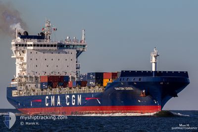
CMA CGM LOUGA
Cargo A
Current Trip
| Time Travelled | 7 days |
|---|---|
| Remaining Time | --- |
| Distance Travelled | 750.86 nm |
| Remaining Distance | --- |
| AVG Speed | 10.2 Knots |
| MAX Speed | 16.5 Knots |
| AVG Wind | 13.4 knots |
| MAX Wind | 24 knots |
| MIN Temp | 16.4°C / 61.52°F |
| MAX Temp | 18.2°C / 64.76°F |
| Draught | 10.8 m |
| Position Received | 1 d ago |
Current Position
| Longitude | 14.60698° |
|---|---|
| Latitude | 35.34010° |
| Status | Under way using engine |
| Speed | 0.7 Knots |
| Course | 217° |
| Area | Mediterranean Sea - Eastern Basin |
| Station | T-AIS |
| Position Received | 1 d ago |
Info
Information
The current position of CMA CGM LOUGA is in Mediterranean Sea - Eastern Basin with coordinates 35.34010° / 14.60698° as reported on 2024-05-03 02:50 by AIS to our vessel tracker app. The vessel's current speed is 0.7 Knots
The vessel CMA CGM LOUGA (IMO: 9745550, MMSI: 248655000) is a Cargo A It's sailing under the flag of [MT] Malta.
In this page you can find informations about the vessels current position, last detected port calls, and current voyage information. If the vessels is not in coverage by AIS you will find the latest position.
The current position of CMA CGM LOUGA is detected by our AIS receivers and we are not responsible for the reliability of the data. The last position was recorded while the vessel was in Coverage by the Ais receivers of our vessel tracking app.
The current draught of CMA CGM LOUGA as reported by AIS is 10.8 meters
Weather
| Temperature | 17.2°C / 62.96°F |
|---|---|
| Wind Speed | 18 knots |
| Direction | 303° WNW |
| Pressure | 1018.7 hPa |
| Humidity | 69.3 % |
| Cloud Coverage | 3 % |
Featured Company
Last Port Calls
| Port | Arrival | Departure | Time In Port |
|---|---|---|---|
| 2024-04-26 12:22 | 2024-04-26 17:36 | 5 h | |
| 2024-04-23 10:47 | 2024-04-24 04:33 | 17 h | |
| 2024-04-21 05:44 | 2024-04-22 05:52 | 1 d | |
| 2024-04-15 06:51 | 2024-04-17 07:06 | 2 d | |
| 2024-04-03 20:38 | 2024-04-04 22:38 | 1 d | |
| 2024-03-30 04:17 | 2024-04-02 17:20 | 3 d | |
| 2024-03-29 09:33 | 2024-03-29 19:22 | 9 h | |
| 2024-03-24 09:53 | 2024-03-24 18:21 | 8 h | |
| 2024-03-20 14:58 | 2024-03-21 23:32 | 1 d | |
| 2024-03-18 22:46 | 2024-03-19 19:36 | 20 h |
Most Visited Ports (Last year)
| Port | Arrivals | |
|---|---|---|
| 13 | ||
| 10 | ||
| 8 | ||
| 8 | ||
| 8 | ||
| 8 |
Last Trips
| Origin | Departure | Destination | Arrival | Distance | |
|---|---|---|---|---|---|
| 2024-04-24 06:33 | 2024-04-26 15:22 | 625.37 nm | |||
| 2024-04-22 07:52 | 2024-04-23 12:47 | 170.04 nm | |||
| 2024-04-17 09:06 | 2024-04-21 07:44 | 821.09 nm | |||
| 2024-04-05 00:38 | 2024-04-15 08:51 | 2510.19 nm | |||
| 2024-04-02 19:20 | 2024-04-03 22:38 | 315.40 nm | |||
| 2024-03-29 20:22 | 2024-03-30 05:17 | 116.33 nm | |||
| 2024-03-24 20:21 | 2024-03-29 10:33 | 1121.37 nm | |||
| 2024-03-22 00:32 | 2024-03-24 11:53 | 287.95 nm | |||
| 2024-03-19 21:36 | 2024-03-20 15:58 | 281.84 nm | |||
| 2024-03-18 15:57 | 2024-03-19 00:46 | 118.87 nm |
Events
| Time | Event | Details | Position / Dest | Info |
|---|---|---|---|---|
| 2024-05-03 07:00 | START Moving |
35.31599 / 14.69149
MTMAR
|
Speed: 4.6 kn Course: 69° |
|
| 2024-05-03 02:55 | Status Changed | Default Under way using engine |
35.33986 / 14.60803
MTMAR
|
Speed: 0.7 kn Course: 217° |
| 2024-05-03 02:50 | OUT of Coverage |
35.34010 / 14.60698
Mediterranean Sea - Eastern Basin
|
Speed: 0.7 kn Course: 107.9° |
|
| 2024-05-03 02:34 | Status Changed | Under way using engine Default |
35.34114 / 14.60320
MTMAR
|
Speed: 1 kn Course: -1° |
| 2024-05-03 02:19 | IN Coverage |
35.34114 / 14.60320
Mediterranean Sea - Eastern Basin
|
Speed: 0.7 kn Course: 106.6° |
|
| 2024-05-03 01:04 | Status Changed | Default Under way using engine |
35.34460 / 14.58413
MTMAR
|
Speed: 0.6 kn Course: 222° |
| 2024-05-03 00:59 | OUT of Coverage |
35.34491 / 14.58295
Mediterranean Sea - Eastern Basin
|
Speed: 0.6 kn Course: 109.4° |
|
| 2024-05-03 00:38 | Status Changed | Under way using engine Default |
35.34643 / 14.57788
MTMAR
|
Speed: 0.8 kn Course: 226° |
| 2024-05-03 00:24 | Status Changed | Default Under way using engine |
35.34751 / 14.57476
MTMAR
|
Speed: 0.7 kn Course: 222° |
| 2024-05-03 00:18 | Status Changed | Under way using engine Default |
35.34795 / 14.57334
MTMAR
|
Speed: 0.7 kn Course: 221° |