
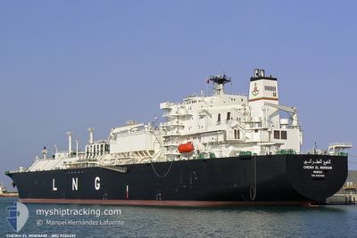
CHEIKH EL MOKRANI
Lng Tanker
Current Trip
| Trip Time | 1 day |
|---|---|
| Trip Distance | 403.67 nm |
| AVG Speed | 10.5 Knots |
| MAX Speed | 13 Knots |
| Draught | 9.7 m |
| AVG Wind | 12.3 knots |
| MAX Wind | 21.9 knots |
| MIN Temp | 15.1°C / 59.18°F |
| MAX Temp | 19.2°C / 66.56°F |
| Position Received | 15 h, 26 m ago |
Current Position
| Longitude | 6.72323° |
|---|---|
| Latitude | 38.09061° |
| Status | Under way using engine |
| Speed | 7.8 Knots |
| Course | 169.1° |
| Area | Mediterranean Sea - Western Basin |
| Station | T-AIS |
| Position Received | 15 h, 26 m ago |
Info
Information
The current position of CHEIKH EL MOKRANI is in Mediterranean Sea - Western Basin with coordinates 38.09061° / 6.72323° as reported on 2024-05-09 22:28 by AIS to our vessel tracker app. The vessel's current speed is 7.8 Knots and is currently inside the port of SKIKDA.
The vessel CHEIKH EL MOKRANI (IMO: 9324332, MMSI: 309979000) is a Lng Tanker that was built in 2007 ( 17 years old ). It's sailing under the flag of [BS] Bahamas.
In this page you can find informations about the vessels current position, last detected port calls, and current voyage information. If the vessels is not in coverage by AIS you will find the latest position.
The current position of CHEIKH EL MOKRANI is detected by our AIS receivers and we are not responsible for the reliability of the data. The last position was recorded while the vessel was in Coverage by the Ais receivers of our vessel tracking app.
The current draught of CHEIKH EL MOKRANI as reported by AIS is 9.7 meters
Weather
| Temperature | 17.5°C / 63.5°F |
|---|---|
| Wind Speed | 9 knots |
| Direction | 29° NNE |
| Pressure | 1018.6 hPa |
| Humidity | 73.1 % |
| Cloud Coverage | 2 % |
Featured Company
Last Port Calls
| Port | Arrival | Departure | Time In Port |
|---|---|---|---|
| 2024-05-10 07:06 | |||
| 2024-05-07 10:12 | 2024-05-08 18:36 | 1 d | |
| 2024-05-02 21:43 | 2024-05-03 19:10 | 21 h | |
| 2024-04-26 06:12 | 2024-04-28 07:02 | 2 d | |
| 2024-04-22 05:44 | 2024-04-23 05:35 | 23 h | |
| 2024-04-18 09:45 | 2024-04-20 14:00 | 2 d | |
| 2024-04-14 15:04 | 2024-04-15 15:46 | 1 d | |
| 2024-04-10 06:53 | 2024-04-12 08:23 | 2 d | |
| 2024-04-07 11:25 | 2024-04-08 10:55 | 23 h | |
| 2024-04-04 11:13 | 2024-04-05 21:58 | 1 d |
Last Trips
| Origin | Departure | Destination | Arrival | Distance | |
|---|---|---|---|---|---|
| 2024-05-08 20:36 | 2024-05-10 08:06 | 403.67 nm | |||
| 2024-05-03 20:10 | 2024-05-07 12:12 | 686.27 nm | |||
| 2024-04-28 09:02 | 2024-05-02 22:43 | 621.26 nm | |||
| 2024-04-23 06:35 | 2024-04-26 08:12 | 594.70 nm | |||
| 2024-04-20 16:00 | 2024-04-22 06:44 | 493.79 nm | |||
| 2024-04-15 16:46 | 2024-04-18 11:45 | 555.95 nm | |||
| 2024-04-12 10:23 | 2024-04-14 16:04 | 505.23 nm | |||
| 2024-04-08 11:55 | 2024-04-10 08:53 | 499.28 nm | |||
| 2024-04-05 23:58 | 2024-04-07 12:25 | 413.93 nm | |||
| 2024-04-02 22:39 | 2024-04-04 13:13 | 423.87 nm |
Events
| Time | Event | Details | Position / Dest | Info |
|---|---|---|---|---|
| 2024-05-10 07:35 | STOP Moving |
36.88167 / 6.94333
[DZ] SKIKDA
|
Speed: Course: -1° |
|
| 2024-05-10 07:06 | PORT ARRIVAL |
|
36.88811 / 6.94325
[DZ] SKIKDA
|
Speed: 4.5 kn Course: 241° |
| 2024-05-09 22:38 | Status Changed | Default Under way using engine |
38.06833 / 6.72833
DZSKI>FRF0S
|
Speed: 7.8 kn Course: 169.1° |
| 2024-05-09 22:28 | Change Sea Area | Algerian part of the Mediterranean Sea - Western Basin Italian part of the Mediterranean Sea - Western Basin |
38.09061 / 6.72323
Mediterranean Sea - Western Basin
|
Speed: 7.8 kn Course: 169.1° |
| 2024-05-09 22:28 | Status Changed | Under way using engine Default |
38.09061 / 6.72323
DZSKI>FRF0S
|
Speed: 7 kn Course: 168° |
| 2024-05-09 22:28 | IN Coverage |
38.09061 / 6.72323
Mediterranean Sea - Western Basin
|
Speed: 7.8 kn Course: 169.1° |
|
| 2024-05-09 22:28 | OUT of Coverage |
38.09061 / 6.72323
Mediterranean Sea - Western Basin
|
Speed: 7.8 kn Course: 169.1° |
|
| 2024-05-09 18:29 | Status Changed | Default Under way using engine |
38.63833 / 6.56667
DZSKI>FRF0S
|
Speed: 9 kn Course: 164° |
| 2024-05-09 18:25 | OUT of Coverage |
38.65049 / 6.56373
Mediterranean Sea - Western Basin
|
Speed: 9 kn Course: 164° |
|
| 2024-05-09 17:52 | Status Changed | Under way using engine Default |
38.73868 / 6.53022
DZSKI>FRF0S
|
Speed: 10 kn Course: 154° |