
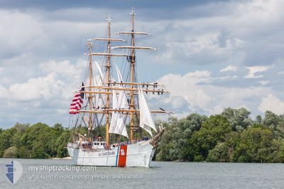
CG EAGLE
Sailing
Current Trip
| Trip Time | 6 days |
|---|---|
| Trip Distance | 620.79 nm |
| AVG Speed | 5.3 Knots |
| MAX Speed | 8.2 Knots |
| Draught | 5 m |
| AVG Wind | 6 knots |
| MAX Wind | 11.7 knots |
| MIN Temp | 26.6°C / 79.88°F |
| MAX Temp | 29.8°C / 85.64°F |
| Position Received | 1 h, 50 m ago |
Current Position
| Longitude | -75.54947° |
|---|---|
| Latitude | 10.40785° |
| Status | Moored |
| Speed | |
| Course | --- |
| Area | Caribbean Sea |
| Station | T-AIS |
| Position Received | 1 h, 50 m ago |
Info
Information
The current position of CG EAGLE is in Caribbean Sea with coordinates 10.40785° / -75.54947° as reported on 2024-06-04 18:34 by AIS to our vessel tracker app. The vessel's current speed is 0 Knots and is currently inside the port of CARTAGENA.
The vessel CG EAGLE (MMSI: 303990000) is a Sailing It's sailing under the flag of [US] USA.
In this page you can find informations about the vessels current position, last detected port calls, and current voyage information. If the vessels is not in coverage by AIS you will find the latest position.
The current position of CG EAGLE is detected by our AIS receivers and we are not responsible for the reliability of the data. The last position was recorded while the vessel was in Coverage by the Ais receivers of our vessel tracking app.
The current draught of CG EAGLE as reported by AIS is 5 meters
Weather
| Temperature | 29.4°C / 84.92°F |
|---|---|
| Wind Speed | 8 knots |
| Direction | 248° WSW |
| Pressure | 1008.9 hPa |
| Humidity | 75.3 % |
| Cloud Coverage | 100 % |
Featured Company
Last Port Calls
| Port | Arrival | Departure | Time In Port |
|---|---|---|---|
| 2024-06-04 15:07 | |||
| 2024-05-25 14:09 | 2024-05-28 19:39 | 3 d |
Most Visited Ports (Last year)
| Port | Arrivals | |
|---|---|---|
| 2 | ||
| 1 | ||
| 1 | ||
| 1 | ||
| 1 | ||
| 1 |
Last Trips
| Origin | Departure | Destination | Arrival | Distance | |
|---|---|---|---|---|---|
| 2024-05-28 15:39 | 2024-06-04 10:07 | 620.79 nm |
Events
| Time | Event | Details | Position / Dest | Info |
|---|---|---|---|---|
| 2024-06-04 18:34 | OUT of Coverage |
10.40785 / -75.54947
Caribbean Sea
[CO] CARTAGENA
|
Speed: Course: 511° |
|
| 2024-06-04 17:00 | Status Changed | Moored Under way using engine |
10.40781 / -75.54948
[CO] CARTAGENA
|
Speed: 0.1 kn Course: 511° |
| 2024-06-04 15:37 | STOP Moving |
10.40620 / -75.54860
[CO] CARTAGENA
|
Speed: 0.3 kn Course: 511° |
|
| 2024-06-04 15:07 | PORT ARRIVAL |
|
10.38900 / -75.54137
[CO] CARTAGENA
|
Speed: 5.4 kn Course: 332.6° |
| 2024-06-04 10:47 | Detected in Sea | Colombian part of the Caribbean Sea |
10.32336 / -75.76816
Caribbean Sea
CARTAGENA, COLOMBIA
|
Speed: 8.2 kn Course: 77° |
| 2024-06-04 10:47 | IN Coverage |
10.32336 / -75.76816
Caribbean Sea
CARTAGENA, COLOMBIA
|
Speed: 8.2 kn Course: 77° |
|
| 2024-05-28 21:29 | OUT of Coverage |
18.26464 / -69.86307
Caribbean Sea
CARTAGENA, COLOMBIA
|
Speed: 7.2 kn Course: 170.1° |
|
| 2024-05-28 21:25 | Destination Changed | CARTAGENA, COLOMBIA SANTO DOMINGO, DR |
18.27189 / -69.86465
CARTAGENA, COLOMBIA
|
Speed: 6.9 kn Course: 174.7° |
| 2024-05-28 21:25 | ETA Changed | 2024/06/04 14:00 2024/05/25 14:00 |
18.27189 / -69.86465
CARTAGENA, COLOMBIA
|
Speed: 6.9 kn Course: 174.7° |
| 2024-05-28 19:39 | PORT DEPARTURE |
|
18.46166 / -69.88906
SANTO DOMINGO, DR
|
Speed: 7.4 kn Course: 227° |