
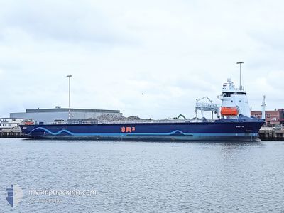
CELTIC
Cargo
Current Trip
| Time Travelled | 10 days |
|---|---|
| Remaining Time | --- |
| Distance Travelled | 2593.88 nm |
| Remaining Distance | --- |
| AVG Speed | 10.5 Knots |
| MAX Speed | 15.4 Knots |
| AVG Wind | 12.1 knots |
| MAX Wind | 28 knots |
| MIN Temp | 10.6°C / 51.08°F |
| MAX Temp | 19.4°C / 66.92°F |
| Draught | 5.4 m |
| Position Received | 21 h, 58 m ago |
Current Position
| Longitude | 15.33834° |
|---|---|
| Latitude | 36.47293° |
| Status | Under way using engine |
| Speed | 10.9 Knots |
| Course | 95° |
| Area | Mediterranean Sea - Eastern Basin |
| Station | T-AIS |
| Position Received | 21 h, 58 m ago |
Info
Information
The current position of CELTIC is in Mediterranean Sea - Eastern Basin with coordinates 36.47293° / 15.33834° as reported on 2024-05-11 01:34 by AIS to our vessel tracker app. The vessel's current speed is 10.9 Knots and is heading at the port of FAMAGUSTA. The estimated time of arrival as calculated by MyShipTracking vessel tracking app is 2024-05-13 17:00 LT
The vessel CELTIC (IMO: 9917672, MMSI: 245720000) is a Cargo It's sailing under the flag of [NL] Netherlands.
In this page you can find informations about the vessels current position, last detected port calls, and current voyage information. If the vessels is not in coverage by AIS you will find the latest position.
The current position of CELTIC is detected by our AIS receivers and we are not responsible for the reliability of the data. The last position was recorded while the vessel was in Coverage by the Ais receivers of our vessel tracking app.
The current draught of CELTIC as reported by AIS is 5.4 meters
Weather
| Temperature | 18.6°C / 65.48°F |
|---|---|
| Wind Speed | 8 knots |
| Direction | 327° NNW |
| Pressure | 1016.2 hPa |
| Humidity | 77.7 % |
| Cloud Coverage | 2 % |
Featured Company
Last Port Calls
| Port | Arrival | Departure | Time In Port |
|---|---|---|---|
| 2024-04-30 16:12 | 2024-05-01 15:45 | 23 h | |
| 2024-04-24 06:32 | 2024-04-27 06:23 | 2 d | |
| 2024-04-22 23:00 | 2024-04-23 11:03 | 12 h | |
| 2024-04-21 18:57 | 2024-04-22 12:01 | 17 h | |
| 2024-04-03 09:23 | 2024-04-06 22:02 | 3 d | |
| 2024-04-01 09:48 | 2024-04-02 08:23 | 22 h | |
| 2024-03-28 05:39 | 2024-03-28 19:43 | 14 h | |
| 2024-03-21 16:06 | 2024-03-25 17:29 | 4 d | |
| 2024-03-02 11:42 | 2024-03-11 19:06 | 9 d |
Last Trips
| Origin | Departure | Destination | Arrival | Distance | |
|---|---|---|---|---|---|
| 2024-04-27 08:23 | 2024-04-30 17:12 | 477.43 nm | |||
| 2024-04-23 13:03 | 2024-04-24 08:32 | 149.23 nm | |||
| 2024-04-22 14:01 | 2024-04-23 01:00 | 125.65 nm | |||
| 2024-04-07 01:02 | 2024-04-21 20:57 | 3213.38 nm | |||
| 2024-04-02 11:23 | 2024-04-03 12:23 | 282.66 nm | |||
| 2024-03-28 21:43 | 2024-04-01 12:48 | 794.50 nm | |||
| 2024-03-25 20:29 | 2024-03-28 07:39 | 589.55 nm | |||
| 2024-03-11 20:06 | 2024-03-21 19:06 | 2568.93 nm | |||
| 2024-02-27 18:54 | 2024-03-02 12:42 | 776.31 nm |
Events
| Time | Event | Details | Position / Dest | Info |
|---|---|---|---|---|
| 2024-05-11 01:42 | Status Changed | Default Under way using engine |
36.47090 / 15.36649
CYFMG
|
Speed: 10.9 kn Course: 95° |
| 2024-05-11 01:34 | OUT of Coverage |
36.47293 / 15.33834
Mediterranean Sea - Eastern Basin
CYFMG
|
Speed: 10.9 kn Course: 95° |
|
| 2024-05-11 00:37 | Status Changed | Under way using engine Default |
36.49554 / 15.12346
CYFMG
|
Speed: 11 kn Course: 98° |
| 2024-05-11 00:30 | Status Changed | Default Under way using engine |
36.49833 / 15.09500
CYFMG
|
Speed: 11.2 kn Course: 98.3° |
| 2024-05-11 00:28 | Status Changed | Under way using engine Default |
36.49976 / 15.08620
CYFMG
|
Speed: 11.5 kn Course: 98° |
| 2024-05-11 00:18 | IN Coverage |
36.49961 / 15.08748
Mediterranean Sea - Eastern Basin
CYFMG
|
Speed: 11.2 kn Course: 98.3° |
|
| 2024-05-10 21:48 | Status Changed | Default Under way using engine |
36.61500 / 14.49333
CYFMG
|
Speed: 11.6 kn Course: 104.9° |
| 2024-05-10 21:41 | OUT of Coverage |
36.62016 / 14.46758
Mediterranean Sea - Eastern Basin
CYFMG
|
Speed: 11.6 kn Course: 104.9° |
|
| 2024-05-10 21:26 | Status Changed | Under way using engine Default |
36.63201 / 14.41262
CYFMG
|
Speed: 12 kn Course: 105° |
| 2024-05-10 21:02 | Status Changed | Default Under way using engine |
36.65167 / 14.32167
CYFMG
|
Speed: 11.4 kn Course: 106.1° |