
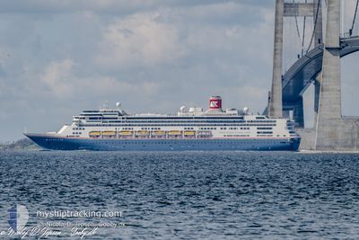
BOREALIS
Passengers Ship
Current Trip
| Time Travelled | 2 days |
|---|---|
| Remaining Time | 1 day |
| Distance Travelled | 749.22 nm |
| Remaining Distance | 489.36 nm |
| AVG Speed | 14.1 Knots |
| MAX Speed | 16.7 Knots |
| AVG Wind | 17.7 knots |
| MAX Wind | 34.6 knots |
| MIN Temp | 12.8°C / 55.04°F |
| MAX Temp | 18.1°C / 64.58°F |
| Draught | 8.4 m |
| Position Received | Now |
Current Position
| Longitude | -10.09891° |
|---|---|
| Latitude | 41.19811° |
| Status | Under way using engine |
| Speed | 14.7 Knots |
| Course | 178.4° |
| Area | North Atlantic Ocean |
| Station | T-AIS |
| Position Received | Now |
Info
Information
The current position of BOREALIS is in North Atlantic Ocean with coordinates 41.19811° / -10.09891° as reported on 2024-06-01 19:27 by AIS to our vessel tracker app. The vessel's current speed is 14.7 Knots and is heading at the port of GIBRALTAR. The estimated time of arrival as calculated by MyShipTracking vessel tracking app is 2024-06-03 06:28 LT
The vessel BOREALIS (IMO: 9122552, MMSI: 311000987) is a Passengers Ship that was built in 1997 ( 27 years old ). It's sailing under the flag of [BS] Bahamas.
In this page you can find informations about the vessels current position, last detected port calls, and current voyage information. If the vessels is not in coverage by AIS you will find the latest position.
The current position of BOREALIS is detected by our AIS receivers and we are not responsible for the reliability of the data. The last position was recorded while the vessel was in Coverage by the Ais receivers of our vessel tracking app.
The current draught of BOREALIS as reported by AIS is 8.4 meters
Weather
| Temperature | 18°C / 64.4°F |
|---|---|
| Wind Speed | 16 knots |
| Direction | 11° N |
| Pressure | 1013.9 hPa |
| Humidity | 77.8 % |
| Cloud Coverage | --- |
Featured Company
Last Port Calls
| Port | Arrival | Departure | Time In Port |
|---|---|---|---|
| 2024-05-30 05:35 | 2024-05-30 18:24 | 12 h | |
| 2024-05-29 06:08 | 2024-05-29 17:13 | 11 h | |
| 2024-05-25 05:29 | 2024-05-25 18:53 | 13 h | |
| 2024-05-21 06:54 | 2024-05-21 15:22 | 8 h | |
| 2024-05-19 16:25 | 2024-05-20 17:04 | 1 d | |
| 2024-05-18 07:21 | 2024-05-18 18:19 | 10 h | |
| 2024-05-14 05:20 | 2024-05-14 17:21 | 12 h | |
| 2024-05-10 08:38 | 2024-05-10 17:18 | 8 h | |
| 2024-05-09 07:16 | 2024-05-09 16:18 | 9 h | |
| 2024-05-07 05:20 | 2024-05-07 18:26 | 13 h |
Last Trips
| Origin | Departure | Destination | Arrival | Distance | |
|---|---|---|---|---|---|
| 2024-05-29 17:13 | 2024-05-30 05:35 | 140.17 nm | |||
| 2024-05-25 18:53 | 2024-05-29 06:08 | 610.89 nm | |||
| 2024-05-21 15:22 | 2024-05-25 05:29 | 1231.70 nm | |||
| 2024-05-20 17:04 | 2024-05-21 06:54 | 228.66 nm | |||
| 2024-05-18 18:19 | 2024-05-19 16:25 | 339.34 nm | |||
| 2024-05-14 17:21 | 2024-05-18 07:21 | 1334.64 nm | |||
| 2024-05-10 17:18 | 2024-05-14 05:20 | 1028.10 nm | |||
| 2024-05-09 16:18 | 2024-05-10 08:38 | 263.34 nm | |||
| 2024-05-07 18:26 | 2024-05-09 07:16 | 543.77 nm | |||
| 2024-05-06 08:35 | 2024-05-07 05:20 | 295.46 nm |
Events
| Time | Event | Details | Position / Dest | Info |
|---|---|---|---|---|
| 2024-06-01 17:17 | Change Sea Area | Portuguese part of the North Atlantic Ocean Spanish part of the North Atlantic Ocean |
41.73437 / -10.11807
North Atlantic Ocean
GI GIB
|
Speed: 14.7 kn Course: 177.2° |
| 2024-06-01 15:48 | Status Changed | Under way using engine Default |
42.10389 / -10.12654
GI GIB
|
Speed: 14 kn Course: 181° |
| 2024-06-01 15:43 | Status Changed | Default Under way using engine |
42.12500 / -10.12333
GI GIB
|
Speed: 15 kn Course: 180.2° |
| 2024-06-01 15:34 | Status Changed | Under way using engine Default |
42.16594 / -10.12434
GI GIB
|
Speed: 15 kn Course: 180° |
| 2024-06-01 15:16 | IN Coverage |
42.16545 / -10.12434
North Atlantic Ocean
GI GIB
|
Speed: 15 kn Course: 179.8° |
|
| 2024-06-01 12:28 | Status Changed | Default Under way using engine |
42.91167 / -10.13500
GI GIB
|
Speed: 13.8 kn Course: 179.2° |
| 2024-06-01 12:25 | Status Changed | Under way using engine Default |
42.92339 / -10.13554
GI GIB
|
Speed: 13 kn Course: 179° |
| 2024-06-01 12:25 | OUT of Coverage |
42.92339 / -10.13554
North Atlantic Ocean
GI GIB
|
Speed: 13.8 kn Course: 179.2° |
|
| 2024-06-01 12:19 | Status Changed | Default Under way using engine |
42.94667 / -10.13500
GI GIB
|
Speed: 14 kn Course: 177.4° |
| 2024-06-01 12:01 | Status Changed | Under way using engine Default |
43.01764 / -10.13744
GI GIB
|
Speed: 14 kn Course: 179° |