
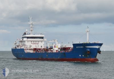
BITFJORD
Tanker
Current Trip
| Time Travelled | 4 days |
|---|---|
| Remaining Time | 2 h, 45 mins |
| Distance Travelled | 1181.41 nm |
| Remaining Distance | 30.09 nm |
| AVG Speed | 11 Knots |
| MAX Speed | 15 Knots |
| AVG Wind | 11.9 knots |
| MAX Wind | 21 knots |
| MIN Temp | 10°C / 50°F |
| MAX Temp | 15.9°C / 60.62°F |
| Draught | 6.6 m |
| Position Received | 1 m ago |
Current Position
| Longitude | 12.64441° |
|---|---|
| Latitude | 56.05176° |
| Status | Under way using engine |
| Speed | 9.9 Knots |
| Course | 149° |
| Area | Kattegat |
| Station | T-AIS |
| Position Received | 1 m ago |
Info
Information
The current position of BITFJORD is in Kattegat with coordinates 56.05176° / 12.64441° as reported on 2024-05-29 02:59 by AIS to our vessel tracker app. The vessel's current speed is 9.9 Knots and is heading at the port of MALMO. The estimated time of arrival as calculated by MyShipTracking vessel tracking app is 2024-05-29 05:45 LT
The vessel BITFJORD (IMO: 9753844, MMSI: 244090224) is a Tanker It's sailing under the flag of [NL] Netherlands.
In this page you can find informations about the vessels current position, last detected port calls, and current voyage information. If the vessels is not in coverage by AIS you will find the latest position.
The current position of BITFJORD is detected by our AIS receivers and we are not responsible for the reliability of the data. The last position was recorded while the vessel was in Coverage by the Ais receivers of our vessel tracking app.
The current draught of BITFJORD as reported by AIS is 6.6 meters
Weather
| Temperature | 11.6°C / 52.88°F |
|---|---|
| Wind Speed | 7 knots |
| Direction | 173° S |
| Pressure | 1014.5 hPa |
| Humidity | 89.5 % |
| Cloud Coverage | 1 % |
Featured Company
Last Port Calls
| Port | Arrival | Departure | Time In Port |
|---|---|---|---|
| 2024-05-23 15:42 | 2024-05-24 16:23 | 1 d | |
| 2024-05-20 01:31 | 2024-05-21 02:31 | 1 d | |
| 2024-05-16 11:26 | 2024-05-17 06:20 | 18 h | |
| 2024-05-13 07:32 | 2024-05-15 08:29 | 2 d | |
| 2024-05-07 15:11 | 2024-05-09 04:05 | 1 d | |
| 2024-05-03 18:40 | 2024-05-04 06:55 | 12 h | |
| 2024-05-02 18:34 | 2024-05-03 18:09 | 23 h | |
| 2024-05-02 14:50 | 2024-05-02 17:54 | 3 h | |
| 2024-04-23 06:07 | 2024-04-25 07:53 | 2 d | |
| 2024-04-20 07:21 | 2024-04-20 22:30 | 15 h |
Most Visited Ports (Last year)
| Port | Arrivals | |
|---|---|---|
| 21 | ||
| 7 | ||
| 7 | ||
| 7 | ||
| 4 | ||
| 4 |
Last Trips
| Origin | Departure | Destination | Arrival | Distance | |
|---|---|---|---|---|---|
| 2024-05-21 04:31 | 2024-05-23 17:42 | 41.24 nm | |||
| 2024-05-17 08:20 | 2024-05-20 03:31 | 669.39 nm | |||
| 2024-05-15 09:29 | 2024-05-16 13:26 | 279.22 nm | |||
| 2024-05-09 06:05 | 2024-05-13 08:32 | 823.88 nm | |||
| 2024-05-04 08:55 | 2024-05-07 17:11 | 717.55 nm | |||
| 2024-05-03 20:09 | 2024-05-03 20:40 | 2.24 nm | |||
| 2024-05-02 19:54 | 2024-05-02 20:34 | 4.11 nm | |||
| 2024-04-25 09:53 | 2024-05-02 16:50 | 1027.48 nm | |||
| 2024-04-20 23:30 | 2024-04-23 08:07 | 629.74 nm | |||
| 2024-04-19 20:50 | 2024-04-20 08:21 | 125.45 nm |
Events
| Time | Event | Details | Position / Dest | Info |
|---|---|---|---|---|
| 2024-05-29 01:38 | Change Sea Area | Danish part of the Kattegat Swedish part of the Kattegat |
56.20040 / 12.39051
Kattegat
FRDON>SEMMA
|
Speed: 10.7 kn Course: 162.6° |
| 2024-05-28 17:08 | Change Sea Area | Swedish part of the Kattegat Danish part of the Kattegat |
57.51933 / 11.33437
Kattegat
FRDON>SEMMA
|
Speed: 10.6 kn Course: 136.7° |
| 2024-05-28 15:05 | Change Sea Area | Danish part of the Kattegat Danish part of the Skaggerak |
57.78119 / 10.86990
Kattegat
FRDON>SEMMA
|
Speed: 10.1 kn Course: 131.3° |
| 2024-05-28 06:08 | Change Sea Area | Danish part of the Skaggerak Danish part of the North Sea |
57.18553 / 8.52019
Skaggerak
FRDON>SEMMA
|
Speed: 11 kn Course: 53° |
| 2024-05-27 21:50 | Detected in Sea | Danish part of the North Sea |
55.99693 / 7.06810
North Sea
FRDON>SEMMA
|
Speed: 10.4 kn Course: 42.2° |
| 2024-05-27 21:50 | Status Changed | Under way using engine Default |
55.99693 / 7.06810
FRDON>SEMMA
|
Speed: 10 kn Course: 41° |
| 2024-05-27 21:50 | IN Coverage |
55.99693 / 7.06810
North Sea
FRDON>SEMMA
|
Speed: 10.4 kn Course: 42.2° |
|
| 2024-05-27 06:42 | Status Changed | Default Under way using engine |
53.64434 / 4.86379
FRDON>SEMMA
|
Speed: 11.2 kn Course: 21.6° |
| 2024-05-27 06:40 | Status Changed | Under way using engine Default |
53.63956 / 4.86054
FRDON>SEMMA
|
Speed: 11 kn Course: 23° |
| 2024-05-27 06:40 | OUT of Coverage |
53.63956 / 4.86054
North Sea
FRDON>SEMMA
|
Speed: 11.2 kn Course: 21.6° |